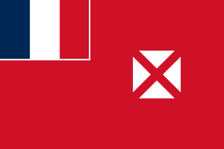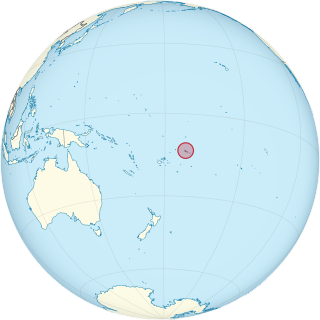
Wallis and Futuna, officially the Territory of the Wallis and Futuna Islands, is a French island collectivity in the South Pacific, situated between Tuvalu to the northwest, Fiji to the southwest, Tonga to the southeast, Samoa to the east, and Tokelau to the northeast.

The United States Pacific Fleet (USPACFLT) is a theater-level component command of the United States Navy, located in the Pacific Ocean. It provides naval forces to the Indo-Pacific Command. Fleet headquarters is at Joint Base Pearl Harbor–Hickam, Hawaii, with large secondary facilities at Naval Air Station North Island, California.

Samuel Wallis was a British naval officer and explorer of the Pacific Ocean who made the first recorded visit by a European navigator to Tahiti.

Wallis is a Polynesian atoll/island in the Pacific Ocean belonging to the French overseas collectivity of Wallis and Futuna. It lies north of Tonga, northeast of Fiji, east-northeast of the Hoorn Islands, east of Fiji's Rotuma, southeast of Tuvalu, southwest of Tokelau and west of Samoa. Its area is almost 100 km2 (39 sq mi) with 8,333 people. Its capital is Mata Utu. Roman Catholicism is the predominant religion. Its highest point is Mount Lulu Fakahega. Wallis is of volcanic origin with fertile soil and some remaining lakes. Rainfall is plentiful.

Mata Utu is the capital city of Wallis and Futuna, an overseas collectivity of France. It is located on the island of Uvéa (ʻUvea), in the district of Hahake, of which it is also the capital. It is one of two ports in Wallis and Futuna, the other being at Leava on Futuna. Hihifo Airport, the main airport serving the island and city, is 5.6 kilometres (3.5 mi) to the northwest. Its population was 1,029 in 2018, up from 815 in 1998.

The Coastwatchers, also known as the Coast Watch Organisation, Combined Field Intelligence Service or Section C, Allied Intelligence Bureau, were Allied military intelligence operatives stationed on remote Pacific islands during World War II to observe enemy movements and rescue stranded Allied personnel. They played a significant role in the Pacific Ocean theatre and South West Pacific theatre, particularly as an early warning network during the Guadalcanal campaign.

Matureivavao, or Maturei-vavao is an uninhabited atoll in the Acteon Group in the southeastern part of the Tuamotu Islands. It is the largest atoll within the Acteon Group, and like others in this group, is administratively part of the commune of the Gambier Islands.

Tenarunga or Tenania, previously Narunga and formerly Minto Island, is a low, wooded atoll in the Acteon Group in the southeastern part of the Tuamotu Islands in French Polynesia. It is administratively a part of the Gambier Islands. The atoll has a population of between 10 and 50 people.

The Battle of Hollandia was an engagement between Allies of World War II and Japanese forces during World War II. The majority of the Allied force was provided by the United States, with the bulk of two United States Army infantry divisions being committed on the ground. Air and naval support consisted largely of U.S. assets, although Australia also provided air support during preliminary operations and a naval bombardment force.

Lake Lalolalo is a volcanic crater lake surrounded by jungle to the southwest of the island of Wallis (Uvea) in the Pacific Ocean. The largest lake on the island, it lies off Route 1 between the coastal village of Mala'etoli and Ahoa. A small lake, Lake Lano, lies just to the northwest.

United States Naval Districts is a system created by the United States Navy to organize military facilities, numbered sequentially by geographic region, for the operational and administrative control of naval bases and shore commands in the United States and around the world. Established in 1903, naval districts became the foundational system for organizing U.S. naval forces ashore during the 20th century. The term "Naval" forces includes United States Marine Corps and current United States Coast Guard units.

The following outline is provided as an overview of and topical guide to Wallis and Futuna:

Cámara Base is an Argentine Antarctic base and scientific research station named after Frigate Lieutenant Naval Aviator Juan Ramón Cámara. It is located in the northern foothills of La Morenita Hill, at Menguante Cove in Half Moon Island off the east coast of Livingston Island in the South Shetland Islands, Antarctica.

Wallis Lake, an open and trained wave dominated barrier estuary, is located within the Mid-Coast Council local government area in the Mid North Coast region of New South Wales, Australia. Wallis Lake is located adjacent to the towns of Forster and Tuncurry, and adjacent to the east coast, about 308 kilometres (191 mi) north of Sydney.

Lake Kikila is a lake on the southeastern side of Wallis (Uvea) in the French overseas collectivity of Wallis and Futuna, South Pacific. It is marginally the second lake largest lake on the island after Lake Lalolalo, although is not rounded like Lalolalo. It lies to the just to the southwest of Falaleu and northwest of Ha'afuasia.
Alofivai is a village in Wallis and Futuna. It is located in Hahake District on the northeast coast of Wallis Island, along Route 1. The hamlets of Finetomai and Papakila also form part of the area.

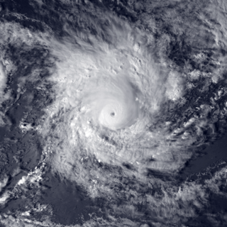
Severe Tropical Cyclone Ron was a powerful tropical cyclone that became the strongest on record to impact Tonga. The system was first noted as a tropical depression, to the northeast of Samoa on January 1, 1998. Over the next day the system gradually developed further and was named Ron as it developed into a Category 1 tropical cyclone on the Australian tropical cyclone intensity scale during the next day. The system subsequently continued to move south-westwards and became a Category 3 severe tropical cyclone, as it passed near Swains Island during January 3.

Naval Base Samoa, codename Operation Straw, was a number of United States Navy bases at American Samoa in the central Pacific Ocean. The bases were used during World War II to support the island hopping Pacific War efforts of the allied nations fighting the Empire of Japan.


