
The Lakota are a Native American tribe. Also known as the Teton Sioux, they are one of the three main subcultures of the Sioux people. Their current lands are in North and South Dakota. They speak Lakȟótiyapi—the Lakota language, the westernmost of three closely related languages that belong to the Siouan language family.

Lake County is a county in the U.S. state of South Dakota. As of the 2010 United States Census, the population was 11,200. Its county seat is Madison. The county was formed in 1873.

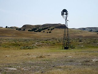
Hyde County is a county in the U.S. state of South Dakota. As of the 2010 census, the population was 1,420, making it the fourth-least populous county in South Dakota. Its county seat is Highmore. The county was founded in 1873, as a county of the Dakota Territory, and organized in 1883. It was named for James Hyde, a member of legislature in the 1870s.

Harding County is a county in the U.S. state of South Dakota. As of the 2010 census, the population was 1,255, making it the second-least populous county in South Dakota. Its county seat is Buffalo.

Buffalo County is a county in the U.S. state of South Dakota. As of the 2010 census, the population was 1,912. Its county seat is Gann Valley which, at 14 people, is the least populous county seat in the United States. The county was created in 1864, and was organized in 1871 as part of the Dakota Territory.

Brule County is a county in the U.S. state of South Dakota. As of the 2010 census, the population was 5,255. Its county seat is Chamberlain.

U.S. Route 12 is an east–west United States highway, running from Aberdeen, Washington, to Detroit, Michigan, for almost 2,500 miles (4,000 km). The highway has mostly been superseded by Interstate 90 (I-90) and I-94, but unlike most U.S. routes that have been superseded by an Interstate, US 12 remains as an important link for local and regional destinations.

The Coteau des Prairies is a plateau approximately 200 miles in length and 100 miles in width, rising from the prairie flatlands in eastern South Dakota, southwestern Minnesota, and northwestern Iowa in the United States. The southeast portion of the Coteau comprises one of the distinct regions of Minnesota, known as Buffalo Ridge.

U.S. Route 16 (US 16) is an east–west United States Highway between Rapid City, South Dakota and Yellowstone National Park in Wyoming. As of 2004, the highway's eastern terminus is at a junction with Interstate 90/U.S. Route 14 (I-90/US 14), concurrent with I-190, in Rapid City, South Dakota. The western terminus is the east entrance to Yellowstone National Park, concurrent with US 14 and US 20. U.S. 16 used to extend all the way to Michigan, but has been truncated in favor of Interstates 90 and 96.
Big Bend Dam is a major embankment rolled-earth dam on the Missouri River in Central South Dakota, United States, creating Lake Sharpe. The dam was constructed by the U.S. Army Corps of Engineers as part of the Pick-Sloan Plan for Missouri watershed development authorized by the Flood Control Act of 1944. Construction began in 1959 and the embankment was completed in July 1963. Power generation began at the facility in 1964 and the entire complex was completed in 1966 at a total cost of $107 million. The hydroelectric plant generates 493,300 kilowatts of electricity at maximum capacity, with an annual production of 969 million kilowatt hours, and meets peak-hour demand for power within the Missouri River Basin.
Lake Sharpe is a large reservoir impounded by Big Bend Dam on the Missouri River in central South Dakota, United States. The lake has an area of 56,884 acres (230.20 km2) and a maximum depth of 78 ft (24 m). Lake Sharpe is approximately 80 mi (130 km) long, with a shoreline of 200 mi (320 km). Lake Sharpe is the 54th largest reservoir in the United States. The lake starts near Ft. Thompson and stretches upstream to Oahe Dam, near Pierre. The lake is located within the following counties: Buffalo, Lyman, Hyde, Hughes, and Stanley. The Big Bend of the Missouri is about 7 miles (11 km) north of the dam.
Buffalo Gap National Grassland is a National Grassland located primarily in southwestern South Dakota, United States. It is also the second largest National Grassland, after Little Missouri National Grassland in North Dakota. Characteristics of the grasslands include mixed prairie and chalky badlands. The grassland is managed by the U.S. Forest Service and is a division of Nebraska National Forest. In descending order of land area it is located in parts of Fall River, Pennington, Jackson, and Custer counties.

The Spirit Lake Tribe is a federally recognized tribe based on the Spirit Lake Dakota Reservation located in east-central North Dakota on the southern shores of Devils Lake. It is made up of people of the Pabaksa (Iháŋkthuŋwaŋna), Sisseton (Sisíthuŋwaŋ) and Wahpeton (Waȟpéthuŋwaŋ) bands of the Dakota tribe. Established in 1867 in a treaty between Sisseton-Wahpeton Bands and the United States government, the reservation, at 47°54′38″N98°53′01″W, consists of 1,283.777 square kilometres (495.669 sq mi) of land area, primarily in Benson and Eddy counties. Smaller areas extend into Ramsey, Wells and Nelson counties.

Buffalo Ridge is a large expanse of rolling hills in the southeastern part of the larger Coteau des Prairies. It stands 1,995 feet (608 m) above sea level. The Buffalo Ridge is sixty miles (97 km) long and runs through Lincoln, Pipestone, Murray, Nobles, and Rock counties in the southwest corner of Minnesota.

Lake Francis Case is a large reservoir impounded by Fort Randall Dam on the Missouri River in south-central South Dakota, United States. The lake has an area of 102,000 acres (410 km2) and a maximum depth of 140 ft (43 m). Lake Francis Case has a length of approximately 107 mi (172 km) and has a shoreline of 540 mi (870 km). The lake is the eleventh-largest reservoir in the United States and is located within the counties of: Charles Mix, Gregory, Lyman, Brule, and Buffalo. The lake stretches from Pickstown, South Dakota upstream to Big Bend Dam.

South Dakota is a state located in the north-central United States. It is usually considered to be in the Midwestern region of the country. The state can generally be divided into three geographic regions: eastern South Dakota, western South Dakota, and the Black Hills. Eastern South Dakota is lower in elevation and higher in precipitation than the western part of the state, and the Black Hills are a low, isolated mountain group in the southwestern corner of the state. Smaller sub-regions in the state include the Coteau des Prairies, Coteau du Missouri, James River Valley, the Dissected Till Plains. Geologic formations in South Dakota range in age from two billion-year-old Precambrian granite in the Black Hills to glacial till deposited over the last few million years. South Dakota is the 17th-largest state in the country.

The state of South Dakota is a leader in the U.S. in wind power generation with over 30% of the state's electricity generation coming from wind in 2017. In 2016, South Dakota had 583 turbines with a total capacity of 977 megawatts (MW) of wind generation capacity. In 2019, the capacity increased to 1525 MW.
Buffalo Lakes is a lake chain in South Dakota, in the United States.

Buffalo Lake is a lake in South Dakota, in the United States.
Buffalo Creek is a stream in the U.S. state of South Dakota.

