Related Research Articles

Matagorda County is a county located in the U.S. state of Texas. As of the 2020 census, the population was 36,255. Its county seat is Bay City, not to be confused with the larger Baytown in Harris and Chambers Counties. Matagorda County is named for the canebrakes that once grew along the coast.
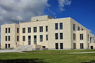
Chambers County is a county in the U.S. state of Texas. As of the 2020 census, its population was 46,571. The county seat is Anahuac.

Anahuac is a city in the U.S. state of Texas on the coast of Trinity Bay. The population of the city was 1,980 at the 2020 census. Anahuac is the seat of Chambers County and is situated in Southeast Texas. The Texas Legislature designated the city as the "Alligator Capital of Texas" in 1989. Anahuac hosts an annual alligator festival.

The Trinity River is a 710-mile (1,140 km) river, the longest with a watershed entirely within the U.S. state of Texas. It rises in extreme northern Texas, a few miles south of the Red River. The headwaters are separated by the high bluffs on the southern side of the Red River.

The West South Central states, colloquially known as the South Central states, is a region of the United States defined by the U.S. Census Bureau as covering four states: Arkansas, Louisiana, Oklahoma, and Texas. The West South Central or South Central region is located within the Southern United States and Gulf Coast regions, bordering the Mountain states and Midwestern U.S. regions to its north and west. The Gulf of Mexico is to the south of the region. Houston is the South Central's largest city, and the Dallas–Fort Worth–Arlington metropolitan statistical area is the region's largest metropolis.
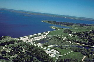
Lake Whitney is a flood control reservoir on the main stem of the Brazos River in Texas. It is located on River Mile Marker 442 and controls drainage for 17,656 square miles (45,730 km2) of Texas and parts of New Mexico. The reservoir encompasses a surface area of more than 23,500 acres and 225 miles (362 km) of shoreline. The area consists of rolling, tallgrass prairies; cedar trees; hardwood timber; and 100 ft (30 m) bluffs and rock points. Lake Whitney is also part of the Texas Lakes Trail Region of North Texas.
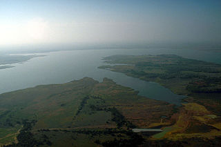
Lake Ray Roberts is an artificial 29,350-acre (119 km2) American reservoir located 10 miles (20 km) north of Denton, Texas, between the cities of Pilot Point, Texas and Sanger, Texas. It is filled by a tributary of the Trinity River.
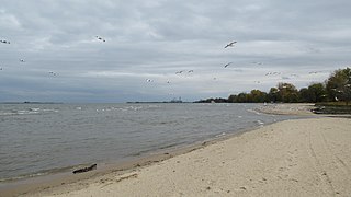
Bay City State Park is a 2,389-acre (967 ha) state park located on the shore of Saginaw Bay near Bay City in Bay County, Michigan, United States. The Tobico Marsh, one of the largest remaining freshwater, coastal wetlands on the Great Lakes is located in the park. Other natural features of the park include a mile of sandy beach, over 2,000 acres (810 ha) of wetland woods, meadows, oak savannah prairies, and cattail marshes. The park is a haven for migratory birds and wetland wildlife.

The John H. Kerr Reservoir is a reservoir along the border of the U.S. states of North Carolina and Virginia. The U.S. Army Corps of Engineers constructed the John H. Kerr Dam across the Roanoke River between 1947 and 1952 to produce hydroelectricity as well as for flood control. Kerr Lake is the largest lake in Virginia, with 850 miles (1,370 km) of shoreline located in Vance, Granville, and Warren counties in North Carolina, as well as Mecklenburg, Charlotte, and Halifax counties in Virginia. At its maximum capacity, it covers approximately 50,000 acres (200 km2) and is one of the largest reservoirs in the Southeastern United States. The name honors its Congressional sponsor, John H. Kerr, a North Carolina Democrat who supported creation of the lake. The lake supports recreational tourism in North Carolina and Virginia as described below.

Wright Patman Lake is a reservoir in northeast Texas in the United States. The lake is a U.S. Army Corps of Engineers reservoir formed on the Sulphur River in Bowie and Cass counties by Wright Patman Dam. The reservoir provides flood control and water conservation for the communities downstream from the dam. The lake is also a popular recreational destination. The Bowie County side of the lake is part of the Texarkana metropolitan area.
Wallisville is an unincorporated town in northern Chambers County, Texas, United States. According to the Handbook of Texas, the community had a population of 460 in 2000. It is located within the Greater Houston metropolitan area.
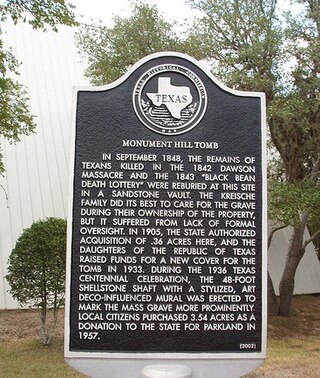
The Dawson massacre, also called the Dawson expedition, was an incident in which 36 Texian militiamen were killed by Mexican soldiers on September 17, 1842 near San Antonio de Bexar. The event occurred during the Battle of Salado Creek, which ended with a Texian victory. This was among numerous armed conflicts over the area between the Rio Grande and Nueces rivers, which the Republic of Texas tried to control after achieving independence in 1836.

Lavon Lake is a freshwater reservoir located in southeast Collin County, Texas, on the East Fork of the Trinity River near Wylie, off State Highway 78. It is commonly called Lake Lavon for commercial and recreational purposes, but Lavon Lake is its official name according to the U.S. Army Corps of Engineers. It was originally called Lavon Reservoir.
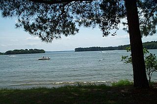
Lake Livingston is a reservoir located in the East Texas Piney Woods. Lake Livingston was built and is owned and operated by the Trinity River Authority (TRA) of Texas under contract with the City of Houston for water-supply purposes. The USCG Auxiliary Flotilla 6-9 is also stationed on the lake. The lake is the third-largest lake located in the state of Texas. The Livingston Dam, constructed across the Trinity River about 7 miles (11 km) southwest of the city of Livingston is 2.5 miles (4 km) in length and has an average depth of 55 feet (17 m).

The Baytown Nature Center is located in Baytown, Texas, 20 miles (32 km) east of Houston. It is located on a 450-acre (1.8 km2) peninsula along the Houston Ship Channel and surrounded on three sides by Burnet Bay, Crystal Bay, and Scott Bay.
Lake Bridgeport, also known as Bridgeport Lake, is a man-made, freshwater reservoir located in Wise and Jack Counties in North Texas. The lake was created by damming the West Fork of the Trinity River and sits upstream from Eagle Mountain Lake. The lake is owned by the Tarrant Regional Water District and the water impounded is used for flood control, residential and commercial sales, irrigation, and recreation.
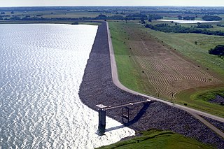
Lake Bardwell is a lake in Ellis County, Texas. The lake was constructed by the United States Army Corps of Engineers in 1965. Lake Bardwell is not used for military operations, and is accessible to the public for recreational purposes; it has seven facilities, but the state public ramp is closed.
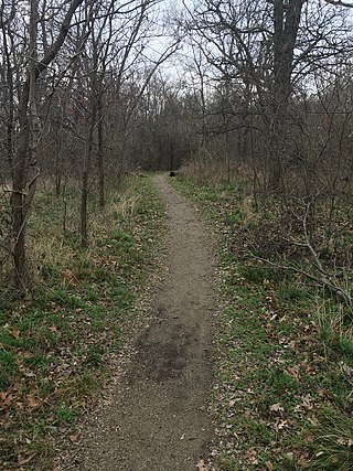
Lewisville Lake Environmental Learning Area, or LLELA, is a 2,600-acre park in Lewisville, Texas. It features Blackland Prairie and Eastern Cross Timbers ecosystems, as well as wetlands and hardwood forests. The Elm Fork branch of the Trinity River runs through the park, and it is adjacent to Lake Lewisville, although there is no lake access from the park.
References
- ↑ "TSHA | Lake Charlotte". www.tshaonline.org. Retrieved 2022-11-24.
- 1 2 3 4 "Galveston District > Locations > Wallisville Lake Project Office > Recreation". www.swg.usace.army.mil. Retrieved 2022-11-24.
- ↑ "TSHA | Labadie, Nicholas Descomps". www.tshaonline.org. Retrieved 2022-11-24.
- ↑ "Trinity Loop — Texas Parks & Wildlife Department". tpwd.texas.gov. Retrieved 2022-11-24.