An algal bloom or algae bloom is a rapid increase or accumulation in the population of algae in freshwater or marine water systems. It is often recognized by the discoloration in the water from the algae's pigments. The term algae encompasses many types of aquatic photosynthetic organisms, both macroscopic multicellular organisms like seaweed and microscopic unicellular organisms like cyanobacteria. Algal bloom commonly refers to the rapid growth of microscopic unicellular algae, not macroscopic algae. An example of a macroscopic algal bloom is a kelp forest.

Lady Bird Lake is a river-like reservoir on the Colorado River in Austin, Texas, United States. The City of Austin created the reservoir in 1960 as a cooling pond for a new city power plant. The lake, which has a surface area of 416 acres (168 ha), is now used primarily for recreation and flood control. The reservoir is named in honor of former First Lady of the United States Lady Bird Johnson.

Florida Bay is the bay located between the southern end of the Florida mainland and the Florida Keys in the United States. It is a large, shallow estuary that while connected to the Gulf of Mexico, has limited exchange of water due to various shallow mudbanks covered with seagrass. The banks separate the bay into basins, each with its own unique physical characteristics.

Pymatuning State Park is a Pennsylvania state park covering 21,122 acres (8,548 ha) in Conneaut, North Shenango, Pine, Sadsbury, South Shenango, West Fallowfield and West Shenango Townships, Crawford County, Pennsylvania, in the United States. Pymatuning State Park is the largest state park in Pennsylvania and contains the 17,088 acres (6,915 ha) of Pymatuning Lake, three-quarters of which is in Pennsylvania and one-quarter of which is in Ohio. A three-mile (5 km) causeway extends between Pennsylvania and Ohio near the center of the lake. The lake provides fishing and boating year round. There are two natural areas, Clark Island and Blackjack in the park. The park is also home to the University of Pittsburgh's Pymatuning Laboratory of Ecology. Like all Pennsylvania state parks, admission to the Pymatuning State Park is free. The northern access for Pymatuning State Park can be reached from U.S. Route 6 and the southern access is reached from U.S. Route 322.

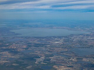
Lake Apopka is the fourth largest lake in the U.S. state of Florida. It is located 15 miles (24 km) northwest of Orlando, mostly within the bounds of Orange County, although the western part is in Lake County. Fed by a natural spring, rainfall and stormwater runoff, water from Lake Apopka flows through the Apopka-Beauclair Canal and into Lakes Beauclair and Dora. From Lake Dora, water flows into Lake Eustis, then into Lake Griffin and then northward into the Ocklawaha River, which flows into the St. Johns River. Multiple parks or nature trails are present around the lake including Magnolia Park, Lake Apopka Wildlife Drive, Ferndale Preserve, Oakland Nature Preserve, Dr. Bradford Memorial Park, and Newton Park, named for A. B. Newton.
Spring Meadow Lake State Park is a public recreation area covering 61 acres (25 ha) just west of Helena, Montana. Once the site of a gravel pit and factory, the state park centers around a man-made, spring-fed lake, which is used for swimming, fishing, non-motorized boating, and scuba diving. The park also offers picnicking, a mile-long trail around the lake, and ice fishing and ice skating in winter. Largemouth bass, westslope cutthroat trout, yellow perch, and pumpkinseed are the main catches. A fishing pier was added to 30-acre (12 ha) lake in 2011.

Brady Creek Reservoir is a reservoir on Brady Creek in McCulloch County, Texas in the United States. The lake is about 3 miles west of downtown Brady, Texas. The dam and lake are managed by the City of Brady. The reservoir was officially impounded in 1963. The reservoir is also sometimes called Brady Reservoir or Brady Lake. The dam for Brady Creek Reservoir is 8,400 ft. long and 104 ft. high and has a storage capacity of 30,430 acre-Ft.

Lake Needwood is a 75-acre (300,000 m2) reservoir in Derwood, Maryland, United States. Located east of Rockville, in the eastern part of Montgomery County, it is situated on Rock Creek. The lake was created by damming Rock Creek in 1965 with the goal of providing flood control and reducing soil erosion. Lake Needwood also protects the water quality of the creek by functioning as a retention basin to trap sediment from storm-water runoff.

Silver Springs State Fish and Wildlife Area is an Illinois state park on 1,350 acres (550 ha) in Kendall County, Illinois, United States. The park was established in the late 1960s and is named for the natural spring within its boundaries. The park has two artificial lakes and the Fox River flows through the northern end of the park. Silver Springs hosts a variety of activities including fishing, hunting, boating and hiking. The park has areas of native prairie restoration, a sledding hill and a seven-mile (11 km) equestrian trail. The prairie restoration areas hold many species of plants including lead plant, and purple coneflower.

Siltcoos Lake (silt’-koos), at 3,164 acres (1,280 ha), is the largest lake on the Oregon Coast of the United States. Fed by runoff from a basin of about 68 square miles (180 km2) in Douglas and Lane counties, it is about 7 miles (11 km) south of Florence and 0.5 miles (1 km) east of U.S. Route 101. Its name comes from a Lower Umpqua (Siuslaw) placename, a variant of which is Tsiltcoos.

Hedgecourt is a 33.6-hectare (83-acre) biological Site of Special Scientific Interest (SSSI) north of Felbridge in Surrey. An area of 5 ha is managed by the Surrey Wildlife Trust.

A harmful algal bloom (HAB), or excessive algae growth, is an algal bloom that causes negative impacts to other organisms by production of natural algae-produced toxins, mechanical damage to other organisms, or by other means. HABs are sometimes defined as only those algal blooms that produce toxins, and sometimes as any algal bloom that can result in severely lower oxygen levels in natural waters, killing organisms in marine or fresh waters. Blooms can last from a few days to many months. After the bloom dies, the microbes that decompose the dead algae use up more of the oxygen, generating a "dead zone" which can cause fish die-offs. When these zones cover a large area for an extended period of time, neither fish nor plants are able to survive. Harmful algal blooms in marine environments are often called "red tides".

Blue Lake Regional Park is a public park in Fairview, in the U.S. state of Oregon. The 101-acre (41 ha) park, near the south shore of the Columbia River in Multnomah County, includes many covered and uncovered picnic areas, playing fields for sports such as softball, a cross country course and infrastructure related to lake recreation including swimming, boating, and fishing. Encompassing wooded areas, three ponds, and a wetland in addition to the lake, the park is frequented by migrating birds and other wildlife. Paved paths run through the park, which is near the 40-Mile Loop hiking and biking trail. Park vegetation includes cottonwoods, willows, and other trees and shrubs as well as wetland plants such as cattails.

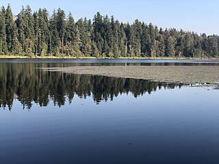
Anderson Lake State Park is a public recreation area on the Quimper Peninsula, seven miles (11 km) south of Port Townsend, in Jefferson County, Washington. The state park has 496 acres (201 ha) of woods and wetland that slope down to 70-acre (28 ha) Anderson Lake. The park offers picnicking, trails for hiking, biking, and equestrian use, non-motorized boating, fishing, and birdwatching. The presence of toxic algae forbids water use of any kind from time to time. Algae blooms generally occur during late spring and summer months.

Lake Elmo State Park is a public recreation area located on the northeast side of Billings, Montana. The state park occupies 123 acres (50 ha) and is at an elevation of 3,199 feet (975 m). It offers swimming and non-motorized boating on a 64-acre (26 ha) reservoir, three beach-front areas, fishing pier, grassed multi-use areas, two group-use shelters, playground, and fenced-in dog park on the lake's west side. The reservoir is primarily fed by the Billings Bench Water Association Canal.

Anderson Lake is a 57-acre (23 ha) body of water lying 1.5 miles (2.4 km) west of Chimacum in Jefferson County, Washington. It is located in Section 9, Township 29N, Range 1W. Anderson Lake reaches a depth of 29 feet (8.8 m) at its deepest point and has a water volume of 1,228 acre-feet (1,515,000 m3). The lake drains into Chimacum Creek and Port Townsend Bay. It is surrounded by Anderson Lake State Park. The lake's fish population includes lake-reared rainbow trout, that carry over to a second season from the initial spring fishery.

Ford Lake is a fresh water artificial reservoir located in Washtenaw County in the U.S. state of Michigan. The lake was created from the construction of Ford Lake Dam along the Huron River in the early 1930s. The lake is named after business magnate Henry Ford.

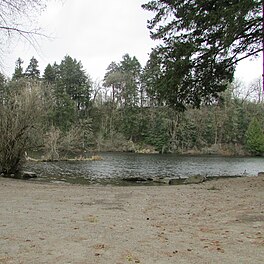
Echo Lake is located in Shoreline, Washington, a suburb adjacent to Seattle. Echo Lake Park sits on its northeastern corner.

Clark Lake Park is a 150-acre (61 ha) park in Kent, Washington, with the eponymous Clark Lake, 8-acre (3.2 ha) in size, the main highlight of the park.

Spring Lake is located in King County, Washington, in the Maple Heights-Lake Desire census-designated place. It sits next to Spring Lake/Lake Desire Park, on the opposite side of Lake Desire. The lake also has fishing opportunities.


