
A gravel pit is an open-pit mine for the extraction of gravel.

Jinshan District, is a suburban district of southwestern Shanghai, neighboring Zhejiang province and Hangzhou Bay. It has a land area of 586.14 square kilometers (226.31 sq mi) and a population of 732,500 as of the 2010 Chinese census. Jinshan District, located in the southwest of Shanghai, is one of the biggest districts of the city. Local political administration is divided into nine towns and one subdistrict. About 6.2 kilometers (3.9 mi) off the coast of Jinshan, there are three islands named Dajinshan, Xiaojinshan, and Fushan. At 103 meters (338 ft) above sea level, the peak of Dajinshan Island is the highest point within the Shanghai municipality. There are several beaches along the 23.3-kilometer (14.5 mi) shoreline, which are popular tourism destinations.
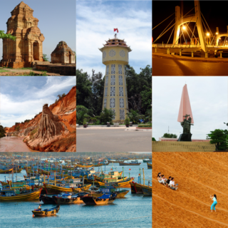
Phan Thiết is the capital of Bình Thuận Province on the southeast coast in Vietnam. While most of the inhabitants live in the city center, others reside in the four urban coastal wards, extending from Suối Nước beach in the northeast towards cape Kê Gà in the southwest.

Moraine State Park is a Pennsylvania state park on 16,725 acres (6,768 ha) in Brady, Clay, Franklin, Muddy Creek, and Worth townships in Butler County, Pennsylvania.

Pymatuning State Park is a Pennsylvania state park covering 21,122 acres (8,548 ha) in Conneaut, North Shenango, Pine, Sadsbury, South Shenango, West Fallowfield and West Shenango Townships, Crawford County, Pennsylvania, in the United States. Pymatuning State Park is the largest state park in Pennsylvania and contains the 17,088 acres (69.15 km2) of Pymatuning Lake, three-quarters of which is in Pennsylvania and one-quarter of which is in Ohio. A 1.7-mile (2.7 km) causeway extends between Pennsylvania and Ohio near the center of the lake. The lake provides fishing and boating year round. There are two natural areas, Clark Island and Blackjack in the park. The park is also home to the University of Pittsburgh's Pymatuning Laboratory of Ecology. Like all Pennsylvania state parks, admission to the Pymatuning State Park is free. The northern access for Pymatuning State Park can be reached from U.S. Route 6 and the southern access is reached from U.S. Route 322.
Jewel Lake Provincial Park is a provincial park bordering the northwestern end of Jewel Lake in the Boundary region of south central British Columbia. The park, via BC Highway 3 and Jewel Lake Rd, is about 14 kilometres (8.7 mi) northeast of Greenwood and 48 kilometres (30 mi) northwest of Grand Forks
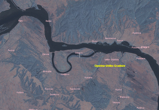
Silver Lake or Srebrno Lake is an oxbow lake along the right Danube bank in the Braničevo region in eastern Serbia, near the town of Veliko Gradište. It is a popular tourist resort.

Quarry Lakes Regional Recreation Area is a regional park located in Fremont, California that is part of the East Bay Regional Parks system. Before being converted into a park, the site was used as a gravel quarry. When water purchased by the public for groundwater recharge of the Niles Cone flooded the gravel pits, the gravel harvesters began to daily pump the seeping water down Alameda Creek into San Francisco Bay. The Alameda County Water District acquired the quarry after the pumping was declared to be an illegal waste in 1976.

Shadow Cliffs Regional Recreation Area is a regional park on the border of Pleasanton and Livermore, California, that is part of the East Bay Regional Parks (EBRP) system. Its lake, once a gravel pit, has a sandy beach and is used for swimming, fishing, and recreational boating. The park once featured water slides, which were closed in 2011 and have since been taken down, and are planned to be replaced by an Interpretive Center. The park is also a popular picnic ground.

Puerto Ángel is a small coastal town in the Mexican state of Oaxaca located in the municipality of San Pedro Pochutla. It, along with San Agustinillo and Playa Zipolite are known as the "Riviera Oaxaqueña". It is located 9 km south of city of Pochutla approximately 50 kilometers west of Huatulco and 80 kilometers east of Puerto Escondido. Despite tourism development since the 1960s, the town is still mostly a fishing village, located on a small bay surrounded by rocky hills that lead into the Sierra Madre del Sur. It was founded in the mid-19th century as a port for the region's coffee and lumber industries but since then other means of shipping these products has replaced it.
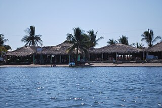
Boca de Cielo is a small fishing town and beach in the municipality of Tonalá, Chiapas, Mexico. It and Puerto Arista, fifteen km away, are the two best known beaches on the Chiapas coast. Boca de Cielo is part of Chiapas’ Istmus-Costa Region on the north coast. it is one of many beaches in the region that stretch uninterrupted by anything except estuaries and lagoons formed by the small rivers that run from the nearby Sierra Madre de Chiapas mountains to the Pacific Ocean. The climate is semi moist with rain mostly in the summer and an average annual temperature of 27C, with weather is hottest in the spring and summer. The area around Boca del Cielo is filled with pastures for cattle as this is the main economic activity of the northern coast region.

Ghioroc is a commune in Arad County, Romania. Ghioroc commune is situated in the contact zone of Zărand Mountains and Arad Plateau, on the Matca channel, and it stretches over 4,890 ha. It is composed of three villages: Cuvin (Aradkövi), Ghioroc and Miniș (Ménes).

The Mureș Floodplain Natural Park, set aside by the Romanian government in 2005, is located in western Romania outside the city of Arad. The park covers 17,455 ha and follows the river Mureș westward from the city of Arad to the Hungarian border. The park is a typical ecosystem for wetlands, with running waters, lakes, swamps and floodplains, with forests, an important place for the passage and nesting of bird species and is subjected to periodical floods. The forests in the park are made up primarily of common oak, narrow-leafed ash, black and white poplar, white willow, and American black walnut. This area is an important place for nesting and passage for nearly 200 species of birds, most of which are strictly protected internationally.
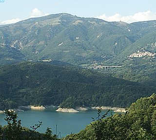
Lago del Salto is a reservoir lake in the Province of Rieti, Lazio, Italy. At an elevation of 535 m, its surface area is 10 km².

East Lake is a large freshwater lake within the city limits of Wuhan, China, the largest or the second largest urban lake in China. Wuhan's East Lake covers an area of 88 square kilometers. It is one of the 5A tourist zones of China, and admits over a million people yearly. It is one of the largest sites in Huazhong District. It is also the largest "City Lake" in China. East Lake is made of four areas, Ting Tao, Moshan, Luo Yan Island and Museum of Hubei Province.
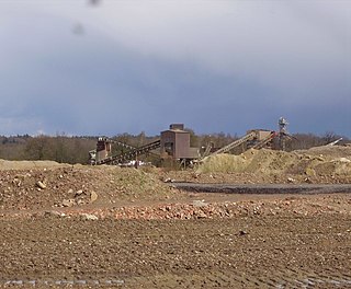
The Yateley Complex is a working gravel pit and a series of fishing lakes at Yateley, Hampshire, England, operated by CEMEX, the world's largest building materials supplier. The fishing side of the facility is under the management of CEMEX Angling, a subsidiary of the main company. CEMEX Angling operates 11 lakes at the site, which includes part of the River Blackwater and is stocked with a variety of fish. Around 5000 anglers a year visit the complex, which was also home to Heather the Leather, described as "Britain's most famous fish". In addition to angling use, some of the gravel pits have been restored as sports pitches and some were nominated as potential allotment sites.

Green Head is a small Australian coastal town in the Shire of Coorow. The town is situated between Geraldton and Perth in the Mid West region of Western Australia along Indian Ocean Drive. Its beaches and lifestyle provide a relaxed holiday atmosphere. It is the home of what was a significant, but now declining, rock lobster industry.
There are three Manistique Lakes in the Upper Peninsula of Michigan. The lakes include North Manistique Lake, Big Manistique Lake, and South Manistique Lake. The towns surrounding the lakes are Curtis, Germfask, and Helmer. The lakes are known for vacationing and fishing. They are also in close proximity to other natural sights such as the Great Lakes, rivers, and smaller lakes as well as tourist attractions including the Canada–US border, the Soo Locks, Mackinac Island, parks, and museums.

Rakina Bara is a lake in Sremčica, a suburb of Belgrade, Serbia. It is located in the municipality of Čukarica.

Wraysbury No 1 Gravel Pit is a 58.0-hectare (143-acre) biological Site of Special Scientific Interest in Wraysbury in Berkshire. It is part of South West London Waterbodies Ramsar site, and Special Protection Area. The lake has an area of 39.6 hectares. The pit was excavated in the 1920s and 1930s with gravel being removed from the site. Over the years plants and wildlife have colonised the area and it is now mature.


