Uganda is located in eastern Africa, west of Kenya, south of South Sudan, east of the Democratic Republic of the Congo, and north of Rwanda and Tanzania. It is in the heart of the Great Lakes region, and is surrounded by three of them, Lake Edward, Lake Albert, and Lake Victoria. While much of its border is lakeshore, Uganda is landlocked with no access to the sea.

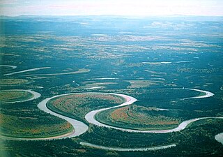
An oxbow lake is a U-shaped lake that forms when a wide meander of a river is cut off, creating a free-standing body of water. This landform is so named for its distinctive curved shape, which resembles the bow pin of an oxbow. In Australia, an oxbow lake is called a billabong, from the indigenous Wiradjuri language. In south Texas, oxbows left by the Rio Grande are called resacas.

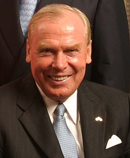
Jon Meade Huntsman Jr. is an American businessman, diplomat, politician, and the current Ambassador of the United States to Russia, serving since October 2017. Huntsman was the U.S. Ambassador to Singapore from 1992 to 1993, the Governor of Utah from 2005 to 2009, and the U.S. Ambassador to China from 2009 to 2011. He has served in the administrations of five Presidents and was a candidate for the 2012 Republican presidential nomination.

Jon Meade Huntsman Sr. was an American businessman and philanthropist. He was the founder and executive chairman of Huntsman Corporation, a global manufacturer and marketer of specialty chemicals. Huntsman plastics are used in a wide variety of familiar objects, including (formerly) clamshell containers for McDonald's hamburgers. Huntsman Corporation also manufactures a wide variety of organic and inorganic chemicals that include polyurethanes, textiles, and pigments. Huntsman's philanthropic giving exceeds $1.5 billion, focusing on areas of cancer research, programs at various universities, and aid to Armenia.

State Route 147 is a state highway serving the Las Vegas Valley in southern Nevada. It is signed as Lake Mead Boulevard and runs from Interstate 15 (I-15) and U.S. Route 93 in North Las Vegas east to the border of the Lake Mead National Recreation Area. It is not to be confused with Lake Mead Parkway, which also goes to Lake Mead but mainly runs in southern Las Vegas Valley and carries the designation of State Route 564.

The Murrumbidgee Irrigation Area (MIA) is geographically located within the Riverina area of New South Wales. It was created to control and divert the flow of local river and creek systems for the purpose of food production. The main river systems feeding and fed by the area are the Murrumbidgee and the Tumut. It is one of the most diverse and productive regions in Australia contributing over A$5 billion annually to the Australian economy. The MIA was first established in 1912 after the commissioning of Burrinjuck Dam. Further expansion occurred in the 1970s with the completion of the Snowy Mountains Scheme and construction of Blowering Dam on the Tumut River, which meets the Murrumbidgee near Gundagai.

The Weber River is a c. 125-mile (201 km) long river of northern Utah, United States. It begins in the northwest of the Uinta Mountains and empties into the Great Salt Lake. The Weber River was named for American fur trapper John Henry Weber.

Lake Çıldır, is a large freshwater lake in the Ardahan Province, northeastern part of Turkey. It is located at 41.0425°N 43.2552778°E, close to the borders with Georgia and Armenia. Lake Çıldır is located at the elevation of about 1,900 m (6,200 ft) and is surrounded by a mountainous region. It has an area of 123.00 km2 (47.49 sq mi) and a maximum depth of about 42 m (138 ft). Water from the lake is used for irrigation.

Quamby Bluff is a mountain in Northern Tasmania, Australia that is an outlying part of the Great Western Tiers mountain range.

The 2004 Utah gubernatorial election took place November 2, 2004. Incumbent Republican Governor Mike Leavitt resigned to join the George W. Bush administration, and incumbent Republican Lieutenant Governor Olene S. Walker became Governor. Governor Walker was defeated in the GOP convention -placing fourth- far behind Jon Huntsman, jr. Huntsman won the general election, carrying 25 of the 29 counties, winning 57.7% of the overall vote. This is the last time that a Democratic nominee for any statewide office has received forty percent or more of the popular vote, and the most recent election in which a Democratic nominee carried more than three counties in the state.

The Forth River is a perennial river located in northwest Tasmania, Australia.

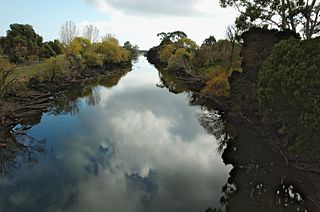
The Mulwala Canal is an irrigation canal in the southern Riverina region of New South Wales, Australia. It is the largest irrigation canal in the Southern Hemisphere. The canal, starting at Lake Mulwala, diverts water from the Murray River across the southern Riverina plain to the Edward River at Deniliquin. The channel has an offtake capacity of 10,000 megalitres (ML) per day and annually supplies over 1,000,000 ML to 700,000 hectares in the Murray Irrigation Area.

Lake Kununurra is a freshwater man-made reservoir located in the Ord River valley. The lake was formed in 1963 by the construction of the Ord Diversion Dam in Kununurra, northern Western Australia, which was built to supply water to the Ord River Irrigation Area. Prior to the Diversion Dam construction a natural permanent waterhole held back by the Bandicoot Bar was known as "Carlton Reach," which was reputed to be the largest waterhole in the Kimberley.
Perumal Eri is a major fresh water lake in the Cuddalore district of Tamil Nadu, India.

The Swinging Skirts LPGA Classic was a women's professional golf tournament in California on the LPGA Tour, held at Lake Merced Golf Club in Daly City, an adjacent suburb south of San Francisco. It debuted in April 2014, but ran for just three years, the LPGA Mediheal Championship succeeded it in 2018, also played at Lake Merced.
The Ashley Youth Detention Centre is a Youth detention centre outside Deloraine, Tasmania, Australia. It is the only such centre in Tasmania and has a capacity of 51 beds for 10‑ to 18-year-old offenders.

The Meander Dam is a concrete gravity dam across the Upper Meander River, located in northern Tasmania, Australia. The impounded reservoir is called Lake Huntsman.

The Pennsylvania State Game Lands Number 30 are Pennsylvania State Game Lands in McKean County in Pennsylvania in the United States providing hunting, bird watching, and other activities.


