Great Western Tiers

Last updated
Great Western Tiers
Kooparoona Niara [1]
Drys Bluff from the main road.JPG
Drys Bluff, part of the Great Western Tiers
Highest point
Peak Ironstone Mountain
Elevation 1,444 m (4,738 ft) [2]
AHD
Coordinates 41°42′36″S146°28′12″E / 41.71000°S 146.47000°E / -41.71000; 146.47000 [3]
Dimensions
Length100 km (62 mi)NE/SW
Geography
Relief Map of Tasmania.png
Red triangle with thick white border.svg
Location in Tasmania
Country Australia
State Tasmania
District Central Highlands
Range coordinates 41°55′48″S147°10′12″E / 41.93000°S 147.17000°E / -41.93000; 147.17000 [4]
Geology
Age of rock Jurassic
Type of rock Dolerite

The Great Western Tiers (Palawa kani: Kooparoona Niara) are a collection of mountain bluffs that form the northern edge of the Central Highlands plateau in Tasmania, Australia. The bluffs are contained within the Tasmanian Wilderness World Heritage Site.

Contents

The bluffs stretch northwest to southeast over 100 kilometres (62 mi) from the 1,420-metre (4,660 ft) Western Bluff near the town of Mole Creek to the 1,210-metre (3,970 ft) Millers Bluff, approximately 25 kilometres (16 mi) west of Campbell Town. [5] During the late 19th century the Tiers were known as the Great Western Range. [6]

Features

The Central Highlands, or Tasmanian central plateau, was uplifted from the lower Meander Valley, most probably in the Eocene epoch though possibly earlier, forming the Tiers' escarpment. [7] The plateau's north-east boundary, which ranges from 760 metres (2,490 ft)1,500 metres (4,900 ft), originated in extensive Tertiary faulting. [8]

This escarpment divides the high, rocky, sparsely inhabited central plateau from the fertile lower land of the Meander Valley and the northern midlands. The edge of the tiers have prominent cliffs and columns of Jurassic dolerite. The highest peak in the tiers is the 1,444-metre (4,738 ft) Ironstone Mountain. [2] Unlike most of the bluffs this mountain is not visible from the Meander Valley, but is south of the escarpment. [5] The escarpment has a distinct concave profile. Cliffs and scree slopes are common features. [9] The dolerite is so prominent as the older rocks that overlay them are softer and have been eroded away. In places dolerite columns have collapsed into scree slopes. [10]

The face of the tiers has been eroded and retreated approximately 4 miles (6.4 km) since their formation, leaving the mountain Quamby Bluff as a solitary outlier. The central plateau's landform has been changed by glaciation. Valleys under the tiers are filled with talus, mostly bounders with a 25% mix of soil formed from boulder weathering. [11]

Peaks

The peaks and bluffs of the Great Western Tiers include:

Panorama from Chudleigh towards the Great Western Tiers GreatWesternTiersFromChudleigh.jpg
Panorama from Chudleigh towards the Great Western Tiers

See also

Related Research Articles

<span class="mw-page-title-main">Cradle Mountain</span> Mountain in Tasmania

Cradle Mountain is a locality and mountain in the Central Highlands region of the Australian state of Tasmania. The mountain is situated in the Cradle Mountain-Lake St Clair National Park.

<span class="mw-page-title-main">Meander Valley Council</span> Local government body in Tasmania, Australia

Meander Valley Council is a local government body in northern Tasmania. It covers the western outskirts of Launceston, and further westward along the Meander River. Meander Valley Council is classified as a rural local government area and has a population of 19,713. Major towns and localities of the region include Elizabeth Town, Mole Creek, Westbury and the principal town of Deloraine.
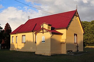
<span class="mw-page-title-main">Meander, Tasmania</span> Town in Tasmania, Australia

Meander is a rural locality and town in the local government area of Meander Valley in the Launceston region of Tasmania. The locality is about 34 kilometres (21 mi) south-west of the town of Westbury. The 2016 census has a population of 328 for the state suburb of Meander.
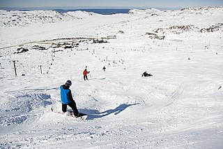
<span class="mw-page-title-main">Ben Lomond (Tasmania)</span> Mountain in the north of Tasmania

Ben Lomond is a mountain in the north-east of Tasmania, Australia.
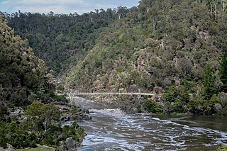
<span class="mw-page-title-main">South Esk River</span> River in Tasmania, Australia

The South Esk River, the longest river in Tasmania, is a major perennial river located in the northern region of Tasmania, Australia.

<span class="mw-page-title-main">Mole Creek</span> Town in Tasmania, Australia

Mole Creek is a town in the upper Mersey Valley, in the central north of Tasmania, Australia. Mole Creek is well known for its honey and accounts for about 35 percent of Tasmania's honey production. The locality is in the Meander Valley Council area, but with about 3% in the Kentish Council LGA.

<span class="mw-page-title-main">Liffey Falls</span> Waterfall in Tasmania, Australia

The Liffey Falls, a series of four distinct tiered–cascade waterfalls on the Liffey River, is located in the Midlands region of Tasmania, Australia. The falls are a significant massacre site where 30-60 Aboriginal people were murdered in a reprisal killing for the killing of the stockman William Knight by Aboriginal people.

<span class="mw-page-title-main">Barn Bluff</span> Mountain in Tasmania, Australia

Barn Bluff is a mountain located in the Central Highlands region of Tasmania, Australia. The mountain is situated in the Cradle Mountain-Lake St Clair National Park at the junction of the easternmost points of the Murchison and Mackintosh river catchments.

<span class="mw-page-title-main">Ironstone Mountain</span> Mountain in Tasmania, Australia

The Ironstone Mountain is a mountain located in the Central Highlands region of Tasmania, Australia. Part of Great Western Tiers escarpment, the mountain is situated south of the small country village of Mole Creek.

<span class="mw-page-title-main">Mother Cummings Peak</span> Mountain in Tasmania, Australia

The Mother Cummings Peak is one of the prominent peaks on the Great Western Tiers located in the Central Highlands region of Tasmania, Australia.

<span class="mw-page-title-main">Quamby Bluff</span>

Quamby Bluff is a mountain in Northern Tasmania, Australia that is an outlying part of the Great Western Tiers mountain range.

<span class="mw-page-title-main">Stacks Bluff</span>

The Stacks Bluff is a peak in northeast Tasmania, Australia. The mountain is situated on the Ben Lomond plateau.

<span class="mw-page-title-main">Mount Barrow</span> Mountain in Tasmania, Australia

Mount Barrow is a mountain in the northern region of Tasmania, Australia. With an elevation of 1,406 metres (4,613 ft) above sea level, the mountain is located 22 kilometres (14 mi) east-north-east of Launceston. The mountain habitat is a mixture of temperate old growth rainforest, subalpine and alpine landscapes.

<span class="mw-page-title-main">Liffey River (Tasmania)</span> River in Tasmania, Australia

The Liffey River is a river in Northern Tasmania, Australia.

<span class="mw-page-title-main">Hagley, Tasmania</span> Town in Tasmania, Australia

Hagley is a rural locality and town in the local government area of Meander Valley in the Launceston region of Tasmania. The locality is about 5 kilometres (3.1 mi) north-east of the town of Westbury. The 2016 census has a population of 335 for the state suburb of Hagley.

The Meander Dam is a concrete gravity dam across the Upper Meander River, located in northern Tasmania, Australia. The impounded reservoir is called Lake Huntsman.

Chudleigh is a rural locality in the local government area of Meander Valley in the Launceston region of Tasmania. The locality is about 37 kilometres (23 mi) west of the town of Westbury. The 2016 census has a population of 203 for the state suburb of Chudleigh.

<span class="mw-page-title-main">Dry's Bluff</span> Mountain in Tasmania, Australia

Dry's Bluff is a mountain in the Great Western Tiers Range in Tasmania. The walk to its summit is listed in The Abels as one of the hardest day walks in Tasmania with an elevation gain of over 1000m from the base of the plateau. Access to the start of the walk is through Bob Brown's residence Oura Oura which has the sign Trespassers Welcome on the gate.

<span class="mw-page-title-main">Tasmanian Central Highland forests</span> Terrestrial ecoregion in Tasmania, Australia

The Tasmanian Central Highland forests is a temperate broadleaf and mixed forests ecoregion in Australia. It covers Tasmania's Central Highlands region.

References

  1. Petrusma, Jacquie (3 June 2022). "On Mole Creek & Kooparoona Niara National Parks …". Tasmanian Times. Retrieved 3 April 2023.
  2. 1 2 3 "Ironstone Mountain, Australia". Peakbagger.com. Retrieved 31 May 2017.
  3. "Ironstone Mountain (TAS)". Gazetteer of Australia online. Geoscience Australia, Australian Government.
  4. "Great Western Tiers (TAS)". Gazetteer of Australia online. Geoscience Australia, Australian Government.
  5. 1 2 3 Lloyd, p.1
  6. Whitworth, p.91
  7. Fish and Yaxley, p.253
  8. Fish and Yaxley, p.293
  9. Fish and Yaxley, p.294
  10. Lloyd, p.5
  11. Fish and Yaxley, p.12
  12. Whitworth, p.22
  13. Whitworth, p.61
  14. Whitworth, p.135
  15. "Cummings Head, Australia". Peakbagger.com. Retrieved 31 May 2017.
  16. Forestry Commission of Tasmania, p.9

Bibliography