
Mount Read is a mountain located in the West Coast region of Tasmania, Australia, and is at the north west edge of the West Coast Range.
Mount Darwin is a mountain located in the West Coast region of Tasmania, Australia.

Mount Murchison is a mountain on the West Coast Range, located in the West Coast region of Tasmania, Australia.

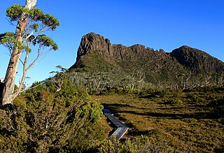
Barn Bluff is a mountain located in the Central Highlands region of Tasmania, Australia. The mountain is situated in the Cradle Mountain-Lake St Clair National Park at the junction of the easternmost points of the Murchison and Mackintosh river catchments.

The Stacks Bluff is a peak in northeast Tasmania, Australia. The mountain is situated on the Ben Lomond plateau.

The Du Cane Range is a mountain range in the Central Highlands region of Tasmania, Australia.
Mount Massif is a mountain in the Central Highlands region of Tasmania, Australia. Situated in the Cradle Mountain-Lake St Clair National Park, the mountain is part of the Du Cane Range.

Mount Geryon is a mountain in the Central Highlands region of the Australian state of Tasmania. The mountain is part of the Du Cane Range and is situated within the Cradle Mountain-Lake St Clair National Park.
King Davids Peak, also known as the West Wall, is a mountain in the Central Highlands region of Tasmania, Australia. The mountain is situated in the Walls of Jerusalem National Park.

Mount Gould is a mountain in the Central Highlands region of Tasmania, Australia. Situated within the Cradle Mountain-Lake St Clair National Park, the mountain is a major feature of the national park, and is a popular venue with bushwalkers and mountain climbers.
Mount Thetis is a mountain in the Central Highlands region of Tasmania, Australia. It is part of the Pelion Range and is situated within the Cradle Mountain-Lake St Clair National Park. It is a major feature of the national park, and is a popular venue with bushwalkers and mountain climbers.
The Acropolis is a mountain in the Central Highlands region of Tasmania, Australia. Situated in the Cradle Mountain-Lake St Clair National Park, the mountain is part of the Du Cane Range.
Mount Achilles is a mountain that is part of the Du Cane Range, located in the Cradle Mountain-Lake St Clair National Park in Tasmania, Australia. With an elevation of 1,353 metres (4,439 ft) above sea level, the peak is the 46th highest mountain in Tasmania.
Adamson's Peak is a mountain in the Hartz Mountains National Park in southern Tasmania, Australia. With an elevation of 1,225 metres (4,019 ft) above sea level, it is the 55th highest mountain in Tasmania. It is a prominent feature of the national park, and is a popular venue with bushwalkers.
Artillery Knob is a mountain in the Cradle Mountain-Lake St Clair National Park in the Central Highlands region of Tasmania, Australia. It is the 57th highest mountain in Tasmania. It is a prominent feature of the national park, and is a popular venue with bushwalkers.
Mount Victoria is a mountain in the Mount Victoria Forest Reserve in north-east Tasmania, Australia, and also forms part of the Ben Lomond biogeographic region and the Ben Lomond National Park. The peak has an elevation of 1,213 metres (3,980 ft) above sea level and is the 58th highest mountain in Tasmania. It is a prominent feature of the reserve, and is a popular venue with bushwalkers.
The Smithies Peak, sometimes incorrectly called Smithies Towers, is a mountain in the Central Highlands region of Tasmania, Australia. The mountain is situated in the Cradle Mountain-Lake St Clair National Park.

The Tyndall Range, commonly called The Tyndalls, is a mountain range that is part of the West Coast Range located in the Western region of Tasmania, Australia.

