
Strahan, is a small town and former port on the west coast of Tasmania. It is now a significant locality for tourism in the region.

Macquarie Harbour is a shallow fjord in the West Coast region of Tasmania, Australia. It is approximately 315 square kilometres (122 sq mi), and has an average depth of 15 metres (49 ft), with deeper places up to 50 metres (160 ft). It is navigable by shallow-draft vessels. The main channel is kept clear by the presence of a rock wall on the outside of the channel's curve. This man-made wall prevents erosion and keeps the channel deep and narrow, rather than allowing the channel to become wide and shallow. A reported Aboriginal name for the harbour is Parralaongatek.

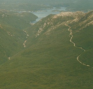
The West Coast Range is a mountain range located in the West Coast region of Tasmania, Australia.
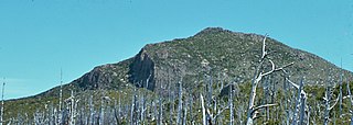
Mount Lyell is a mountain in the West Coast Range of Western Tasmania, Australia.

Hells Gates is the name of the mouth of Macquarie Harbour on the West Coast of Tasmania.

Mount Owen is a mountain directly east of the town of Queenstown on the West Coast Range in Western Tasmania, Australia.

Mount Huxley is a mountain located on the West Coast Range in the West Coast region of Tasmania, Australia. With an elevation of 926 metres (3,038 ft) above sea level, the mountain was named by Charles Gould in 1863 in honour of Professor Thomas Henry Huxley.
Mount Darwin is a mountain located in the West Coast region of Tasmania, Australia.
Mount Jukes is a mountain located on the Jukes Range, a spur off the West Coast Range, in the West Coast region of Tasmania, Australia.
Mount Sedgwick is a mountain located within the West Coast Range, in the West Coast region of Tasmania, Australia.

Cape Sorell is a headland located in the Southern Ocean outside Macquarie Harbour on the West Coast of Tasmania, Australia. The cape and the Cape Sorell Lighthouse, located above the headland, are important orientation points for all vessels entering the Macquarie Heads and then through Hells Gates at the entrance to the harbour.

William Sorell was a soldier and third Lieutenant-Governor of Van Diemen's Land.
Mount Tyndall is a mountain that is part of the Tyndall Range, a spur off the West Coast Range, located in the Western region of Tasmania, Australia.
Mount Strahan is a mountain located on the West Coast Range in the West Coast region of Tasmania, Australia. With an elevation of 855 metres (2,805 ft) above sea level, the mountain is situated directly east of Macquarie Harbour and, like Mount Sorell, dominates the east side of the harbour near Sarah Island.
Mount Dundas is a mountain located in the West Coast region of Tasmania, Australia. The mountain is situated at the north west edge of the West Coast Range.
Mount Geikie is a mountain in the West Coast Range of Western Tasmania, Australia.
The Sticht Range is a mountain range located in the West Coast region of Tasmania, Australia. The range runs between two tributaries of the Eldon River and is located within the eastern part of the West Coast Range and has an unnamed peak with an elevation of 1,080 metres (3,540 ft) above sea level.
The Macquarie Heads Breakwater was a project of the Strahan Marine Board in Western Tasmania to sustain a reasonable depth to the Hells Gates and Macquarie Heads of the Macquarie Harbour area to allow for shipping of limited tonnage to serve Regatta Point while the Mount Lyell Mining and Railway Company was exporting its mineral products by sea. The heads were notoriously difficult to navigate in good weather, and even more difficult in bad weather.

The Tyndall Range, commonly called The Tyndalls, is a mountain range that is part of the West Coast Range located in the Western region of Tasmania, Australia.
Point Hibbs is a headland on the south-west coast of Tasmania, Australia. The headland is located south of the most southern point of Macquarie Harbour, and west of the Gordon River. It is the next named feature along the coast south of Cape Sorell that is used to delineate sections of the coast. Like South West Cape, it is used as a reference point for nearby wrecks.
