The Mount Read Volcanics is a Cambrian volcanic belt in Western Tasmania.
It is a complex belt due to folding, faulting and a range of tectonic events.
Between 1986 and 1993 a project to research and map the belt was conducted. [1] [2]
The component regions within the belt were identified in separate maps: [3]
Geological conferences in Australia and Tasmania have had symposiums and excursions to consider aspects of the phenomenon:
It is a productive mineralised belt that has had profitable copper-silver and gold production of Mount Lyell, Rosebery, and Henty Gold Mine, as well as numerous smaller sites of prospective mineralisation along the West Coast Range.

Diabase, also called dolerite or microgabbro, is a mafic, holocrystalline, subvolcanic rock equivalent to volcanic basalt or plutonic gabbro. Diabase dikes and sills are typically shallow intrusive bodies and often exhibit fine-grained to aphanitic chilled margins which may contain tachylite.

The West Coast Range is a mountain range located in the West Coast region of Tasmania, Australia.
Mount Lyell Mining and Railway Company was a Tasmanian mining company formed on 29 March 1893, most commonly referred to as Mount Lyell. Mount Lyell was the dominant copper mining company of the West Coast from 1893 to 1994, and was based in Queenstown, Tasmania.

The Melba Line is a 1,067 mm narrow-gauge railway on the West Coast of Tasmania. The line was originally constructed as a private railway line named the Emu Bay Railway and was one of the longest-lasting and most successful private railway companies in Australia. While at present the line travels from Burnie to Melba Flats, it previously ran through to Zeehan carrying minerals and passengers as an essential service for the West Coast community.
Mount Read is a mountain located in the West Coast region of Tasmania, Australia, and is at the north west edge of the West Coast Range.
The Mount Jukes mine sites were a series of short-lived, small mine workings high on the upper regions of Mount Jukes in the West Coast Range on the West Coast of Tasmania.
The history of the railways on the West Coast of Tasmania has fascinated enthusiasts from around the world, because of the combination of the harsh terrain in which the railways were created, and the unique nature of most of the lines.
Mount Tyndall is a mountain that is part of the Tyndall Range, a spur off the West Coast Range, located in the Western region of Tasmania, Australia.
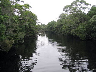
The Henty River is a perennial river in the West Coast region of Tasmania, Australia. The river generally lies north of Queenstown and south of Zeehan.

Mount Murchison is a mountain on the West Coast Range, located in the West Coast region of Tasmania, Australia.
Mount Dundas is a mountain located in the West Coast region of Tasmania, Australia. The mountain is situated at the north west edge of the West Coast Range.
Mount Geikie is a mountain in the West Coast Range of Western Tasmania, Australia.
The Henty Gold Mine is located at the head of the Henty River on the edge of the West Coast Range in Western Tasmania. It is approximately 30 km north of Queenstown. It is east of Zeehan and south of Rosebery. It can be reached by the Hydro-built road that passes between the Henty River and Tullah.
David Edward Leaman was an author, structural geologist, geohydrologist and geophysicist.

The geology of Tasmania is complex, with the world's biggest exposure of diabase, or dolerite. The rock record contains representatives of each period of the Neoproterozoic, Paleozoic, Mesozoic and Cenozoic eras. It is one of the few southern hemisphere areas that were glaciated during the Pleistocene with glacial landforms in the higher parts. The west coast region hosts significant mineralisation and numerous active and historic mines.

Lake Beatrice is a 55-hectare (140-acre) natural lake on the lower eastern side of Mount Sedgwick in the West Coast Range of Western Tasmania, Australia.
The Anthony Road is a major B Route in Western Tasmania, running from the Murchison Highway (A10) at Tullah to the Zeehan Highway (A10) north of Queenstown.

The Tyndall Range, commonly called The Tyndalls, is a mountain range that is part of the West Coast Range located in the Western region of Tasmania, Australia.
Mount Charter is an extinct volcano located on the West Coast of Tasmania, Australia.
{{citation}}: CS1 maint: numeric names: authors list (link){{citation}}: CS1 maint: numeric names: authors list (link){{citation}}: CS1 maint: numeric names: authors list (link)| Arthur Range |
| ||||||
|---|---|---|---|---|---|---|---|
| Ben Lomond |
| ||||||
| Du Cane Range |
| ||||||
| Eldon Range |
| ||||||
| Great Western Tiers |
| ||||||
| Pelion Range |
| ||||||
| Wellington Range |
| ||||||
| West Coast Range |
| ||||||
| Not in a defined range |
| ||||||