Mount Pelion West

Last updated

Mount Pelion West
Pelion West from Pelion Plains 2.jpg
Pelion West from near Pelion Hut on Pelion Plains
Highest point
Elevation 1,560 m (5,120 ft) [1] [2]
Prominence 469 m (1,539 ft) [2]
Isolation 6.35 km (3.95 mi) [2]
Coordinates 41°49′48″S145°58′12″E / 41.83000°S 145.97000°E / -41.83000; 145.97000 Coordinates: 41°49′48″S145°58′12″E / 41.83000°S 145.97000°E / -41.83000; 145.97000 [3]
Geography
Relief Map of Tasmania.png
Red triangle with thick white border.svg
Mount Pelion West
Location in Tasmania
Location Central Highlands, Tasmania, Australia
Parent range Pelion Range
Topo map Achilles (4036)
Geology
Age of rock Jurassic
Mountain type Dolerite
Climbing
Easiest route One day return from Pelion Hut, via the Overland Track

Mount Pelion West is a mountain located in the Central Highlands region of Tasmania, Australia. The mountain is part of the Pelion Range and is situated within the Cradle Mountain-Lake St Clair National Park at the easternmost boundary of the Murchison River catchment.

Contents

Mount Pelion West is the fourth highest mountain in Tasmania with an elevation of 1,560 metres (5,120 ft) above sea level [1] [2] and is one of only eight mountains in the state which are over 1,500 metres (4,900 ft). [4]

Mountain location

The mountain summit is at grid reference 152682 UTM Zone 55S and high resolution topographical information is available on Tasmap Achilles (4036) 1:25000. To the west lies an extensive, relatively flat moorland, to the north is Cradle Mountain and Barn Bluff, to the northeast and quite close at 6 kilometres (3.7 mi) is Mount Oakleigh, to the east is Mount Pelion East and due south is Mount Achilles. Below the northern side of the mountain is Pelion Creek which flows into the head waters of the Forth River. The Forth River has its origin directly east of Pelion West at Frog Flats (720 metres (2,360 ft) above sea level), the lowest point on the whole Overland Track. At its closest point the Overland Track passes within 2 kilometres (1.2 mi) of the mountain summit.[ citation needed ]

Ascending

Keith Ernest Lancaster, an early bushwalking and mountain climbing pioneer, climbed Mount Pelion West on 30 January 1946 by enduring a slow and painful crawl through sections of the sharp and prickly Richea scoparia that frequently inhabits alpine areas around Tasmanian mountains. Lancaster referred to Mount Pelion West as one of "The Giants of the Reserve". In his account of his climb Lancaster mentions "the confusion of the enormous boulders" on the top of the mountain. [5]

On the Achilles Tasmap is marked the approximate location of a walking track to climb the mountain along its northeastern spur. The unmarked track start is approximately 250 metres (820 ft) east of the Pelion Creek crossing on the Overland Track and is in between two logs that are perpendicular to the Overland Track. This mountain is much more difficult to climb than either Mount Ossa or Mount Pelion East, the more traditional side-excursion climbs along the famous 65-kilometre (40 mi) Overland Track. [6] This is due to a difficult traverse of over 500 metres (1,600 ft) across huge dolerite boulders to reach the obelisk shaped, sloping summit boulder.

Pelion Range from Mt Oakleigh.jpg
Mount Pelion West (right) in context with other mountains in the Pelion Range

See also

Related Research Articles

Cradle Mountain-Lake St Clair National Park Protected area in Tasmania, Australia

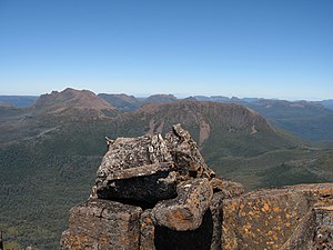
Cradle Mountain-Lake St Clair National Park is located in the Central Highlands area of Tasmania (Australia), 165 kilometres (103 mi) northwest of Hobart. The park contains many walking trails, and is where hikes along the well-known Overland Track usually begin. Major features are Cradle Mountain and Barn Bluff in the northern end, Mount Pelion East, Mount Pelion West, Mount Oakleigh and Mount Ossa in the middle and Lake St Clair in the southern end of the park. The park is part of the Tasmanian Wilderness World Heritage Area.

Cradle Mountain Mountain in Tasmania

Cradle Mountain is a locality and mountain in the Central Highlands region of the Australian state of Tasmania. The mountain is situated in the Cradle Mountain-Lake St Clair National Park.

Lake St Clair (Tasmania) Lake in Tasmania, Australia

Lake St Clair or leeawulenna is a natural freshwater lake located in the Central Highlands area of Tasmania, Australia. The lake forms the southern end of the Cradle Mountain-Lake St Clair National Park. It has an area of approximately 45 square kilometres (17 sq mi), and a maximum depth of 160 metres (520 ft), making it Australia's deepest lake.

Mount Ossa (Tasmania) Highest mountain in Tasmania, Australia

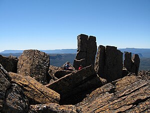
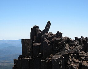
Mount Ossa is the highest mountain in Tasmania, with a summit elevation of 1,617 metres (5,305 ft) above sea level. It makes up part of the Pelion Range within Cradle Mountain-Lake St Clair National Park in the Central Highlands region of Tasmania, Australia.

Overland Track Hiking trail in Cradle Mountain-Lake St Clair National Park

The Overland Track is an Australian bushwalking track, traversing Cradle Mountain-Lake St Clair National Park, within the Tasmanian Wilderness World Heritage Area. It's walked by more than nine thousand people each year, with numbers limited in the warmer months. Officially the track runs for 65 kilometres (40 mi) from Cradle Mountain to Lake St Clair however many choose to extend it by walking along Lake St Clair for an extra day, bringing it to 82 kilometres (51 mi). It winds through terrain ranging from glacial mountains, temperate rainforest, wild rivers and alpine plains.

Frenchmans Cap Mountain in Western Tasmania, located in Wilderness World Heritage area

Frenchmans Cap is a mountain in the West Coast region of Tasmania, Australia. The mountain is situated in the Franklin-Gordon Wild Rivers National Park.

Eldon Range

The Eldon Range is a mountain range located in the west coast region of Tasmania, Australia.

Barn Bluff Mountain in Tasmania, Australia

Barn Bluff is a mountain located in the Central Highlands region of Tasmania, Australia. The mountain is situated in the Cradle Mountain-Lake St Clair National Park at the junction of the easternmost points of the Murchison and Mackintosh river catchments.

Mount Pelion East

Mount Pelion East is a mountain located in the Central Highlands region of Tasmania, Australia. The mountain is situated within the Cradle Mountain-Lake St Clair National Park.

Pelion Gap

Pelion Gap is the mountain pass between Mount Doris and Mount Ossa to the south and Mount Pelion East to the north through which the Overland Track in Tasmania passes.

Mount Achilles (Tasmania) Mountain in Tasmania

Mount Achilles is a mountain that is part of the Du Cane Range, located in the Cradle Mountain-Lake St Clair National Park in Tasmania, Australia. With an elevation of 1,353 metres (4,439 ft) above sea level, the peak is the 46th highest mountain in Tasmania.

Mount Ragoona Mountain in Tasmania, Australia

Mount Ragoona, sometimes Mount Rogoonga, is a relatively high mountain in the southern region of the Walls of Jerusalem National Park in Tasmania, Australia. The mountain, with an elevation of 1,336 metres (4,383 ft) above sea level, is virtually surrounded by four large lakes; Myrtle, Meston, Louisa and Adelaide. The mountain rises from the shores of Lake Myrtle.

Cathedral Mountain (Tasmania) Mountain in Tasmania, Australia

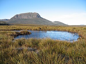
Cathedral Mountain is a dominant mountain in the Cradle Mountain-Lake St Clair National Park in the central highlands in the state of Tasmania, Australia.

New Pelion Hut

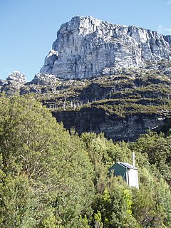
New Pelion Hut is the largest alpine hut in the Cradle Mountain-Lake St Clair National Park in the Central Highlands of Tasmania, Australia

Old Pelion Hut

Old Pelion Hut is an alpine hut located in Cradle Mountain-Lake St Clair National Park in the Central Highlands of Tasmania. It was built for the Mount Pelion Copper Mining Company at around 1936.

Smithies Peak

The Smithies Peak, sometimes incorrectly called Smithies Towers, is a mountain in the Central Highlands region of Tasmania, Australia. The mountain is situated in the Cradle Mountain-Lake St Clair National Park.

Pelion Range

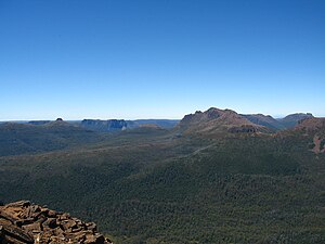
The Pelion Range is a mountain range in the Cradle Mountain-Lake St Clair National Park, Tasmania, Australia.

Skiing in Tasmania

Skiing in Tasmania takes place in the high country of the state of Tasmania, Australia, during the Southern Hemisphere winter. Cross country skiing is possible within the Tasmanian Wilderness and two small downhill ski-fields have been developed at Ben Lomond and Mount Mawson.

Mount Olympus (Tasmania) Mountain in Tasmania

Mount Olympus is a mountain in the Cradle Mountain-Lake St Clair National Park in Tasmania, Australia. It is the 24th highest mountain in Tasmania at 1,472 metres (4,829 ft) above sea level and is situated about 8 kilometres (5.0 mi) South-East of Mount Gould and about 4 kilometres (2.5 mi) west of Lake St. Clair.

References

  1. 1 2 "LISTmap (Mount Pelion West)". Tasmanian Government Department of Primary Industries and Water. Retrieved 14 January 2008.
  2. 1 2 3 4 "Mount Pelion West, Australia". Peakbagger.com. Retrieved 6 June 2015.
  3. "Mount Pelion West (TAS)". Gazetteer of Australia online. Geoscience Australia, Australian Government.
  4. "Height of major Mountains, Tasmania". Australian Bureau of Statistics. January 1946. Retrieved 6 June 2015.
  5. Lancaster, Keith. "CLIMBING THE GIANTS IN THE HEART OF THE CRADLE MT. - LAKE ST. CLAIR SCENIC RESERVE". Keith Lancaster's Mountaineering Diaries. Dirk Veltkamp. Retrieved 8 October 2019.
  6. The Overland Track Tasmania Parks & Wildlife Service