Mount Darwin (Tasmania)

Last updated

Mount Darwin
Relief Map of Tasmania.png
Red triangle with thick white border.svg
Mount Darwin
Location in Tasmania
Highest point
Elevation 1,033 m (3,389 ft)
Coordinates 42°15′00″S145°35′48″E / 42.25000°S 145.59667°E / -42.25000; 145.59667 (Mount Darwin) Coordinates: 42°15′00″S145°35′48″E / 42.25000°S 145.59667°E / -42.25000; 145.59667 (Mount Darwin) [1]
Geography
Location Western Tasmania, Australia
Parent range West Coast Range
Geology
Age of rock Jurassic

Mount Darwin is a mountain located in the West Coast region of Tasmania, Australia.

Contents

With an elevation of 1,033 metres (3,389 ft) above sea level, the mountain is situated on the West Coast Range. On the eastern side of the mountain is Darwin, a long-abandoned town site. Mount Darwin is the southernmost mountain of the West Coast range. Mount Jukes is north of the mountain while Mount Sorell is west of it. [2]

The mountain is named in honour of Charles Darwin. [2]

Mine sites

Long abandoned short drives and shallow holes are found on Mount Darwin and are usually cited as being part of the Jukes-Darwin field. [3] [4]

Features and access

The mountain has a plateau and has mining exploration tracks that lead to some of the older workings. It was possible in the 1970s to travel to the top of Mount Darwin in four wheel drive vehicles. The tracks also lead over towards the Clark River Valley which lies between Darwin and Mount Sorell to the west, and some tracks also were made on the ridge between Mount Darwin and the southern side of Mount Jukes.

Additional features located adjacent to the mountain includes a series of valleys and depressions called respectively the East Darwin Cirque, [5] the South Darwin Cirque, [6] and the Darwin Crater, a probable impact crater, [7] lying 8.5 kilometres (5.3 mi) to the south-east of the mountain; the South Darwin Peak, a hill; [8] [9] [10] and the Darwin Plateau. [11]

See also

Related Research Articles

Great Western Tiers mountain range in Tasmania, Australia

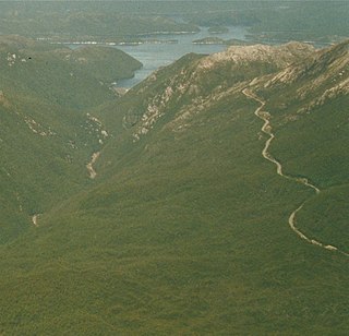
The Great Western Tiers are a collection of mountain bluffs that form the northern edge of the Central Highlands plateau in Tasmania, Australia. The bluffs are contained within the Tasmanian Wilderness World Heritage Site.

West Coast Range Mountain range in Tasmania, Australia

The West Coast Range is a mountain range located in the West Coast region of Tasmania, Australia.

Mount Lyell (Tasmania) mountain in West Coast Range in Western Tasmania

Mount Lyell is a mountain in the West Coast Range of Western Tasmania, Australia.

Mount Owen (Tasmania) mountain in the West Coast Range, Western Tasmania, situated east of Queenstown, Tasmania

Mount Owen is a mountain directly east of the town of Queenstown on the West Coast Range in Western Tasmania, Australia.

The Mount Jukes Mine sites were a series of short-lived, small mine workings high on the upper regions of Mount Jukes in the West Coast Range on the West Coast of Tasmania.

Mount Huxley (Tasmania) mountain located in West Coast Range, Western Tasmania

Mount Huxley is a mountain located on the West Coast Range in the West Coast region of Tasmania, Australia. With an elevation of 926 metres (3,038 ft) above sea level, the mountain was named by Charles Gould in 1863 in honour of Professor Thomas Henry Huxley.

Mount Jukes (Tasmania) mountain in West Coast Range, Western Tasmania, Australia

Mount Jukes is a mountain located on the Jukes Range, a spur off the West Coast Range, in the West Coast region of Tasmania, Australia.

Mount Sorell mountain in West Coast Range, Western Tasmania, Australia

Mount Sorell is a mountain located in the West Coast region of Tasmania, Australia.

Mount Sedgwick (Tasmania) mountain in West Coast Range, Western Tasmania, Australia

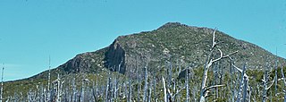
Mount Sedgwick is a mountain located within the West Coast Range, in the West Coast region of Tasmania, Australia.

Mount Tyndall (Tasmania) mountain in the West Coast Range, Western Tasmania, Australia

Mount Tyndall is a mountain that is part of the Tyndall Range, a spur off the West Coast Range, located in the Western region of Tasmania, Australia.

Mount Strahan Mountain in Australia

Mount Strahan is a mountain located on the West Coast Range in the West Coast region of Tasmania, Australia. With an elevation of 855 metres (2,805 ft) above sea level, the mountain is situated directly east of Macquarie Harbour and, like Mount Sorell, dominates the east side of the harbour near Sarah Island.

Mount Dundas (Tasmania) mountain in Australia

Mount Dundas is a mountain located in the West Coast region of Tasmania, Australia. The mountain is situated at the north west edge of the West Coast Range.

Mount Geikie mountain in West Coast Range, Western Tasmania, Australia

Mount Geikie is a mountain in the West Coast Range of Western Tasmania, Australia.

Sticht Range mountains in Australia

The Sticht Range is a mountain range located in the West Coast region of Tasmania, Australia. The range runs between two tributaries of the Eldon River and is located within the eastern part of the West Coast Range and has an unnamed peak with an elevation of 1,080 metres (3,540 ft) above sea level.

Eldon Range mountain range

The Eldon Range is a mountain range located in the west coast region of Tasmania, Australia.

Mount Arthur (Tasmania) mountain

Mount Arthur is a mountain in the northern region of Tasmania, Australia. With an elevation of 1,188 metres (3,898 ft) above sea level, the mountain is located north-east of Launceston, near the town of Lilydale.

Tyndall Range mountains in Western Tasmania

The Tyndall Range, commonly called The Tyndalls, is a mountain range that is part of the West Coast Range located in the Western region of Tasmania, Australia.

Mount Black (Tasmania)

Mount Black is a mountain on the West Coast Range located in the West Coast region of Tasmania, Australia. With an elevation of 950 metres (3,117 ft) above sea level, the mountain is located adjacent to the town of Rosebery.

References

  1. "Mount Darwin (TAS)". Gazetteer of Australia online. Geoscience Australia, Australian Government.
  2. 1 2 Baillie, Peter (2010). "The West Coast Range, Tasmania: Mountains and Geological Giants" (PDF). Papers and Proceedings of the Royal Society of Tasmania (reprint ed.). Hobart, Tasmania: University of Tasmania. 144: 1–13. ISSN   0080-4703. Archived from the original (PDF) on 16 June 2015. Retrieved 18 June 2015.
  3. Geological map of Mount Darwin region with relief shown by contours: Darwin [cartographic material] (Map). 1:25,000. Tasmanian Geological Survey. 2001. Sheet 3832.
  4. Waller, George A; Tasmania. Department of Mines (1903), Report on Findon's copper sections, Mount Darwin, Dept. of Mines, retrieved 16 June 2015
  5. "East Darwin Cirque (TAS)". Gazetteer of Australia online. Geoscience Australia, Australian Government.
  6. "South Darwin Cirque (TAS)". Gazetteer of Australia online. Geoscience Australia, Australian Government.
  7. "Darwin Crater (TAS)". Gazetteer of Australia online. Geoscience Australia, Australian Government.
  8. "South Darwin Peak (TAS)". Gazetteer of Australia online. Geoscience Australia, Australian Government.
  9. Jones, A. T. (November 1993), The geology, geochemistry and structure of the Mount Darwin-South Darwin Peak area, western Tasmania , retrieved 16 June 2015
  10. "The South Mount, Darwin[?] Mineral Field TASMANIA". Melbourne Punch (Vic. : 1855 - 1900) . Vic.: National Library of Australia. 12 October 1899. p. 8. Retrieved 16 June 2015.
  11. "Darwin Plateau (TAS)". Gazetteer of Australia online. Geoscience Australia, Australian Government.

Further reading