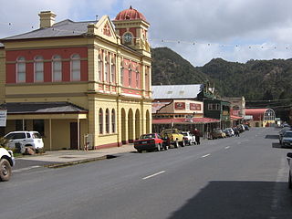
Queenstown is a town in the West Coast region of the island of Tasmania, Australia. It is in a valley on the western slopes of Mount Owen on the West Coast Range.
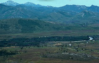
The King River is a major perennial river in the West Coast region of Tasmania, Australia.

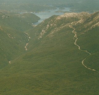
The West Coast Range is a mountain range located in the West Coast region of Tasmania, Australia.
Mount Lyell Mining and Railway Company was a Tasmanian mining company formed on 29 March 1893, most commonly referred to as Mount Lyell. Mount Lyell was the dominant copper mining company of the West Coast from 1893 to 1994, and was based in Queenstown, Tasmania.
Gormanston is a town in Tasmania on the slopes of Mount Owen, above the town of Queenstown in Tasmania's West Coast. In the 2016 census, Gormanston had a population of 17.

The North Mount Lyell Railway was built to operate between the North Mount Lyell mine in West Coast Tasmania and Pillinger in the Kelly Basin of Macquarie Harbour.

Mount Owen is a mountain directly east of the town of Queenstown on the West Coast Range in Western Tasmania, Australia.

The Queen River, part of the King River catchment, is a minor perennial river located in the West Coast region of Tasmania, Australia. It is notable for its high level of pollution caused by mining runoff which has led the river to be uninhabitable to life.
The Mount Jukes mine sites were a series of short-lived, small mine workings high on the upper regions of Mount Jukes in the West Coast Range on the West Coast of Tasmania.
Lake Burbury is a man-made water reservoir created by the Crotty Dam inundating the upper King River valley that lies east of the West Coast Range. Discharge from the reservoir feeds the John Butters Hydroelectric Power Station, owned and operated by Hydro Tasmania.

Mount Huxley is a mountain located on the West Coast Range in the West Coast region of Tasmania, Australia. With an elevation of 926 metres (3,038 ft) above sea level, the mountain was named by Charles Gould in 1863 in honour of Professor Thomas Henry Huxley.
Mount Jukes is a mountain located on the Jukes Range, a spur off the West Coast Range, in the West Coast region of Tasmania, Australia.
North Mount Lyell was the name of a mine, mining company, locality and former railway north of Gormanston on the southern slopes of Mount Lyell in the West Coast Range on the West Coast of Tasmania, and on to the ridge between Mount Lyell and Mount Owen.
Pillinger is an abandoned port and townsite in Kelly Basin, on the south eastern side of Macquarie Harbour on the West Coast of Tasmania.
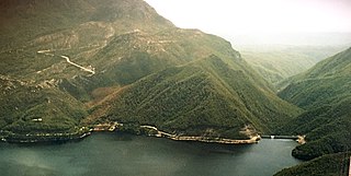
The Crotty Dam, also known during construction as the King Dam, or the King River Dam on initial approval, is a rockfill embankment dam with a controlled and uncontrolled spillway across the King River, between Mount Jukes and Mount Huxley, located in Tasmania, Australia. The impounded reservoir is called Lake Burbury.

The Darwin Dam is an offstream earthfill embankment saddle dam without a spillway, located in Western Tasmania, Australia. The impounded reservoir, also formed by Crotty Dam, is called Lake Burbury.

Linda is the site of an old ghost town in the Linda Valley in the West Coast Range of Tasmania, Australia. It has also been known as Linda Valley.
James Crotty was an Irish-born Australian mining prospector who formed a mining company, the North Mount Lyell mining company, in the western region of Tasmania, just before the turn of the twentieth century.

Iron Blow was the site of the earliest major mining venture at Mount Lyell on the west coast of Tasmania, Australia in 1883.

