Linda Valley is a valley in the West Coast Range of Tasmania. It was earlier known as the Vale of Chamouni. It is located between Mount Owen and Mount Lyell.
Contents

Linda Valley is a valley in the West Coast Range of Tasmania. It was earlier known as the Vale of Chamouni. It is located between Mount Owen and Mount Lyell.
Linda Valley is the location of two historical settlements, Linda and Gormanston. These settlements were close to the Mount Lyell mines and workings, at the western edge of Lake Burbury, and east of the old Mount Lyell Mining and Railway Company operations.
The terminus of the North Mount Lyell Railway was at Gormanston for a short time, the main point of operations for the railway was the yard and railway station at Linda, [1] known as the Linda Valley station in early records. [2]
A curiosity in the landscape is the formation created for the Comstock Tram that was proposed to circumnavigate Mount Lyell but was never completed, it started at Linda. The formation created can still be seen in parts around the sides of Mount Lyell.
The valley suffered from extensive bush fires in the early twentieth century, and as a consequence the forested valley became denuded. Large numbers of tree stumps line the Mount Lyell slopes in the valley a hundred years after the fires. [3] [4]
The valley is the site of extensive evidence of glaciation in the West Coast Range with a particular stage known as the Linda Glacial stage [5] The valley is also known as part of the landscape affected by the King River Glacier, which also left moraine at Crotty and Henty River [6]
The valley's glacial moraine is the only Late Pliocene site with plant fossil assemblages in Tasmania and one of only a few in Australia. [7]
The valley has been part of recent mineral exploration lease areas - however prospective mineral deposits have not been located to date, possibly due to the glacial moraine. [8]
West Coast Council is a local government body in Tasmania, covering much of the western region of the state. West Coast is classified as a rural local government area and has a population of 4,167. The major towns and localities of the region include Strahan, Rosebery, Zeehan and the principal town of Queenstown.

Zeehan is a town on the west coast of Tasmania, Australia 139 kilometres (86 mi) south-west of Burnie. It is located north of Strahan, Tasmania and Queenstown, Tasmania.

The West Coast Range is a mountain range located in the West Coast region of Tasmania, Australia.
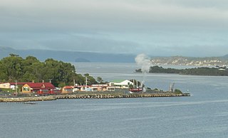
Regatta Point is the location of a port and rail terminus on Macquarie Harbour.
The North Mount Lyell disaster refers to a fire that broke out on 12 October 1912 at the Mount Lyell Mining and Railway Company operations on the West Coast of Tasmania, killing 42 miners. The mine had been taken over from the North Mount Lyell Company in 1903.

The North East Dundas Tramway (NEDT) was a 2 ft narrow gauge tramway on West Coast Tasmania that ran between Zeehan and Deep Lead. It was part of Tasmanian Government Railways. The world's first Garratt locomotives TGR K Class were used on the line, as were two G Class 0-4-2T engines built by Sharp-Stewart of Glasgow in 1896 and a massive 'J Class' 2-6-4-0T articulated locomotive manufactured by Hagans of Erfurt in 1900.
Mount Read is a mountain located in the West Coast region of Tasmania, Australia, and is at the north west edge of the West Coast Range.

Mount Owen is a mountain directly east of the town of Queenstown on the West Coast Range in Western Tasmania, Australia.

The Queen River, part of the King River catchment, is a minor perennial river located in the West Coast region of Tasmania, Australia.
The Mount Jukes Mine sites were a series of short-lived, small mine workings high on the upper regions of Mount Jukes in the West Coast Range on the West Coast of Tasmania.
Comstock Tram refers to three different tramways in the West Coast Tasmania, Australia
North Mount Lyell was the name of a mine, mining company, locality and former railway north of Gormanston on the southern slopes of Mount Lyell in the West Coast Range on the West Coast of Tasmania, and on to the ridge between Mount Lyell and Mount Owen.
The mines of the West Coast of Tasmania have a rich historical heritage as well as an important mineralogical value in containing or having had found, specimens of rare and unusual minerals. Also, the various mining fields have important roles in the understanding of the mineralization of the Mount Read Volcanics, and the occurrence of economic minerals.
The history of the Railways on the West Coast of Tasmania has fascinated enthusiasts from around the world, because of the combination of the harsh terrain in which the railways were created, and the unique nature of most of the lines.

Linda is the site of an old ghost town in the Linda Valley in the West Coast Range of Tasmania, Australia. It has also been known as Linda Valley.

Mount Murchison is a mountain on the West Coast Range, located in the West Coast region of Tasmania, Australia.
Mount Dundas is a mountain located in the West Coast region of Tasmania, Australia. The mountain is situated at the north west edge of the West Coast Range.

Dundas was a historical mining locality, mineral field and railway location on the western foothills of the West Coast Range in Western Tasmania. It is now part of the locality of Zeehan.
The Zeehan and Dundas Herald was a newspaper for the West Coast Tasmania community, based in Zeehan and Dundas from 1890 to 1922.
Philosophers Ridge is the long spur that connects Mount Lyell and Mount Owen in the West Coast Range of Western Tasmania.