Notes
- ↑ "NORTH LYELL RAILWAY". The Examiner (DAILY ed.). Launceston, Tasmania. 8 October 1901. p. 6. Retrieved 9 February 2015– via National Library of Australia.
Gormanston railway station was a short lived railway station in Gormanston, Tasmania at the highest location on the North Mount Lyell Railway. It was situated on the lower northern slopes of Mount Owen in the Linda Valley, just east of the Iron Blow.
Despite its short lifespan, it was considered an important point to have been reached by the railway. [1] The spur to the Gormanston station from Linda was the shortest lived railway operating railway line in Tasmanian railway history, apart from mining and timber tramways that would have been changed regularly in the Zeehan area for instance.

The King River is a major perennial river in the West Coast region of Tasmania, Australia.

West Coast Council is a local government body in Tasmania, covering much of the western region of the state. West Coast is classified as a rural local government area and has a population of 4,167. The major towns and localities of the region include Strahan, Rosebery, Zeehan and the principal town of Queenstown.

The West Coast Range is a mountain range located in the West Coast region of Tasmania, Australia.
Lake Margaret is a concrete-faced gravity dam with an uncontrolled spillway across the Yolande River, located on the north side of Mount Sedgwick, in the West Coast Range, West Coast of Tasmania, Australia.
Mount Lyell is a mountain in the West Coast Range of Western Tasmania, Australia.
Mount Lyell Mining and Railway Company was a Tasmanian mining company formed on 29 March 1893, most commonly referred to as Mount Lyell. Mount Lyell was the dominant copper mining company of the West Coast from 1893 to 1994, and was based in Queenstown, Tasmania.
Gormanston is a town in Tasmania on the slopes of Mount Owen, above the town of Queenstown in Tasmania's West Coast. At the 2016 Gormanston had a population of 17.
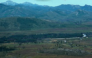
Crotty is a former gazetted townsite that was located in Western Tasmania, Australia. The township was located on the eastern lower slopes of Mount Jukes, below the West Coast Range, and on the southern bank of the King River. The locality had had a former name of King River

The North Mount Lyell Railway was built to operate between the North Mount Lyell mine in West Coast Tasmania and Pillinger in the Kelly Basin of Macquarie Harbour.

Mount Owen is a mountain directly east of the town of Queenstown on the West Coast Range in Western Tasmania, Australia.

The Queen River, part of the King River catchment, is a minor perennial river located in the West Coast region of Tasmania, Australia.

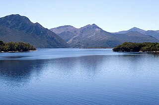
Lake Burbury is a man-made water reservoir created by the Crotty Dam inundating the upper King River valley that lies east of the West Coast Range. Discharge from the reservoir feeds the John Butters Hydroelectric Power Station, owned and operated by Hydro Tasmania.
North Mount Lyell was the name of a mine, mining company, locality and former railway north of Gormanston on the southern slopes of Mount Lyell in the West Coast Range on the West Coast of Tasmania, and on to the ridge between Mount Lyell and Mount Owen.

Linda Valley is a valley in the West Coast Range of Tasmania. It was earlier known as the Vale of Chamouni. It is located between Mount Owen and Mount Lyell.
Darwin was a surveyed and short-lived community at the eastern side of Mount Darwin on the West Coast Range.
The mines of the West Coast of Tasmania have a rich historical heritage as well as an important mineralogical value in containing or having had found, specimens of rare and unusual minerals. Also, the various mining fields have important roles in the understanding of the mineralization of the Mount Read Volcanics, and the occurrence of economic minerals.
The history of the Railways on the West Coast of Tasmania has fascinated enthusiasts from around the world, because of the combination of the harsh terrain in which the railways were created, and the unique nature of most of the lines.

The Darwin Dam is an offstream earthfill embankment saddle dam without a spillway, located in Western Tasmania, Australia. The impounded reservoir, also formed by Crotty Dam, is called Lake Burbury.

Linda is the site of an old ghost town in the Linda Valley in the West Coast Range of Tasmania, Australia. It has also been known as Linda Valley.

Philosophers Ridge is the long spur that connects Mount Lyell and Mount Owen in the West Coast Range of Western Tasmania.