Protected areas of Tasmania consists of protected areas located within Tasmania and its immediate onshore waters, including Macquarie Island. It includes areas of crown land managed by Tasmanian Government agencies as well as private reserves. As of 2016, 52% of Tasmania's land area has some form of reservation classification, the majority is managed by the Tasmania Parks & Wildlife Service. Marine protected areas cover about 7.9% of state waters.
The Walls of Jerusalem National Park is a national park located in the Central Highlands region of Tasmania, Australia. The park is located approximately 144 km (89 mi) northwest of Hobart, east of the Cradle Mountain-Lake St Clair National Park, and west of the Central Plateau Conservation Area. It is south of Mole Creek, Tasmania, and Rowallan Lake. The national park forms part of the Tasmanian Wilderness World Heritage Area.

Mount Ossa is the highest mountain in Tasmania with a summit elevation of 1,617 metres (5,305 ft) above sea level. It makes up part of the Pelion Range within Cradle Mountain-Lake St Clair National Park in the Central Highlands region of Tasmania, Australia.

Deloraine is a town on the Meander River, in the central north of Tasmania, Australia. It is 50 km west of Launceston and 52 km south of Devonport along the Bass Highway. It is part of the Meander Valley Council. As of 2011, the town of Deloraine had a population of 2,745

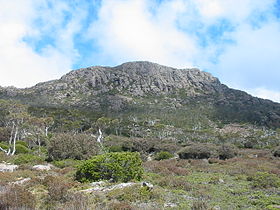
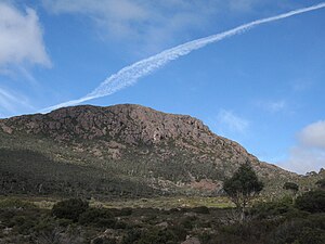
The Great Western Tiers are a collection of mountain bluffs that form the northern edge of the Central Highlands plateau in Tasmania, Australia. The bluffs are contained within the Tasmanian Wilderness World Heritage Site.

Blanca Peak is the fourth highest summit of the Rocky Mountains of North America and the U.S. state of Colorado. The ultra-prominent 14,351-foot (4,374 m) peak is the highest summit of the Sierra Blanca Massif, the Sangre de Cristo Range, and the Sangre de Cristo Mountains. The fourteener is located 9.6 miles (15.5 km) north by east of the Town of Blanca, on the drainage divide separating Rio Grande National Forest and Alamosa County from the Sangre de Cristo Land Grant and Costilla County. The summit is the highest point of both counties and the entire drainage basin of the Rio Grande. Below the steep North Face of Blanca Peak two live Glaciers once developed, until extinction sometime after 1903. North & South Blanca Glaciers were located at 37° 35N.,longitude 105° 28W. Blanca Peak is higher than any point in the United States east of its longitude.

The Lyell Highway is a highway in Tasmania, running from Hobart to Queenstown. It is the one of two transport routes that passes through the West Coast Range, the other being the Anthony Road.
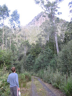
Frenchmans Cap is a mountain in the West Coast region of Tasmania, Australia. The mountain is situated in the Franklin-Gordon Wild Rivers National Park.

Ben Lomond is a mountain in the north-east of Tasmania, Australia.

Mount Sorell is a mountain located in the West Coast region of Tasmania, Australia.

Central Plateau Conservation Area is an animal and plant conservation area in Tasmania, Australia. It is adjacent to the Walls of Jerusalem National Park.

Federation Peak is a Tasmanian mountain with a sharp spire-like shape, which marks the end of the Eastern Arthur Range in the Southwest National Park. The peak, approximately 90 kilometres (56 mi) south-west from Hobart, was named after the Federation of Australia.
The Poatina Power Station is a conventional hydroelectric power station located in the Central Highlands region of Tasmania, Australia. The power station is situated on the Great Lake and South Esk and is owned and operated by Hydro Tasmania.

Mount Murchison is a mountain on the West Coast Range, located in the West Coast region of Tasmania, Australia.
Bathurst Harbour is a shallow bay located in the south west region of Tasmania, Australia. Bathurst Harbour is contained within the Port Davey/Bathurst Harbour Marine Nature Reserve, and the Southwest National Park, part of the Tasmanian Wilderness World Heritage Area.
The Mother Cummings Peak is one of the prominent peaks on the Great Western Tiers located in the Central Highlands region of Tasmania, Australia.

Mount Pelion West is a mountain located in the Central Highlands region of Tasmania, Australia. The mountain is part of the Pelion Range and is situated within the Cradle Mountain-Lake St Clair National Park at the easternmost boundary of the Murchison River catchment.

Mount Pelion East is a mountain located in the Central Highlands region of Tasmania, Australia. The mountain is situated within the Cradle Mountain-Lake St Clair National Park.

Cathedral Mountain is a dominant mountain in the Cradle Mountain-Lake St Clair National Park in the central highlands in the state of Tasmania, Australia.

The Tyndall Range, commonly called The Tyndalls, is a mountain range that is part of the West Coast Range located in the Western region of Tasmania, Australia.