
Cradle Mountain is a locality and mountain in the Central Highlands region of the Australian state of Tasmania. The mountain is situated in the Cradle Mountain-Lake St Clair National Park.

Mount Ossa is the highest mountain in Tasmania, with a summit elevation of 1,617 metres (5,305 ft) above sea level. It makes up part of the Pelion Range within Cradle Mountain-Lake St Clair National Park in the Central Highlands region of Tasmania, Australia.

The Great Western Tiers are a collection of mountain bluffs that form the northern edge of the Central Highlands plateau in Tasmania, Australia. The bluffs are contained within the Tasmanian Wilderness World Heritage Site.
Frenchmans Cap is a mountain in the West Coast region of Tasmania, Australia. The mountain is situated in the Franklin-Gordon Wild Rivers National Park.

Ben Lomond is a mountain in the north-east of Tasmania, Australia.

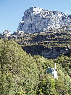
Mount Owen is a mountain directly east of the town of Queenstown on the West Coast Range in Western Tasmania, Australia.
Mount Darwin is a mountain located in the West Coast region of Tasmania, Australia.
Mount Sorell is a mountain located in the West Coast region of Tasmania, Australia.

Federation Peak is a Tasmanian mountain with a sharp spire-like shape, which marks the end of the Eastern Arthur Range in the Southwest National Park. The peak, approximately 90 kilometres (56 mi) south-west from Hobart, was named after the Federation of Australia.

Mount Murchison is a mountain on the West Coast Range, located in the West Coast region of Tasmania, Australia.
The Eldon Range is a mountain range located in the west coast region of Tasmania, Australia.

Barn Bluff is a mountain located in the Central Highlands region of Tasmania, Australia. The mountain is situated in the Cradle Mountain-Lake St Clair National Park at the junction of the easternmost points of the Murchison and Mackintosh river catchments.

The Legges Tor is the summit of the Ben Lomond mountain range in northeast Tasmania, Australia.

The Ironstone Mountain is a mountain located in the Central Highlands region of Tasmania, Australia. Part of Great Western Tiers escarpment, the mountain is situated south of the small country village of Mole Creek.

Quamby Bluff is a mountain in Northern Tasmania, Australia that is an outlying part of the Great Western Tiers mountain range.

Mount Pelion West is a mountain located in the Central Highlands region of Tasmania, Australia. The mountain is part of the Pelion Range and is situated within the Cradle Mountain-Lake St Clair National Park at the easternmost boundary of the Murchison River catchment.

The Stacks Bluff is a peak in northeast Tasmania, Australia. The mountain is situated on the Ben Lomond plateau.
Mount Achilles is a mountain that is part of the Du Cane Range, located in the Cradle Mountain-Lake St Clair National Park in Tasmania, Australia. With an elevation of 1,353 metres (4,439 ft) above sea level, the peak is the 46th highest mountain in Tasmania.
The Smithies Peak, sometimes incorrectly called Smithies Towers, is a mountain in the Central Highlands region of Tasmania, Australia. The mountain is situated in the Cradle Mountain-Lake St Clair National Park.


