Mole Creek

Last updated

Mole Creek
Tasmania
Mole-Creek-Hotel-20070422-026.jpg
Mole Creek Hotel and post office.
Australia Tasmania location map.svg
Red pog.svg
Mole Creek
Coordinates 41°33′25″S146°24′28″E / 41.5570°S 146.4077°E / -41.5570; 146.4077
Population609 (2011 census) [1]
Postcode(s) 7304
Elevation240 m (787 ft) [2]
Location
LGA(s) Meander Valley Council
State electorate(s) Lyons
Federal division(s) Lyons
Mean max temp [3] Mean min temp [3] Annual rainfall [4]
16.1 °C
61 °F
4.4 °C
40 °F
1,125 mm
44.3 in

Mole Creek is a town in the upper Mersey Valley, in the central north of Tasmania, Australia. Mole Creek is well known for its honey and accounts for about 35 percent of Tasmania's honey production. The locality is in the Meander Valley Council area, but with about 3% in the Kentish Council LGA.

Contents

History

Australian Aboriginals have lived on the island of Tasmania for thousands of years. The earliest archaeological evidence for Aboriginal habitation of Tasmania is from the valley of the Forth River, 35000 years before the present. [5] Prior to European settlement, Mole Creek, along with much of the surrounding area, was part of the lands of the Pallittorre Aboriginal tribe. Their range included Deloraine, the face of the Great Western Tiers, and the Gog mountain range to the north of Mole Creek where they mined ochre in the Toolumbunner ochre pits. [6] There is evidence that they had been settled in the Mole Creek area for at least 10,000 years. As Europeans moved onto their land the two groups came into conflict, many Aboriginal people and some Europeans were killed. [7] Their population in the area has been estimated to drop from 200 to 60 during 1827-30. [8]

During the 1820s, the Van Diemen's Land Company cut a stock route from Deloraine to Emu Bay (now known as Burnie) via Chudleigh and Mole Creek. Prior to this cattlemen had run cattle and built stockman's huts on the land west of Westbury. From the 1820s onwards land grants began being issued as the land was gradually surveyed. [9] A systemic exploration of Mole Creek and the area west was conducted in 1826 by Edward Curr, Joseph Fossey and Henry Hellyer. [10] Mole Creek was originally a mixture of tall forest, plains and boggy marsh. [7] Settlers in the early 19th century cleared the land largely using fire and the ring barking of trees. [11] The land was first held in large leaseholds by the wealthiest in the colony of Tasmania. In the mid-19th century a number of waste lands acts were passed by the government allowing for smaller holdings, opening up the then densely forested land around the town of Mole Creek. [12] Many of these first settlers were farm labourers or ex-convicts, who had worked as labourers or tenant farmers on the larger holdings. [7]

The name Mole Creek comes from a nearby stream, recorded as early as the Land Commissioner's reports' maps from 1826-28. This creek flows above ground, and in portions underground through the caves underlying the area. [13] The caves of the nearby Mole Creek Karst National Park, which include the show caves Marakoopa Cave and King Solomons Cave, have attracted tourists since the 1850s. Their popularity encouraged the establishment of tourist facilities in Mole Creek including Howe's Boarding House and Lee's Mountain View Guest House. [14] By 1876 the town had a water-powered flour mill and water powered saw mill. At the same time a Wesleyan chapel and minister's residence were being constructed. [15] A post office opened on 28 May 1884 [16] though the town remained small. A former resident remembered Mole Creek in the 1890s as "a small bush settlement". [17] Lime kilns were built at Mole Creek in the late 19th century, taking advantage of the extensive limestone in the area. [18]

20th century

In the early 20th century the opening of some scenic caves for tourism lead to further development in the town. King Solomon's Cave was discovered in 1906 and opened for tours in 1908. Marakoopa cave was found in 1910, opened in 1912 and sold to the state tourist department in 1919. [19] Edward Charles James, who had obtained a lease on King Solomon's Cave, built what is now the Mole creek hotel over 1907-8 as a 30-room guest house. Due to some unusual sale conditions he could not serve alcohol. The building was sold in 1910 to George Lee who ran it as the Mountain View Guest House. A grocery and hardware shop ran from part of the building from 1929 to 1965. In June 1953 the sale conditions were overcome and a licence to serve alcohol was granted. [20] [note 1]

R Stephens honey factory R Stephens Mole Creek.JPG
R Stephens honey factory

Robert Stephens had kept bees as a hobby. After he returned from service in World War I he continued his interest. He opened a commercial honey production facility in Mole Creek in 1918. By 1923 the factory had 50 hives and was selling honey under the Golden Bee brand. [21] Since 1951 it has concentrated on leatherwood honey. Each year hives are transported to Tasmania's west coast to make honey with the distinctive flavour of leatherwood ( Eucryphia lucida and Eucryphia milliganii ). [22] The Factory and Apiary are provisionally registered on the Tasmanian Heritage Register. It has operated on the same 2-acre (0.81 ha) site since operations began; the oldest building is a c.1920 timber cottage and the prominent façade that faces the main road dates from the 1970s. The factory is run by Stephen's decedents using the "Golden Bee" label introduced in 1930 and the "Golden Nectar" label for leatherwood honey introduced 1951. As of 2010 it was producing 350 tonnes (390 tons) of honey each year and approximately 35% of all Tasmanian honey. [23]

Electricity, supplied by the Hydroelectric Commission, reached Mole Creek in 1936 and street lighting was installed soon after. [24] Construction of a memorial hall began at the end of 1950, [25] funded by a state government grant of 1000  pounds. A driving force behind construction was the school's lack of a recreation hall forcing them to on occasion rent the Methodist Hall. [26] The Mole Creek bush nursing centre was opened in mid-1944. [27] and came under control of the Launceston Public Hospitals District Board in 1968. [28] The site is now a health centre housing the Mole Creek Child Health Centre and is operated by the Department of Health and Human Services. [29]

Railway

A rail line was opened in 1890. It ran 20.4 kilometres (12.7 mi) [30] to Mole Creek, through Chudleigh, from a junction near Deloraine on the Western Line. There was a plan to extend the line further west and government surveyors employed to this end. The survey was cancelled in 1891 [31] and by 1900 there was no longer an expectation that the line would be extended to Tasmania's west coast. [32] Throughout its existence, it carried mostly timber destined for the paper mill at Burnie and, in later days, woodchips for Bell Bay. From the 1920s passenger services, which on occasion ran as far as Devonport, were mostly conducted by railcars. [33] From the 1970s to the 1980s the track saw extensive use transporting limestone to South Burnie. The rail extension was closed in 1985 and the track lifted in 1992. [30]

Religion

St Andrew's Presbyterian Church St Andrews Presbyterian church Mole Creek.JPG
St Andrew's Presbyterian Church

The Deloraine Wesleyan district decided, in 1875, to erect a chapel in Mole creek. [34] Construction began on the Methodist (Wesleyan) church, on donated land, and an associated cottage in late 1876. [35] It was completed in 1878, then enlarged in 1880, at which time the original building was moved to the rear and used as a supper room. An adjacent church hall was added in 1919. [36] The Wesleyan chapel was rented by the Government for a school from at least June 1879. [37] A new parsonage was built and opened in 1956 but was subsequently sold to Forestry Tasmania in 1972. In 1976, along with most Methodist churches in Australia, it became part of the Uniting Church in Australia. [38] It was still used as of 1996 [36] but was subsequently closed and sold. [note 2]

A news report in 1900 reports that, in addition to the Wesleyan weatherboard church, there was a Baptist church [39] and in 1905 the town had a Seventh-day Adventist church. [40] In the 19th century Anglican services were held in the Wesleyan chapel. St Colombia's Anglican church was built in Mole Creek and dedicated in September 1902 by Bishop Henry Montgomery and Gilbert White, a missionary. The church was in the parish of Deloraine [41] and was closed in the early 1990s. [42] Mole Creek's only remaining church is part of the Presbyterian Church of Tasmania, in the Presbytery of Bass. St Andrew's church was consecrated 12 September 1932. [43] It celebrated its 40th anniversary in 1972 [44] and remains in use. [45]

Geography and climate

The town of Mole Creek lies at 240 metres (790 ft) above sea level. [2] The Mole Creek-Chudleigh karst is an area underlain by limestone with underground streams, sinkholes and caves. It was formed when Gondwanaland was covered by a shallow sea approximately 500 million years ago. The area has a layer of Ordovician limestone, approximately 100 metres (330 ft) thick covering an area 26 by 10 kilometres (16.2 by 6.2 mi), and other sedimentary rocks. [46] The town is surrounded by a plain underlain by this limestone which crops up through the overlying sediments. [47] Nearby hills have prominent basalt, limestone and dolerite depending on location. The flats are of alluvial origin with Permian sediments formed from mudstone and sandstone. [48] The karst is riddled with over 400 caves and sinkholes, some of which are open to the public. [49] King Solomon's Cave and the Marakoopa Caves became part of a state cave reserve in 1939. The caves and many other parts of the karst became part of the Mole Creek Karst National Park when it was formed in 1996. [50] The agricultural land around Mole Creek is mostly suited to grazing, intensive in some areas, though some is marginal cropping land that requires careful crop rotation with seasons where the land must be left fallow. [51]

Mole creek has a cool temperate climate. [47] The area is notably frosty in winter and experiences the occasional snowfall. [52] The average rainfall of 1,125 millimetres (44.3 in) [note 3] is significantly higher than parts of the Meander Valley Council area further to the east. The average rainfall has noticeably declined over the past 3-4 decades. [2]

Climate data for Deloraine (Station 091000 temperature), Mole Creek (Station 091065 rainfall)
MonthJanFebMarAprMayJunJulAugSepOctNovDecYear
Mean daily maximum °C (°F)21.3
(70.3)
22.5
(72.5)
19.6
(67.3)
16.5
(61.7)
13.2
(55.8)
10.9
(51.6)
10.4
(50.7)
11.4
(52.5)
13.3
(55.9)
15.5
(59.9)
17.7
(63.9)
20.1
(68.2)
16.1
(61.0)
Mean daily minimum °C (°F)7.7
(45.9)
8.7
(47.7)
6.3
(43.3)
4.5
(40.1)
2.7
(36.9)
1.0
(33.8)
0.9
(33.6)
1.2
(34.2)
3.1
(37.6)
4.4
(39.9)
5.4
(41.7)
7.2
(45.0)
4.4
(39.9)
Average rainfall mm (inches)52.9
(2.08)
59.7
(2.35)
60.6
(2.39)
83.6
(3.29)
109.5
(4.31)
113.9
(4.48)
147.6
(5.81)
145.6
(5.73)
113.1
(4.45)
93.3
(3.67)
72.1
(2.84)
68
(2.7)
1,125.1
(44.30)
Source 1: Bureau of Meteorology, Deloraine (Athol). [3]
Source 2: Bureau of Meteorology,Mole Creek. [4]

School

Mole Creek Primary school is a government school for students from kindergarten to grade 6 that has, as of 2015, 76 students. [53] There was a state school in Mole Creek by 1900. [54] It was changed to a district or area school in 1936. [55] A single-room school building, and associated teacher's residence, had been constructed over 189293 in Caveside. When the school was closed in 1937 the building was moved to Mole Creek in 1938 and used for 'domestic arts' at school. [56] Western Creek, near Meander, had a school from 1893 to 1938. After it closed some students attended Meander's school, but others moved to schools at Mole Creek and Deloraine. This school building was also moved and added to those at Mole Creek's school. [57] The primary school services surrounding districts including Chudleigh and Caveside. The nearest high school is in Deloraine. [58]

Current town

The town is named after Mole Creek, a tributary of the Mersey River. [59] This creek is named due to the way that it appears above ground, descends below ground into the limestone cave system, then reappears multiple times. [60] The main industries in the area are forestry, farming, limestone mining and the R Stephen's honey factory. [61] One of the largest non-farm employers in the area is Unimim Lime Limited. [62] They quarry and process limestone to make quicklime and hydrated lime. As of 2007 they employed 28 people at Mole Creek [63] Mole Creek is well known for its honey and accounts for about 35 percent of Tasmania's honey production including Leatherwood honeya noted monofloral honey which is unique to Tasmania and sold internationally. [58]

Nearby is the Mole Creek Karst National Park , which includes the show caves Marakoopa Cave and King Solomons Cave. These caves have been popular with tourists for over 100 years. [64] Trowunna Wildlife Park is a 65-acre (26 ha) private sanctuary a short distance on the main road towards Chudleigh. The park contains native Australian animals both in enclosures and free-ranging. It works as part of the effort to preserve Tasmanian devils by keeping a population that are free of facial tumour disease, and runs as a training centre for animal handling and animal keeping. Other animals at the park include spotted-tail quolls, eastern quolls, wombats, grey kangaroos, red-necked wallabies, pademelons, potoroos, bettongs, bandicoots, pygmy possums, wedge-tailed eagles, brown falcons, goshawks, owls, green rosellas, black swans, ducks, honeyeaters, wrens and robins. [65]

Mole Creek has a volunteer fire brigade. It first ran from 1956 to 1962 and was disbanded due to lack of local interest. A district brigade and fire station had been re-established by 1970. [66] The town had a cricket club by the early 20th century and an Australian rules football club by 1946. [67] The football club still exists and plays in the Leven Football Association. [68] The cricket club plays in the Northern Midlands Cricket Association. The town has a community maintained swimming pool. [69] Mole Creek's cemetery opened in 1916, serving also Caveside, [70] and remains open. [71] Mole Creek has a hotel, established in 1907, a guest house and restaurant, a swimming pool and adjacent community hall, supermarket, service station, post office and a church. [72]

Mole Creek is in the Meander Valley Council local government area, [73] the Division of Lyons—for the state house of assembly and the federal house of representatives [74] and the state legislative council electoral division of Western Tiers. [75] At the 2011 census, Mole Creek's statistical areacovering 217.2 square kilometres (83.9 sq mi)had a population of 609 [76] though the town itself had only 230. [1]

Notes

  1. The history of the hotel's use is recorded in a commemorative sign in its lobby
  2. Online sale records date the closure to prior to 2009.
  3. 1,122mm of average rainfall is derived from weather records over 1914 to 2015

Related Research Articles

<span class="mw-page-title-main">Mole Creek Karst National Park</span> Protected area in Tasmania, Australia

Mole Creek Karst is a national park situated in the North of Tasmania, Australia, 168 km northwest of Hobart. It is located on the slopes of the Great Western Tiers to the east of the town of Mole Creek. It is the only national park in Tasmania created specifically to protect karst landforms. It is part of the Tasmanian Wilderness World Heritage Site.

Councils of Tasmania are the 29 administrative districts of the Australian state of Tasmania. Local government areas (LGAs), more generally known as councils, are the tier of government responsible for the management of local duties such as road maintenance, town planning and waste management.

<span class="mw-page-title-main">Meander Valley Council</span> Local government body in Tasmania, Australia

Meander Valley Council is a local government body in northern Tasmania. It covers the western outskirts of Launceston, and further westward along the Meander River. Meander Valley Council is classified as a rural local government area and has a population of 19,713. Major towns and localities of the region include Elizabeth Town, Mole Creek, Westbury and the principal town of Deloraine.

<span class="mw-page-title-main">Deloraine, Tasmania</span> Town in Tasmania, Australia

Deloraine is a town on the Meander River, in the central north of Tasmania, Australia. It is 50 km west of Launceston and 52 km south of Devonport along the Bass Highway. It is part of the Meander Valley Council. Deloraine recorded a population of 3,035 in the 2021 census. Deloraine, like most Tasmanian towns, has a temperate and wet climate.

<span class="mw-page-title-main">Bass Highway, Tasmania</span> Highway in Tasmania, Australia

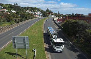
The Bass Highway is a highway in Tasmania, Australia. It connects the three cities across the north of the state – Burnie, Devonport and Launceston. The road was named due to its proximity to the Bass Strait. It is a part of the National Highway, designated as National Highway 1, together with the Midland and Brooker highways in Tasmania.

<span class="mw-page-title-main">Meander, Tasmania</span> Town in Tasmania, Australia

Meander is a rural locality and town in the local government area of Meander Valley in the Launceston region of Tasmania. The locality is about 34 kilometres (21 mi) south-west of the town of Westbury. The 2016 census has a population of 328 for the state suburb of Meander.

<span class="mw-page-title-main">Bracknell, Tasmania</span> Town in Tasmania, Australia

Bracknell is a rural locality and town in the local government areas of Meander Valley and Northern Midlands in the Launceston and Central regions of Tasmania. The locality is about 22 kilometres (14 mi) south-east of the town of Westbury. The 2016 census has a population of 459 for the state suburb of Bracknell.

<span class="mw-page-title-main">Caveside</span> Town in Tasmania, Australia

Caveside is a rural locality in the local government area of Meander Valley in the Launceston region of Tasmania. The locality is about 45 kilometres (28 mi) south-west of the town of Westbury. It lies between the Great Western Tiers to the south and Mole Creek to the north. The 2016 census has a population of 133 for the state suburb of Caveside.

<span class="mw-page-title-main">Carrick, Tasmania</span> Town in Tasmania, Australia

Carrick is a small historic village 17 kilometres (11 mi) west of Launceston, Tasmania, Australia, on the banks of the Liffey River. The Meander Valley Highway passes through the town's centre; this road was formerly the main road from Launceston to Deloraine and Devonport. Carrick has a well-preserved 19th-century heritage; fifteen of its colonial buildings are listed on the Tasmanian Heritage Register including Carrick House (1840), St Andrew's Church (1848), the Old Watch house (1837), Monds Roller Mill (1846) and the Carrick Hotel (1833).

<span class="mw-page-title-main">Elizabeth Town, Tasmania</span> Town in Tasmania, Australia

Elizabeth Town is a populated rural area in Meander Valley, Tasmania bisected by the Bass Highway.

<span class="mw-page-title-main">Australian rules football in Tasmania</span>

Australian rules football in Tasmania, has been played since the late 1870s and draws the largest audience for a football code in the state.

<span class="mw-page-title-main">Tasmanian Government Railways</span> Former government railway operator in Tasmania, Australia

The Tasmanian Government Railways (TGR) was the former operator of the mainline railways in Tasmania, Australia. Formed in 1872, the railway company was managed by the Government of Tasmania, and existed until absorption into the Australian National Railways Commission in 1978.

<span class="mw-page-title-main">Rail transport in Tasmania</span>

Rail transport in Tasmania consists of a network of narrow gauge track of 1,067 mm reaching virtually all cities and major towns in the island state of Tasmania, Australia. Today, rail services are focused primarily on bulk freight, with no commercial passenger services being operated. The mainline railways of Tasmania are currently operated by TasRail, a Government of Tasmania-owned Corporation, who owns and maintains both rolling stock, locomotives, and track infrastructure.

<span class="mw-page-title-main">Hadspen, Tasmania</span> Town in Tasmania, Australia

Hadspen is a town on the South Esk River in the north of Tasmania, Australia, 8 kilometres (5.0 mi) south west of Launceston. Hadspen has few commercial establishments and is primarily a residential suburb of nearby Launceston. Most of the town's buildings are residential, and relatively recent. The town's population of just over 2000 has grown rapidly from only a few hundred in the 1960s, and there are development plans that call for its doubling.

<span class="mw-page-title-main">Whitemore, Tasmania</span> Town in Tasmania, Australia

Whitemore is a rural locality and small town in the local government area of Meander Valley in the Launceston region of Tasmania. The locality is about 11 kilometres (6.8 mi) south-east of the town of Westbury. The 2016 census has a population of 198 for the state suburb of Whitemore.

<span class="mw-page-title-main">Hagley, Tasmania</span> Town in Tasmania, Australia

Hagley is a rural locality and town in the local government area of Meander Valley in the Launceston region of Tasmania. The locality is about 5 kilometres (3.1 mi) north-east of the town of Westbury. The 2016 census has a population of 335 for the state suburb of Hagley.

Exton is a rural locality in the local government area of Meander Valley in the Launceston region of Tasmania. The locality is about 10 kilometres (6.2 mi) west of the town of Westbury. It lies on the outskirts of Deloraine, that lies next to the railway line from Launceston to Devonport. Its population was estimated at 200 in 1932, and the 2011 census reported the area of Reedy Marsh, which incorporated Exton, had a population of 309 people. The 2016 census has a population of 154 for the state suburb of Exton.

Chudleigh is a rural locality in the local government area of Meander Valley in the Launceston region of Tasmania. The locality is about 37 kilometres (23 mi) west of the town of Westbury. The 2016 census has a population of 203 for the state suburb of Chudleigh.

The Tasmanian Heritage Register is the statutory heritage register of the Australian state of Tasmania. It is defined as a list of areas currently identified as having historic cultural heritage importance to Tasmania as a whole. The Register is kept by the Tasmanian Heritage Council within the meaning of the Tasmanian Historic Cultural Heritage Act 1995. It encompasses in addition the Heritage Register of the Tasmanian branch of the National Trust of Australia, which was merged into the Tasmanian Heritage Register. The enforcement of the heritage's requirements is managed by Heritage Tasmania.

Red Hills is a locality and suburb in the local government area of Meander Valley, in the Launceston region of Tasmania. It is located about 7 kilometres (4.3 mi) west of the town of Deloraine. The Meander River forms part of the south-eastern boundary, while its tributary Western Creek forms the remainder. The railway tracks of the Western line pass through the north-eastern corner of the locality, crossing the B12 route at Lemana Junction. The 2016 census determined a population of 120 for the state suburb of Red Hills.

References

  1. 1 2 Australian Bureau of Statistics (31 October 2012). "Mole Creek (L) Urban Centre/Locality". 2011 Census QuickStats. Retrieved 10 November 2007. OOjs UI icon edit-ltr-progressive.svg
  2. 1 2 3 Davey, p.23
  3. 1 2 3 Temperature data is from the nearest recording site in Deloraine from 1884 to April 2014
    "Monthly mean maximum temperature, Deloraine (Athol)". Bureau of Meteorology. Retrieved 26 April 2015.
  4. 1 2 Rainfall data is from the nearest recording site in Mole Creek from 1914 to January 2015
    "Monthly Rainfall, Mole Creek". Bureau of Meteorology. Retrieved 26 April 2015.
  5. Jupp, p.110
  6. Jupp, p.111
  7. 1 2 3 Bourne, Brenda. "Mole Creek & Chudleigh" . Retrieved 6 May 2015.
  8. Australian Garden History Society, pp.14
  9. Evans & Terry, p.9
  10. Evans & Terry, p.20
  11. Evans & Terry, p.33
  12. Evans & Terry, p.26
  13. Evans & Terry, p.11
  14. Evans & Terry, p.79
  15. A correspondant (24 October 1876). "Chudleigh". The Launceston Examiner. p. 3.
  16. Premier Postal History. "Post Office List". Premier Postal Auctions. Retrieved 16 June 2012.
  17. Green, p.4
  18. Evans & Terry, p.21
  19. Sydney, pp.23-24
  20. Sydney, p.25
  21. Evans & Terry, p.38
  22. Holland, pp.117118
  23. Tasmanian Heritage Council. "R. Stephens Golden Bee Honey Factory" (PDF). Retrieved 12 May 2015.
  24. Sydney, p.5
  25. "Mole Creek". The Advocate. Burnie. 1 December 1950. p. 8.
  26. Flowers, T.W. (4 December 1950). "Mole Creek Memorial Hall". The Advocate. Burnie. p. 4.
  27. "Bush nursing centre". The Examiner. Launceston. 16 May 1944. p. 4.
  28. Evans & Terry, p.43
  29. Report 2010-11.pdf "Annual report 2010-2011" (PDF). Tasmanian Heritage Council. Retrieved 13 May 2015.{{cite web}}: Check |url= value (help)
  30. 1 2 "Mole Creek Line". Australian Railway Historical Society (Tasmanian Division). Retrieved 12 May 2015.
  31. Evans & Terry, p.32
  32. The Examiner's Travelling Correspondent (18 April 1900). "Chudleigh and Mole Creek". The Examiner. Launceston. p. 7.
  33. Stokes, pp.243-252
  34. "Wesleyan district meeting". The Mercury. Hobart. 16 November 1875. p. 2.
  35. "Wesleyan council financial district meeting". The Cornwall Chronicle. Launceston. 13 November 1876. p. 3.
  36. 1 2 Sydney, p.2
  37. Mercury Correspondant (4 February 1884). "Mole Creek". The Mercury. Hobart. p. 3.
  38. Stansall, p.65
  39. Travelling Correspondant (18 April 1900). "Chudleigh and Mole Creek". The Examiner. Launceston. p. 7.
  40. Evans & Terry, p.87
  41. Henslowe, p.46
  42. Stephens, p.138
  43. "New Presbyterian church at Mole Creek". The Mercury. Hobart. 12 September 1932. p. 3.
  44. Miller, p.33
  45. Johnstone, David. "Mole Creek Presbyterian Church" . Retrieved 20 March 2014.
  46. Lloyd, p.50
  47. 1 2 Parks and Wildlife Service, p.13
  48. Topoclimate Services, pp.25-26
  49. Lloyd, p.51
  50. Evans & Terry, p.80
  51. Topoclimate Services, p.27
  52. Topoclimate Services, p.24
  53. "Mole Creek Primary School". Department of Education. Retrieved 12 May 2015.
  54. Evans & Terry, pp.61
  55. "New Mole Creek School". The Advocate. Burnie. 18 July 1936. p. 6.
  56. Reunion Committee, p.15
  57. Woods & Pennicott, pp.96–98
  58. 1 2 "The interactive tour of Tasmania, Mole Creek". Tour of Tasmania. Retrieved 20 March 2014.
  59. Whitworth, p.136
  60. "Mole Creek". Meander Valley Council. Retrieved 12 May 2015.
  61. "About us". Mole Creek Progress Association. Retrieved 12 May 2015.
  62. Davey, p.19
  63. "2006/2007 report for UNIMIN LIME (TASMANIA) P/L, Unimin Australia Limited - Mole Creek Site - Mole Creek, TAS". Department of the Environment. 31 January 2008. Retrieved 12 May 2015.
  64. "Mole Creek Karst National Park". Parks and Wildlife Service Tasmania'. Archived from the original on 9 September 2014. Retrieved 12 May 2015.
  65. Haberle, Carol (8 November 2013). "Trowunna Wildlife Park: Adopt a Wombat". Think Tasmania. Retrieved 26 April 2015.
  66. Evans & Terry, p.55
  67. Evans & Terry, p.77
  68. "Mole Creek Football Club". Fox Sports Pulse. Retrieved 12 May 2015.
  69. "Meander Valley, Directory of Community Services" (PDF). Meander Valley Council. May 2013. Archived from the original (PDF) on 18 March 2015. Retrieved 12 May 2015.
  70. Evans & Terry, p.95
  71. "Mole Creek Cemetery". Meander Valley Council. Retrieved 12 May 2015.
  72. Bourne, Brenda. "Mole Creek" . Retrieved 12 May 2015.
  73. "Mole Creek". Meander Valley Council. 12 May 2015.
  74. "Federal Electorate: LYONS". Australian Electoral Commission. Archived from the original on 12 May 2014. Retrieved 8 May 2014.
  75. "Legislative Council Division of Western Tiers". Tasmanian Electoral Commission. Archived from the original on 21 March 2015. Retrieved 15 April 2015.
  76. Australian Bureau of Statistics (31 October 2012). "Mole Creek ( State Suburb )". 2011 Census QuickStats. Retrieved 10 November 2007. OOjs UI icon edit-ltr-progressive.svg

Bibliography