
The Mississippi River is the primary river, and second-longest river, of the largest drainage basin in the United States. From its traditional source of Lake Itasca in northern Minnesota, it flows generally south for 2,340 miles (3,766 km) to the Mississippi River Delta in the Gulf of Mexico. With its many tributaries, the Mississippi's watershed drains all or parts of 32 U.S. states and two Canadian provinces between the Rocky and Appalachian mountains. The main stem is entirely within the United States; the total drainage basin is 1,151,000 sq mi (2,980,000 km2), of which only about one percent is in Canada. The Mississippi ranks as the thirteenth-largest river by discharge in the world. The river either borders or passes through the states of Minnesota, Wisconsin, Iowa, Illinois, Missouri, Kentucky, Tennessee, Arkansas, Mississippi, and Louisiana.

The Great River Road is a collection of state and local roads that follow the course of the Mississippi River through ten states of the United States. They are Minnesota, Wisconsin, Iowa, Illinois, Missouri, Kentucky, Tennessee, Arkansas, Mississippi and Louisiana. It formerly extended north into Canada, serving the provinces of Ontario and Manitoba. The road is designated as both a National Scenic Byway and an All-American Road in several states along the route.

The Chickasaw are an Indigenous people of the Southeastern Woodlands, United States. Their traditional territory was in northern Mississippi, northwestern and northern Alabama, western Tennessee and southwestern Kentucky. Their language is classified as a member of the Muskogean language family. In the present day, they are organized as the federally recognized Chickasaw Nation.
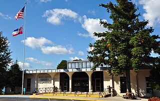
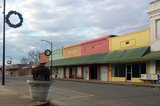
Tishomingo County is a county located in the northeastern corner of the U.S. state of Mississippi. As of the 2020 census, the population was 18,850. Its county seat is Iuka.

DeSoto County is a county located on the northwestern border of the U.S. state of Mississippi. As of the 2020 census, the population was 185,314, making it the third-most populous county in Mississippi. Its county seat is Hernando.

Wabasha County is a county in the U.S. state of Minnesota. As of the 2020 census, the population was 21,387. Its county seat is Wabasha.

Mississippi County is the easternmost county in the U.S. state of Arkansas. As of the 2020 census, the population was 40,685. There are two county seats, Blytheville and Osceola. The county is named for the Mississippi River which borders the county to the east. Mississippi County is part of the First Congressional District in Arkansas.
Lake Village is a city in and the county seat of Chicot County, Arkansas, United States. The population was 2,575 at the 2010 census. It is located in the Arkansas Delta. Lake Village is named for its location on Lake Chicot, an oxbow lake formed by the Mississippi River.

Horseshoe Lake is a town in Crittenden County, Arkansas, United States. The population was 264 at the 2020 census.

Tupelo is a city in and the county seat of Lee County, Mississippi, United States. With an estimated population of 38,300, Tupelo is the 7th most populous city in Mississippi and is considered a commercial, industrial, and cultural hub of North Mississippi.

Lake Pontchartrain is an estuary located in southeastern Louisiana in the United States. It covers an area of 630 square miles (1,600 km2) with an average depth of 12 to 14 feet. Some shipping channels are kept deeper through dredging. It is roughly oval in shape, about 40 miles (64 km) from west to east and 24 miles (39 km) from south to north.
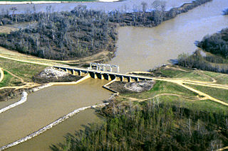
The Yazoo River is a river in the U.S. states of Louisiana and Mississippi. It is considered by some to mark the southern boundary of what is called the Mississippi Delta, a broad floodplain that was cultivated for cotton plantations before the American Civil War. It has continued to be devoted to large-scale agriculture.

The headwater of a river or stream is the farthest point on each of its tributaries upstream from its mouth/estuary into a lake/sea or its confluence with another river. Each headwater is considered one of the river's sources, as it is the place where surface runoffs from rainwater, meltwater and/or spring water begin accumulating into a more substantial and consistent flow that becomes a first-order tributary of that river. The tributary with the longest course downstream of the headwaters is regarded as the main stem.

Arkabutla Lake is a reservoir on the Coldwater River in the U.S. state of Mississippi. It was created following the construction of the Arkabutla Dam in 1940 on the Coldwater River.

Walls is a town located in northern DeSoto County, Mississippi, United States, near the Mississippi River, part of the larger region known as "The Delta", and known for its rich, dark soil. As it is in the upper northwest corner of Mississippi, it is in the Memphis, Tennessee metropolitan area. Its ZIP code is 38680. As of the 2010 census it had a population of 1,162, with an estimated population of 1,463 in 2018.

Mississippi is a state in the Southeastern region of the United States. It borders Tennessee to the north, Alabama to the east, the Gulf of Mexico to the south, Louisiana to the southwest, and Arkansas to the northwest. Mississippi's western boundary is largely defined by the Mississippi River, or its historical course. Mississippi is the 32nd largest by area and 35th-most populous of the 50 U.S. states and has the lowest per-capita income. Jackson is both the state's capital and largest city. Greater Jackson is the state's most populous metropolitan area, with a population of 591,978 in 2020.

M/V Mississippi is a United States Army Corps of Engineers (USACE) towboat operating on the Mississippi River. It is the largest diesel towboat on the river.
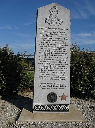
Tishomingo ; was a renowned war chief of the Chickasaw nation in Mississippi.
Piomingo was a Chickasaw chief and diplomat. President George Washington and Piomingo considered themselves to be friends. He was a signatory to the Chickasaw Treaty of Hopewell. Piomingo received a presidential peace medal from Washington for his loyalty to the US.

