
The Great Lakes, also called the Great Lakes of North America, are a series of large interconnected freshwater lakes in the east-central interior of North America that connect to the Atlantic Ocean via the Saint Lawrence River. The five lakes are Superior, Michigan, Huron, Erie, and Ontario and they are in general on or near the Canada–United States border. Hydrologically, Michigan and Huron are a single body of water joined at the Straits of Mackinac. The Great Lakes Waterway enables modern travel and shipping by water among the lakes.

Lake Bonneville was the largest Late Pleistocene paleolake in the Great Basin of western North America. It was a pluvial lake that formed in response to an increase in precipitation and a decrease in evaporation as a result of cooler temperatures. The lake covered much of what is now western Utah and at its highest level extended into present-day Idaho and Nevada. Many other hydrographically closed basins in the Great Basin contained expanded lakes during the Late Pleistocene, including Lake Lahontan in northwestern Nevada.

Grand Lake St. Marys State Park is a public recreation area located on 13,500-acre (5,500 ha) Grand Lake in Mercer and Auglaize counties, Ohio. Grand Lake is the largest inland lake in Ohio in terms of area, but is shallow, with an average depth of only 5–7 feet (1.5–2.1 m). The state park is open for year-round recreation, including boating, fishing, swimming and hunting. The park consists of the lake and park facilities scattered all around the shore intermingled with private property and a facility operated by Wright State University. It is west of St. Marys, and southeast of Celina, 23 miles (37 km) southwest of Lima in the northwestern part of the state.

Wabamun Lake is one of the most heavily used lakes in Alberta, Canada. It lies 65 kilometres (40 mi) west of Edmonton. It is 19.2 kilometres (11.9 mi) long and 6.6 kilometres (4.1 mi) wide, covers 82 square kilometres (32 sq mi) and is 11 metres (36 ft) at its deepest, with somewhat clear water.

Lake Monger is a large urban wetland on the Swan Coastal Plain in suburban Perth, Western Australia nestled between the suburbs of Leederville, Wembley and Glendalough.
Green Lake — also known as Big Green Lake — is a lake in Green Lake County, Wisconsin, United States. Green Lake has a maximum depth of 237 ft (72 m), making it the deepest natural inland lake in Wisconsin and the second largest by volume. The lake covers 29.72 km2 and has an average depth of 30.48 m (100.0 ft). Green Lake has 43.94 km (27.30 mi) of diverse shoreline, ranging from sandstone bluffs to marshes.
Paudash Lake is a lake in south central Ontario southwest of Bancroft along Highway 28. The lake is located just north of Silent Lake Provincial Park in Haliburton County, 27 km (17 mi) south of the panhandle of Algonquin Provincial Park. The nearest communities to Paudash Lake are the village of Cardiff, close to the lake's Inlet Bay, and the hamlet of Paudash to the northeast of Lower Paudash Lake. Actually two lakes, 'Paudash' and 'Lower Paudash', the lakes are located on the Crowe River, near its head waters, which flows into the Trent River at Crowe Bay north of Campbellford.

Lough Bane is a lake on the border of County Meath and County Westmeath in Ireland. The county border runs east–west through the centre of the lake.

A pond is a small, still, land-based body of water formed by pooling inside a depression, either naturally or artificially. A pond is smaller than a lake and there are no official criteria distinguishing the two, although defining a pond to be less than 5 hectares in area, less than 5 metres (16 ft) in depth and with less than 30% with emergent vegetation helps in distinguishing the ecology of ponds from those of lakes and wetlands. Ponds can be created by a wide variety of natural processes, or they can simply be isolated depressions filled by runoff, groundwater, or precipitation, or all three of these. They can be further divided into four zones: vegetation zone, open water, bottom mud and surface film. The size and depth of ponds often varies greatly with the time of year; many ponds are produced by spring flooding from rivers. Ponds may be freshwater or brackish in nature. 'Ponds' consisting of saltwater, with a direct connection to the sea to maintain full salinity, are normally regarded as part of the marine environment. These bodies of water do not support fresh or brackish water-based organisms, and are not considered to be ponds.
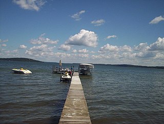
A lake is a naturally occurring, relatively large body of water localized in a basin surrounded by dry land. A lake generally has a slower-moving flow than the inflow or outflow stream(s) that serve to feed or drain it. Lakes lie completely on land and are separate from the ocean, although, like the much larger oceans, they form part of the Earth's water cycle by serving as large standing pools of storage water. Most lakes are freshwater and account for almost all the world's surface freshwater, but some are salt lakes with salinities even higher than that of seawater.

White Lake is a medium-sized lake of Ontario, Canada. It is located in Renfrew County, 60 kilometres (37 mi) west of Ottawa, Ontario near Calabogie to the west and Arnprior to the north. It may be accessed via Highway 417 from Ottawa or Renfrew Country Road 511 from Perth. The town of White Lake lies on the northern shore of the lake.

Castle Rock Lake is an artificial lake on the Wisconsin River. It is located in central Wisconsin in Adams County and Juneau County. The lake has an inflow from Petenwell Lake, Yellow River, Big Roche a Cri., and Klien Creek. It has a surface area of 16,640 acres (67.3 km2) and its depth varies from 8–20 ft (2.4–6.1 m) in most places, with area in the old river beds reaching as deep as 35 ft (11 m).
The Póvoa de Varzim City Park is an urban park of Póvoa de Varzim in Portugal.

The Langwieder lake district is composed of three lakes west of Munich in Bavaria, Germany. It opened in the year 2000 as a recreational area enclosing the Langwieder See, the Lußsee, and the Birkensee. The entire site spans 120 hectares ; 40 of which are the lakes and 80 are land; 27 hectares of which are lawns for sunbathing.
The Saugeen Valley Conservation Authority (SVCA) is a conservation authority in Ontario, Canada. It operates under the Conservation Authorities Act of Ontario. It is a corporate body, through which municipalities, landowners and other organizations work cooperatively to manage the Saugeen River watershed and natural resources within it.

Lake Cobbosseecontee, also known as Cobbossee Lake, is a lake located in the towns of Litchfield, Manchester, Monmouth, West Gardiner, and Winthrop in the U.S. state of Maine. It is the largest lake in the Winthrop Lakes Region at 100 feet (30 m) deep, covering about 8.7 square miles (23 km2) in surface area, a length of 9 miles (14 km), and a shoreline of 62 miles (100 km). The word Cobbosseecontee translates to "plenty of sturgeon" in Wabanaki.

Frame Lake is located in Yellowknife, Northwest Territories, Canada. It is an 84-hectare (210-acre) endorheic freshwater body located between the city's downtown section and a larger residential area. The Frame Lake Trail circles it, and city hall and the territorial legislative assembly building are on its shores.
The Belgrade Lakes are a chain of lakes around Belgrade, Maine. The flow sequence is from East Pond to North Pond to Great Pond to Long Pond to Messalonskee Lake and thence via Messalonskee Stream to the Kennebec River at Waterville. The lakes have long been an important resort area for fishing, boating, and swimming; and shoreline development includes residences for individuals employed in the cities of Waterville and Augusta.

The Cut is a small river located entirely within Roscommon County in the U.S. state of Michigan. The river begins at Higgins Lake and meanders to Houghton Lake at a length of approximately 10 miles (16 km). It also passes through the small Marl Lake within South Higgins Lake State Park near its source.
Freshwater Shoreline Management involves assessing and protecting lakes, rivers, and other freshwater shorelines from excessive development or other anthropogenic disturbances.
