Caddo Lake is a 25,400-acre (10,300 ha) lake and bayou (wetland) on the border between Texas and Louisiana, in northern Harrison County and southern Marion County in Texas and western Caddo Parish in Louisiana. The lake is named after the Caddoans or Caddo, Native Americans who lived in the area until their expulsion by the United States in the 19th century. The US forced most of them to move west to Indian Territory.

iSimangaliso Wetland Park is situated on the east coast of KwaZulu-Natal, South Africa, about 235 km (146 mi) north of Durban by road. It is South Africa's third-largest protected area, spanning 280 km (170 mi) of coastline, from the Mozambican border in the north to Mapelane south of the Lake St. Lucia estuary, and made up of around 3,280 km2 of natural ecosystems, managed by the iSimangaliso Authority. The park includes:

Phinda Private Game Reserve, formerly known as Phinda Resource Reserve, is a 170 km2 (66 sq mi) private game reserve situated in KwaZulu-Natal, South Africa, between the Mkuze Game Reserve and the Greater St. Lucia Wetland Park. Designated in 1990, Phinda is derived from a Zulu phrase "Phinda Izilwane" meaning 'return of wildlife', or more accurately 'do again'.

Vembanad is the longest lake in India, as well as the largest in the state of Kerala. The lake has an area of 230 square kilometers and a maximum length of 96.5 km.

Lake Nakuru is one of the Rift Valley lakes, located at an elevation of 1,754 m (5,755 ft) above sea level. It lies to the south of Nakuru, in the rift valley of Kenya and is protected by Lake Nakuru National Park.

Adeline Jay Geo-Karis Illinois Beach State Park, part of the Illinois state park system, is located along Lake Michigan in northern Lake County in northeast Illinois. Together with lands to the north, including Chiwaukee Prairie, it forms the Chiwaukee Prairie Illinois Beach Lake Plain, an internationally recognized wet-land of importance under the Ramsar Convention. The park is broken into two units that encompass an area of 4,160 acres (1,683 ha) and contains over six miles of Lake Michigan shoreline. In 2010, it was renamed for former state senator Adeline Geo-Karis.

Sasthamcotta Lake or Sasthamkotta Lake, also categorized as a wetland, is the largest fresh water lake in Kerala, a state of India on the south of the West Coast. The lake is named after the ancient Sastha temple located on its bank. It meets the drinking water needs of half million people of the Quilon district and also provides fishing resources. The purity of the lake water for drinking use is attributed to the presence of large population of larva called cavaborus that consumes bacteria in the lake water. The lake is a designated wetland of international importance under the Ramsar Convention since November 2002.

Sodwana Bay is a bay in South Africa on the KwaZulu Natal north coast, between St. Lucia and Lake Sibhayi. It is in the Sodwana Bay National Park, and the Maputaland Marine Reserve, and is a popular recreational diving destination. The term is commonly used to refer to both the marine reserve and the terrestrial park, as well as the geographical bay.

Lough Oughter is a lake, or complex of lakes, in County Cavan covering more than 8,900 hectares. The complex of lakes lies on the River Erne, and forms the southern part of the Lough Erne complex. The lakes are bounded roughly by Belturbet in the north, Cavan town to the east, Crossdoney to the south and Killeshandra to the west.

Lake Connewarre, a shallow estuarine 880-hectare (2,200-acre) lake on the Barwon River, is located on the Bellarine Peninsula southeast of Geelong in the Australian state of Victoria.
Kanjli Wetland is a man-made Wetland that subsumes the Kanjli Lake, and is located in the Kapurthala district of Punjab state in India. It was created in 1870 by constructing the headworks across the perennial Bien River, a tributary of the Beas River to provide irrigation facilities to the hinterland. The rich biodiversity of the wetland comprising aquatic, mesophytic and terrestrial flora and fauna including some important species of plants and animals was recognized internationally by the Ramsar Convention in 2002 by designating the Kanjli Lake in the List of Wetlands of International Importance. In this context, it is reported that the Punjab State which has 14 wetlands covering an area of 225.76 km2 has the unique position of three of its wetlands viz., the Kanjli Wetland covering an area of 490 ha of which the Kanjli Lake water spread is 184 ha), the Harike Wetland and the Ropar Wetland chosen by the Ministry of Environment and Forest (MoE&F), Government of India for their conservation and management are now also included in the Ramsar list covering a total area of 5650 ha; Kanjli is upstream of Harike wetland located in the Beas river basin while the Ropar wetland is in the Roopnagar district.

Harike Wetland also known as "Hari-ke-Pattan", with the Harike Lake in the deeper part of it, is the largest wetland in northern India in the border of Tarn Taran Sahib district and Ferozepur district of the Punjab state in India.

Ropar Wetland, also named Ropar Lake, is a man-made freshwater riverine and lacustrine wetland. The area has at least 9 mammal, 154 bird, 35 fish, 9 arthropod, 11 rotifer, 9 crustacean and 10 protozoan species, making it biologically diverse. This important ecological zone is located in the Shivalik foothills of the Lower Himalayas and was created in 1952 on the Sutlej River, in the Punjab state of India, by building a head regulator to store and divert water for beneficial uses of irrigation, drinking and industrial water supply. The endangered turtle Chitra indica and the threatened snake Python molurus, as per IUCN Red List, are reported to be resident in the wetland. Considering the wetland's diverse and rich biodiversity, Ramsar Convention has included Ropar Wetland as one of the Ramsar sites among the 42 sites listed under India, for "the conservation of global biological diversity and for sustaining human life through the ecological and hydrological functions they perform."
Akyatan Lagoon is a 14700-hectare wetland ecosystem that is designated as Wetland of International Importance by Ramsar Convention. A major stopover for migrating birds, Akyatan is recognized as an Important Bird Area by BirdLife International. It is the single largest green turtle rookery at the Mediterranean, holding 43% of the Mediterranean nesting population.

Thomsons Lake Nature Reserve is a lake nature reserve around Thomsons Lake in the City of Cockburn, Western Australia, approximately 25 kilometres (16 mi) south of the central business district of Perth, the state capital, and on the southern fringes of the Perth metropolitan area. It is in the suburb of Beeliar, 7 kilometres (4.3 mi) south-west of Jandakot Airport. It is a still largely natural wetland, with adjoining native vegetation, surrounded by land developed for housing and agriculture, that regularly supports large numbers of shorebirds and other waterbirds.
The Forrestdale and Thomsons Lakes Ramsar Site comprises two separate nature reserves, totalling 754 ha in area, protecting two shallow fresh to brackish, seasonal lakes in a suburban and agricultural landscape in south-western Western Australia. It lies in the Swan Coastal Plain bioregion and is used mainly for birdwatching and walking. The site is recognised as being of international importance under the Ramsar Convention on Wetlands, under which it was designated Ramsar Site 481 on 7 June 1990.

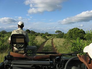
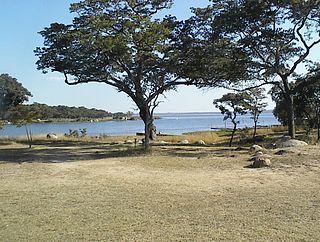
Lake Chivero Recreational Park is a protected area around Lake Chivero within the Zimbabwe Parks and Wildlife Estate.
St Lucia is a settlement in Umkhanyakude District Municipality in the KwaZulu-Natal province of South Africa. The small town is mainly a hub for the iSimangaliso Wetland Park.
The Point Cook Coastal Park covers an area of 863 hectares and includes the Cheetham Wetlands. The park extends from the RAAF Williams Point Cook Base northeast along the coast to the Laverton creek which comprises its northern boundary. The park is approximately 20 kilometres (12 mi) from Melbourne, Australia in a southwesterly direction along Port Phillip Bay. The park is adjoined by the Point Cook Marine Sanctuary, which extends around the point to the south and the east. The northwestern boundary to the park is residential housing.
Lawari Conservation Park is a protected area in the Australian state of South Australia in the gazetted locality of Hindmarsh Island located at the eastern end of the island of the same name.


