Lake Toftir

Last updated
Lake Toftir
Toftavatn (Faroese)
Toftavatn.jpg
Lake Toftir
Faroe Islands location map.svg
Red pog.svg
Lake Toftir
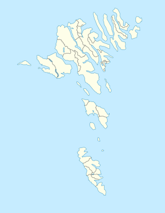
LocationNear Toftir, Faroe Islands
Coordinates 62°05′44.048″N6°42′58.813″W / 62.09556889°N 6.71633694°W / 62.09556889; -6.71633694
Basin  countries Faroe Islands
Surface area51 ha (130 acres)

Lake Toftir [1] (Faroese : Toftavatn) is a lake on the island of Eysturoy in the Faroe Islands. [2]

Lake Toftir is located between the villages of Toftir and Rituvík. It is the fourth-largest natural lake in the Faroe Islands and it measures 51 hectares (130 acres). [3] The lake is noted for its rich bird life. [4] [5]
Related Research Articles

The politics of the Faroe Islands, an autonomous country of the Kingdom of Denmark, function within the framework of a parliamentary, representative democratic dependency, whereby the Prime Minister of the Faroe Islands is the head of government, and of a multi-party system. The Faroe Islands are politically associated with the Kingdom of Denmark but have been self-governing since 1948. Executive power is exercised by the government. Legislative power is vested in both the government and the Løgting. The judiciary is independent of the executive and the legislature and the responsibility of Denmark.

<span class="mw-page-title-main">Transport in the Faroe Islands</span>

The Faroe Islands is served by an internal transport system based on roads, ferries, and helicopters. As of the 1970s, the majority of the population centres of the Faroe Islands have been joined to a single road network, connected by bridges and tunnels.

<span class="mw-page-title-main">Regions of the Faroe Islands</span> Administrative subdivisions of the Faroe Islands

The Faroe Islands are divided into 29 municipalities, six regions/shires and since 2007 there has been only one constituency, earlier there were seven constituencies. Each region has one sheriff.

<span class="mw-page-title-main">B68 Toftir</span> Association football club

B68 Toftir is a Faroese football club based in the village of Toftir in Betri deildin.

<span class="mw-page-title-main">Toftir</span> Village in Faroe Islands, Kingdom of Denmark

Toftir is a village in Nes Municipality on the island of Eysturoy, in the Faroe Islands. It is part of a chain of villages stretching over a distance of 10 kilometres on the east side of Skálafjørður (fjord) on Eysturoy island. The highest hill in Toftir, called Húkslond, is 129 metres high, and Nes Municipality is the only area in the Faroes which has no mountains above 200 metres.

<span class="mw-page-title-main">Streymoy</span> Island in Faroe Islands, Kingdom of Denmark

Streymoy is the largest and most populated island of the Faroe Islands. The capital, Tórshavn, is located on its southeast coast. The name means "island of currents". It also refers to the largest region of the country that also includes the islands of Hestur, Koltur and Nólsoy.

<span class="mw-page-title-main">Eysturoy</span> Island in Faroe Islands, Kingdom of Denmark

Eysturoy is a region and the second-largest of the Faroe Islands, both in size and population.

<span class="mw-page-title-main">NSÍ Runavík</span> Football club

NSÍ Runavík is a Faroese football club, playing in Runavík on the island of Eysturoy. It was founded 24 March 1957. In 2003 NSÍ participated for the first time on a European stage.

<span class="mw-page-title-main">Tórsvøllur</span> Football stadium in Tórshavn, Faroe Islands

Tórsvøllur is a football stadium on the sport site of Gundadalur in Tórshavn, the capital of the Faroe Islands. The stadium holds 6,500 people, and was built in 1999 to become the country's national stadium to provide an artificial grass surface on which international football matches could be played. Previously, the Faroe Islands national team played its home matches in the town of Toftir at Svangaskarð stadium.

<span class="mw-page-title-main">Svangaskarð</span> Multi-purpose stadium in Toftir, Faroe Islands

Svangaskarð, also referred to as Tofta Leikvøllur, is a multi-purpose stadium in Toftir, Faroe Islands with two football fields and a sports arena for athletics around the lower field. It is currently used mostly for football matches. The stadium holds 6,000 people. It was the sole home ground of the Faroe Islands national football team from 1991 and until the Tórsvøllur Stadium was built in the capital Tórshavn in 1999 and is still occasionally used for international football matches.

<span class="mw-page-title-main">Nes, Eysturoy</span> Village in Faroe Islands, Kingdom of Denmark

Nes is a village in Nes Municipality on the southwest coast of the Faroese island of Eysturoy.

Football is the most popular sport in the Faroe Islands, which is an autonomous territory within the Kingdom of Denmark. 60% of those who play sport on the islands play football. Football in the Faroe Islands is governed by the Faroe Islands Football Association, and it is a member of UEFA and FIFA, despite not being a sovereign state.

<span class="mw-page-title-main">Víkingur Gøta</span> Football club

Víkingur is a Faroese professional football club based in Leirvík. The club was founded in 2008 after the merger of GÍ Gøta and Leirvík ÍF. They play at the Serpugerði Stadium in Norðragøta. Both villages are part of the same municipality Eysturkommuna, located on the island of Eysturoy and about 5 kilometers away from each other. The club won the Faroese championship for the first time in the 2016 season. In the 2017 season, Vikingur won the championship again.

<span class="mw-page-title-main">SEV (company)</span> Power producer and distributor on the Faroe Islands

SEV is a power producer and distributor on the Faroe Islands. The company name is derived from the names of islands Streymoy, Eysturoy and Vágar, which established the company on 1 October 1946. All municipalities in Vágar, all in Eysturoy except for Sjóvar municipality and all municipalities in Streymoy except for Tórshavn, Kvívík and Kollafjørður met at the first establishing meeting. Later all municipalities in the Faroe Islands joined SEV. In 2015 60% of the produced electricity of SEV came from green energy sources, 17,8% came from the windmills in Neshagi and Húsahagi, 42,3% came was hydropower.

<span class="mw-page-title-main">Skálafjørður</span> Fjord in Eysturoy, Faroe Islands

Skálafjørður is a fjord in Eysturoy and the longest in the Faroe Islands.

<span class="mw-page-title-main">Lake Eiði</span> Lake on the island of Eysturoy in the Faroe Islands

Lake Eiði is a lake on the island of Eysturoy in the Faroe Islands.

The Eiði Hydroelectric Power Station is the largest hydroelectric power station in the Faroe Islands. It stands below a dam on Lake Eiði on the island of Eysturoy.

<span class="mw-page-title-main">Sundini</span> Sound separating the islands of Streymoy and Eysturoy in the Faroe Islands

Sundini is the northern section of the sound separating the islands of Streymoy and Eysturoy in the Faroe Islands. The southern section of the strait is named Tangafjørður.

Tangafjørður is the southern part of the strait separating the islands of Streymoy and Eysturoy in the Faroe Islands. The northern part of the strait between is named Sundini.

References

  1. Fred.Olsen Cruise Lines: Toue EW - Toftir Lake Hike.
  2. Rasmussen, J. 1982. The Faroe Islands: Geology. In: G.K. Rutherford (ed.), The Physical Environment of the Faeroe Islands, pp. 15–34. The Hague: Dr W. Junk Publishers, p. 31.
  3. Umhvørvisstovan: Størstu vøtn.
  4. Toftavatn - Eysturoy in the Faroe Islands - Framtak.
  5. Marja Pylvänäinen. 2010. Nordic Nature – Trends towards 2010. Copenhagen: Nordic Council of Ministers, p. 47.