
Cicero is a town in Northern Onondaga County, New York, United States. The population was 31,632 at the 2010 census. The name of the town was assigned by a clerk interested in the classics, honoring Cicero, a Roman statesman.

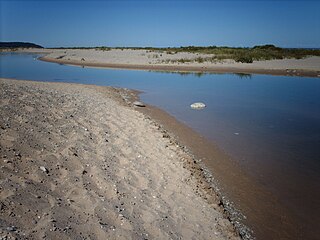
Indiana Dunes National Park is a United States National Park located in Northwestern Indiana, managed by the National Park Service. It was authorized by Congress in 1966 as the Indiana Dunes National Lakeshore, the name by which it was known until it was designated the nation's 61st national park on February 15, 2019. The park runs for nearly 25 miles (40 km) along the southern shore of Lake Michigan; it contains approximately 15,000 acres (6,100 ha). Its visitors center is in Porter, Indiana. Located in the park are sand dune, wetland, prairie, river, and forest ecosystems.

Lake St. Clair is a freshwater lake that lies between the Canadian province of Ontario and the U.S. state of Michigan. It was named in 1679 by French Catholic explorers after Saint Clare of Assisi, on whose feast day they first sighted this body of water.

Sleeping Bear Dunes National Lakeshore is a United States National Lakeshore located along the northwest coast of the Lower Peninsula of Michigan in Leelanau and Benzie counties near Empire, Michigan. The park covers a 35-mile-long (56 km) stretch of Lake Michigan's eastern coastline, as well as North and South Manitou islands. This Northern Michigan park was established primarily because of its outstanding natural features, including forests, beaches, dune formations, and ancient glacial phenomena. The lakeshore also contains many cultural features including the 1871 South Manitou Island Lighthouse, three former stations of the Coast Guard and an extensive rural historic farm district. In 2011, the area won the title of "The Most Beautiful Place in America" from Good Morning America. In 2014, a section of the park was named the Sleeping Bear Dunes Wilderness by the United States Congress.

Lakeshore is a town on Lake St. Clair, in Essex County, Ontario, Canada. The town was incorporated in 1999 by amalgamating the Town of Belle River with the townships of Maidstone, Rochester, Tilbury North, and Tilbury West. It is part of the Windsor census metropolitan area.
M-25 is a state trunkline highway in the US state of Michigan. The route follows an arc-like shape closely along the Lake Huron shore of the Thumb in the eastern Lower Peninsula between Port Huron and Bay City. It serves the lakeshore resorts along Lake Huron and Saginaw Bay and generally lies within sight of the lake and the bay. All is surface road and generally scenic, except for the freeway segment near the junction with Interstate 75 (I-75) and connection into the US Highway 10 (US 10) freeway.

Lake Shore Boulevard is a major arterial road running along more than half of the Lake Ontario waterfront in the city of Toronto, Ontario, Canada. Prior to 1998, two segments of Lake Shore Boulevard were designated as part of Highway 2, with the highway following the Gardiner Expressway between these two sections.

Kipling Avenue, is a street in the Cities of Toronto and Vaughan in Ontario, Canada. It is a concession road, 6 concessions (12 km) from Yonge Street, and is a major north–south arterial road. It consists of three separate sections, with total combined length of 26.4 km. (16.4 mi.).

Bronte is the community that makes up much of the west end of Oakville, in Ontario, Canada. Twelve Mile Creek flows through the middle of town and empties into Lake Ontario. Main roads include Bronte Road (north-south), Lakeshore Road West and Rebecca Street (east-west). Streets in the business section include Lakeshore, Jones, Marine, and Ontario Street. Bronte is also accessed via a superhighway located to the north of the former village. Riggs Road was planned but never opened. Other main roads include Third Line, Speers Road and Burloak Drive to the west

Mimico GO Station is a railway station in the GO Transit network located in the Etobicoke area of Toronto, Ontario, Canada. It is a stop on the Lakeshore West line train service, serving the Mimico neighbourhood.

New Hampshire Route 103 is a 48.300-mile-long (77.731 km) east–west highway in west-central New Hampshire, United States. The highway runs from Claremont, at the Vermont border on the Connecticut River, to Hopkinton, west of Concord.

Sunnyside is a lakefront district in Toronto, Ontario, Canada. It includes a beach and park area along Lake Ontario's Humber Bay, from west of Exhibition Place to the mouth of the Humber River. The area has several recreation uses, including rowing clubs, sports clubs, picnic areas, playgrounds, a nightclub, a bathing pavilion and public pool. The area is a 3 kilometres (1.9 mi) long strip along the lakeshore, bounded by the Gardiner Expressway and rail lines, which separate it from the Parkdale, Roncesvalles and Swansea neighbourhoods to the north. The name originates in a local farm owned by John Howard, which was situated just to the north, on the location of the current St. Joseph's Health Centre hospital.
The Platte River is located in the northern part of the Lower Peninsula of Michigan. Its mouth is located in Sleeping Bear Dunes National Lakeshore and much of the rest is in the Pere Marquette State Forest.
State Route 575 (SR 575) is a 2.60-mile-long (4.18 km) north–south state highway located in the northern portion of the U.S. state of Ohio. The route is located entirely within the western half of Kelleys Island, one of the Lake Erie Islands. The highway runs from its southern terminus at the Neumans Ferry Dock at the south end of the island to its northern terminus at a T-intersection with Division Street in the northern part of the island. This highway, along with SR 357 on South Bass Island, is isolated from the rest of Ohio, and all other Ohio state highways. The route was created in 1937 and has not changed since.
Lakeshore/Lake Vista is a neighborhood of the city of New Orleans, Louisiana. A subdistrict of the Lakeview District Area, its boundaries as defined by the City Planning Commission are: Lake Pontchartrain to the north, Bayou St. John to the east, Robert E. Lee Boulevard to the south and Pontchartrain Boulevard and the New Basin Canal to the west. The neighborhood is composed of the Lakeshore and Lake Vista subdivisions, built on land reclaimed from Lake Pontchartrain. The Lakefront is a term sometimes used to name the larger neighborhood created by the Orleans Levee Board's land reclamation initiative in early 20th century New Orleans; it includes Lakeshore and Lake Vista, as well as Lakeshore Drive, the lakefront park system, the University of New Orleans, Lake Terrace, and Lake Oaks.

Sunnyside Amusement Park was a popular amusement park in Toronto, Ontario, Canada that ran from 1922 to 1955, demolished in 1955 to facilitate the building of the Metro Toronto Gardiner Expressway project. It was located on the Lake Ontario waterfront at the foot of Roncesvalles Avenue, west of downtown Toronto.

Long Branch Loop is the westernmost stop on the longest Toronto Transit Commission (TTC) streetcar route, the 501 Queen line. It is located in the Long Branch neighbourhood in southwestern Toronto, close to the boundary with Mississauga.

Alavaimalai(Tamil: அலவாய்மலை) is a hill in Vennandur block, Namakkal district, Tamil Nadu state, India.
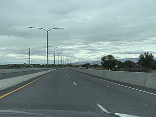
Lakeview Parkway, a yet-to-be-entirely-completed street in Utah County, Utah, United States, that is mostly located within the city limits of Provo and runs along length of the south and west sides of the city. The parkway serves the Provo Municipal Airport and the new campus of Provo High School. Upon final completion, it will be a four- to five-lane road running from Geneva Road at 2000 North to South State Street, running along nearly the entire west and south sides of Provo.

