
The Waikato River is the longest river in New Zealand, running for 425 kilometres (264 mi) through the North Island. It rises on the eastern slopes of Mount Ruapehu, joining the Tongariro River system and flowing through Lake Taupō, New Zealand's largest lake. It then drains Taupō at the lake's northeastern edge, creates the Huka Falls, and flows northwest through the Waikato Plains. It empties into the Tasman Sea south of Auckland, at Port Waikato. It gives its name to the Waikato region that surrounds the Waikato Plains. The present course of the river was largely formed about 17,000 years ago. Contributing factors were climate warming, forest being reestablished in the river headwaters and the deepening, rather than widening, of the existing river channel. The channel was gradually eroded as far up river as Piarere, leaving the old Hinuera channel through the Hinuera Gap high and dry. The remains of the old course are seen clearly at Hinuera, where the cliffs mark the ancient river edges. The Waikato's main tributary is the Waipā River, which converges with it at Ngāruawāhia.
Hakarimata Range is a range of hills on the western edge of Ngāruawāhia township, in the Waikato region of New Zealand, overlooking the confluence of the Waikato and Waipā Rivers. The Hakarimata Range is separated from the Taupiri Range by the Taupiri Gorge, through which the Waikato River flows.
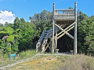
New Zealand has a large number of hot springs, known as waiariki in Māori. Many of them are used for therapeutic purposes.
Waikato Tainui, Waikato or Tainui is a group of Māori iwi based in Waikato Region, in the western central region of New Zealand's North Island. It is part of the larger Tainui confederation of Polynesian settlers who arrived to New Zealand on the Tainui waka. The tribe is named after the Waikato River, which plays a large part in its history and culture.

There are 3,820 lakes in New Zealand that have a surface area larger than one hectare. Many of the lakes in the central North Island are volcanic crater lakes. The majority of the lakes near the Southern Alps were carved by glaciers. Artificial lakes created as hydroelectric reservoirs are common in South Canterbury, Central Otago and along the Waikato River.

The spotless crake is a species of bird in the rail family, Rallidae. It is widely distributed species occurring from the Philippines, New Guinea and Australia, across the southern Pacific Ocean to the Marquesas Islands and south to New Zealand.
His Majesty's colonial brig Elizabeth Henrietta was completed in 1816 for New South Wales service, but capsized on the Hunter River, Australia later that year with the loss of two lives. The ship was wrecked in 1825.
The Devil River is a river of New Zealand's Tasman Region. It starts between the Devil Range and the Anatoki Range and flows generally east through the Kahurangi National Park, reaching the Waingaro River.
The Little Waingaro River is a river of the Tasman Region of New Zealand. It is a tributary of the Waingaro River, which it meets 10 kilometres south of Tākaka.
Waingaro River is the name of two rivers in New Zealand.
The Stanley River is a river of the Tasman Region of New Zealand's South Island. It flows southeast from its sources in the Douglas and Anatoki Ranges, reaching the Waingaro River 12 kilometres west of Upper Takaka.
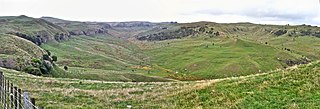
The Waingaro River is a river of the Waikato region of New Zealand's North Island. It flows generally southwest from its origins near Glen Afton and Glen Massey, west of Ngāruawāhia, to reach a northern arm of Raglan Harbour. Its main tributary is Kahuhuru Stream, which Highway 22 follows for several kilometres. Tributaries total about 170 kilometres (110 mi). At Waingaro it is fed by a hot spring.
The Waingaro River is a river of the Tasman Region of New Zealand's South Island.

The Kerikeri River is a short river of the Waikato region of New Zealand's North Island. It flows into the northern shore of Raglan Harbour.
State Highway 22 (SH 22) is a New Zealand state highway just south of Auckland. It connects the town of Pukekohe to the Auckland Southern Motorway.
Lake Whangape is shallow, supertrophic, lateral and the second largest lake in the lower Waikato River basin in New Zealand. One source said the name translated to 'a large sheet of water', another that it was a chief's name.
Te Ākau is a small farming settlement in the North Island of New Zealand, located 62 km (39 mi) north west of Hamilton, 39 km (24 mi) south west of Huntly, 45 km (28 mi) south of Port Waikato and 47 km (29 mi), or 19 km (12 mi) by ferry and road, north of Raglan. It has a hall and a school.
Glen Massey is a former mining village, 9.5 km (5.9 mi) west of Ngāruawāhia, which was, until 1958, terminus of the Glen Massey Line. It then went into decline, but is now becoming a home for Hamilton commuters.

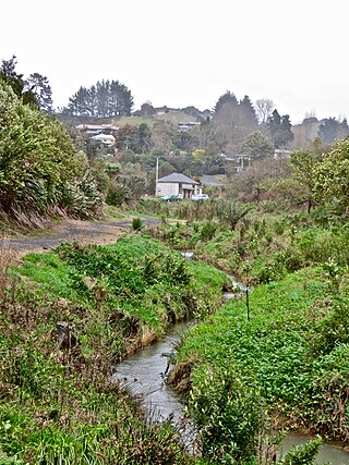
Waingaro is a rural community in the Waikato District and Waikato region of New Zealand's North Island, on the banks of the Waingaro River, where it is fed by a hot spring.
