
Belknap County is a county in the U.S. state of New Hampshire. As of the 2020 census, the population was 63,705. The county seat is Laconia. It is located in New Hampshire's Lakes Region, slightly southeast of the state's geographic center. Belknap County comprises the Laconia, NH Micropolitan Statistical Area, which in turn constitutes a portion of the Boston-Worcester-Providence, MA-RI-NH-CT Combined Statistical Area.

Alton is a town in Belknap County, New Hampshire, United States. The population was 5,894 at the 2020 census, up from 5,250 at the 2010 census. It is home to Alton Bay State Forest and Mount Major State Forest.

Center Harbor is a town in Belknap County, New Hampshire, United States. As of the 2020 census, the town had a population of 1,040. It is situated between Lake Winnipesaukee and Squam Lake.

Gilford is a town in Belknap County, New Hampshire, United States. The population was 7,699 at the 2020 census, up from 7,126 at the 2010 census. Situated on Lake Winnipesaukee, Gilford is home to Governors Island, Ellacoya State Beach, Belknap Mountain State Forest, Gunstock Mountain Resort, and the Bank of New Hampshire Pavilion, a seasonal outdoor concert venue. The lakeside village of Glendale lies within Gilford's borders.
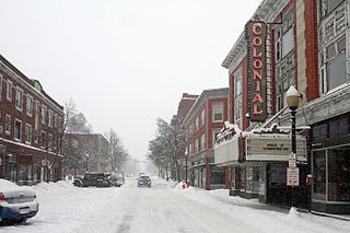
Laconia is a city in Belknap County, New Hampshire, United States. The population was 16,871 at the 2020 census, up from 15,951 at the 2010 census. It is the county seat of Belknap County. Laconia, situated between Lake Winnipesaukee and Lake Winnisquam, includes the villages of Lakeport and Weirs Beach. Each June, the city hosts Laconia Motorcycle Week, also more simply known as "Bike Week", one of the country's largest rallies.

Moultonborough is a town in Carroll County, New Hampshire, United States. The population was 4,918 at the 2020 census, up from 4,044 at the 2010 census. Moultonborough is bounded in large part by Lake Winnipesaukee in the southwest and to a lesser extent by Squam Lake in the northwestern corner. The town includes the census-designated place of Suissevale and the community of Lees Mill.

Franklin is a city in Merrimack County, New Hampshire, United States. At the 2020 census, the population was 8,741, the lowest figure of New Hampshire's 13 cities. Franklin includes the village of West Franklin.

Lake Winnipesaukee is the largest lake in the U.S. state of New Hampshire, located in the Lakes Region at the foothills of the White Mountains. It is approximately 21 miles (34 km) long (northwest-southeast) and from 1 to 9 miles wide (northeast-southwest), covering 69 square miles (179 km2)—71 square miles (184 km2) when Paugus Bay is included—with a maximum depth of 180 feet (55 m). The center area of the lake is called The Broads.

America's Stonehenge is a privately owned tourist attraction and archaeological site consisting of a number of large rocks and stone structures scattered around roughly 30 acres within the town of Salem, New Hampshire, in the United States. It is open to the public for a fee as part of a recreational area which includes snowshoe trails and an alpaca farm.

Meredith is a town in Belknap County, New Hampshire, United States. The population was 6,662 at the 2020 census. Meredith is situated in the state's Lakes Region and serves as a major resort town. Meredith Village, the commercial center of the town, lies along the shores of Lake Winnipesaukee, and several other large lakes lie partially or completely within the town borders. It is home to the Stonedam Island Natural Area and the Winnipesaukee Scenic Railroad, and it serves as one of the ports of call for the MS Mount Washington.

Lake Waukewan is a 928-acre (3.76 km2) water body located in Belknap County in the Lakes Region of central New Hampshire, United States, in the towns of Meredith and New Hampton. The town of Center Harbor occupies part of the lake's northern shoreline.
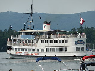
The MS Mount Washington is the flagship vessel of the Winnipesaukee Flagship Corporation. Its home port is on Lake Winnipesaukee in Laconia, New Hampshire, in the United States. The historic ship makes several ports of call around the lake during its scenic cruises in the spring, summer and fall months. Ice-Out is declared when the Mount Washington can get to all of its ports of call.

Funspot is an arcade which features one of the largest collections of early-1970s to late-2000s games in the world. It is located in the village of Weirs Beach in Laconia, New Hampshire, United States. Founded in 1952 by Bob Lawton, Funspot includes over 600 video games, pinball machines, and ticket redemption machines; an indoor miniature golf course; 20-lane ten-pin and candlepin bowling; cash bingo; a restaurant; a tavern; an ice cream stand; kiddie rides; and several other attractions on its grounds.
Bear Island is the second largest of the 264 islands in Lake Winnipesaukee in New Hampshire, United States. In the summer it is accessible only by boat because it is not connected to the mainland via a bridge. In the winter it can be reached by crossing the frozen lake, including by snowmobile. According to the Lake Winnipesaukee Historical Society, the island got its name when a few hunters along with a few members of the Pennacook tribe were sent to survey the island. However, they encountered a few bears, which they decided to hunt. Originally the island was named "Big Bear Island", which was later shortened to "Bear Island" when the island was annexed by the town of Meredith in 1799.

Rattlesnake Island is a large island in Lake Winnipesaukee, New Hampshire. There are conflicting accounts of where it got its name, because its shape looks somewhat like a snake, but some say it is named for a rattlesnake population that lived there.
The Ossipee Mountains are a small mountain range in the New England state of New Hampshire, United States. The remains of an ancient volcanic ring dike, they lie north of Lake Winnipesaukee, east of Squam Lake, and south of the Sandwich Range, the southernmost of the White Mountains. 2,990 ft (910 m) Mount Shaw is their highest point.
Meadow Pond Dam was an earthen dam in Alton, New Hampshire, in the United States, that collapsed in 1996, causing a fatal flood.

The Wolfeboro Railroad or Wolfeborough Railroad is a former short line that provided service to the summer resort town of Wolfeboro, New Hampshire on Lake Winnipesaukee.

Geneva Point Center (GPC) is a historic non-profit conference center and summer camp in a natural northern New England setting. Located in the town of Moultonborough, New Hampshire, the campus includes 184 acres (74 ha) of wooded nature trails and one mile of lakeshore on Lake Winnipesaukee. There are more than 90 structures on the site, including cabins, small family cottages and private lodge rooms. The property has the historic Winnipesaukee Inn. The oldest existing structure is a barn documented to exist in 1839 and is likely much older, perhaps even 18th century. The center has a long-running summer season ice cream shop that is open to the public.
The prehistory of New England is an important topic of research for New England archaeologists. Humans reached the current-day New England region by at least 10,500 years ago and likely earlier, occupying a recently de-glaciated environment. Pre-contact Native American groups in New England did not have full-fledged market economies and physical artifacts tended to change very slowly. However, technological shifts brought agriculture and ceramics to the region prior to the arrival of European settlers in the 17th century.
