
The Sioux or Oceti Sakowin are groups of Native American tribes and First Nations peoples in North America. The term is an exonym created from a French transcription of the Anishinaabe term "Nadouessioux", and can refer to any ethnic group within the Great Sioux Nation or to any of the nation's many language dialects. The modern Sioux consist of two major divisions based on language divisions: the Dakota and Lakota.

Yankton County is a county in the U.S. state of South Dakota. As of the 2010 United States Census, the population was 22,438. Its county seat is Yankton. Yankton County comprises the Yankton, SD Micropolitan Statistical Area.

Nobles County is a county in the U.S. state of Minnesota. As of the 2010 United States Census, the population was 21,378. Its county seat is Worthington.

Lyon County is a county in the U.S. state of Minnesota. As of the 2010 United States Census, the population was 25,857. Its county seat is Marshall.

Yankton is a city in, and the County seat of, Yankton County, South Dakota, U.S. The population was 14,454 at the 2010 census. Yankton is the principal city of the Yankton Micropolitan Statistical Area, which includes the entirety of Yankton County and which had an estimated population of 22,662 as of July 1, 2017. Yankton was the first capital of Dakota Territory. It is named for the Yankton tribe of Western Dakota people; Yankton is derived from the Dakota word I-hank-ton-wan.
Beaver Lake may refer to:
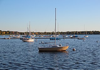
Bde Maka Ska is the largest lake in Minneapolis, Minnesota, United States, and part of the city's Chain of Lakes. Surrounded by city park land and circled by bike and walking trails, it is popular for many outdoor activities. The lake has an area of 401 acres (1.62 km2) and a maximum depth of 87 feet (27 m).

Pipestone National Monument is located in southwestern Minnesota, just north of the city of Pipestone, Minnesota. It is located along the highways of U.S. Route 75, Minnesota State Highway 23 and Minnesota State Highway 30.

Eagle Mountain is the highest natural point in Minnesota, United States, at 2,301 feet (701 m). It is in northern Cook County, in the Boundary Waters Canoe Area Wilderness and Superior National Forest in the Misquah Hills, northwest of Grand Marais. It is a Minnesota State Historic Site.
Mdewakantonwan are one of the sub-tribes of the Isanti (Santee) Dakota (Sioux). Their historic home is Mille Lacs Lake in central Minnesota, which in the Dakota language was called Mde wakan. Together with the Wahpekute, they form the so-called Upper Council of the Dakota or Santee Sioux.

John Blair Smith Todd was a Delegate from Dakota Territory to the United States House of Representatives and a general in the Union Army during the American Civil War.

Lewis and Clark Lake is a 31,400 acre (130 km²) reservoir located on the border of the U.S. states of Nebraska and South Dakota on the Missouri River. The lake is approximately 25 miles (40 km) in length with over 90 miles (140 km) of shoreline and a maximum water depth of 45 feet (14 m). The lake is impounded by Gavins Point Dam and is managed by the U.S. Army Corps of Engineers, Omaha District.
Chan Gurney Municipal Airport is three miles north of Yankton, in Yankton County, South Dakota. It is named for John Chandler "Chan" Gurney, a native of Yankton who was a sergeant in the U.S. Army during World War I and later became a U.S. Senator. The airport covers 458 acres (185 ha) and has two runways.

The Dakota are a Native American tribe and First Nations band government in North America. They compose two of the three main subcultures of the Sioux people, and are typically divided into the Eastern Dakota and the Western Dakota.
Shakopee or Chief Shakopee may refer to any of the three Mdewakanton Dakota leaders, in what is now the United States, who lived in the area of Minnesota from the late 18th century through 1865. The name comes from the Dakota Shák'pí meaning "Six," as the wife of the first Shakopee gave birth to sextuplet boys.
This timeline of South Dakota is a list of events in the history of South Dakota by year.

Wall Lake is an unincorporated community in Otter Tail County, in the U.S. state of Minnesota.
Beaver Lake is a lake in South Dakota, in the United States.

Pierson Ranch Recreation Area is a state recreation area in Yankton County, South Dakota in the United States. The recreation area is 60 acres (24 ha) and lies directly below Gavins Point Dam and Lewis and Clark Lake and is adjacent to Lake Yankton. The area is open for year-round recreation including camping, swimming, fishing, hiking and boating. It is 4 miles (6.4 km) west of Yankton.
