Lake of Two Mountains High School (LTM; French : École secondaire Lake of Two Mountains) is an Anglophone public high school in Deux-Montagnes, Quebec in the Laurentides region. It is a part of the Sir Wilfrid Laurier School Board.
French is a Romance language of the Indo-European family. It descended from the Vulgar Latin of the Roman Empire, as did all Romance languages. French evolved from Gallo-Romance, the spoken Latin in Gaul, and more specifically in Northern Gaul. Its closest relatives are the other langues d'oïl—languages historically spoken in northern France and in southern Belgium, which French (Francien) has largely supplanted. French was also influenced by native Celtic languages of Northern Roman Gaul like Gallia Belgica and by the (Germanic) Frankish language of the post-Roman Frankish invaders. Today, owing to France's past overseas expansion, there are numerous French-based creole languages, most notably Haitian Creole. A French-speaking person or nation may be referred to as Francophone in both English and French.
Quebec is one of the thirteen provinces and territories of Canada. It is bordered to the west by the province of Ontario and the bodies of water James Bay and Hudson Bay; to the north by Hudson Strait and Ungava Bay; to the east by the Gulf of Saint Lawrence and the province of Newfoundland and Labrador; and to the south by the province of New Brunswick and the U.S. states of Maine, New Hampshire, Vermont, and New York. It also shares maritime borders with Nunavut, Prince Edward Island, and Nova Scotia. Quebec is Canada's largest province by area and its second-largest administrative division; only the territory of Nunavut is larger. It is historically and politically considered to be part of Central Canada.
The Laurentides is a region of Quebec. While it is often called the Laurentians in English, the region includes only part of the Laurentian mountains. It has a total land area of 20,744.29 km2 (8,009.42 sq mi) and a 2011 census population of 555,614 inhabitants.
The school's service area includes Deux Montagnes, Kanesatake, southern portions of Mirabel, Oka, Pointe-Calumet, Saint-Eustache, Saint-Placide, Ste-Marthe-sur-le-Lac, and St-Joseph-du-Lac. [1] As of 2014 55 students from Kanesatake choose to attend Lake of Two Mountains. [2]
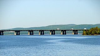
Kanehsatà:ke is a Kanien'kéha:ka Mohawk settlement on the shore of the Lake of Two Mountains in southeastern Quebec, Canada, at the confluence of the Ottawa and St. Lawrence rivers and about 30 miles west of Montreal. People who reside in Kanehsatà:ke are referred to as Kanehsata'kehró:non. As of 2014, the total registered population was 2400, with a total of about 1350 persons living on the territory. Both they and the Kanien'kéha:ka of the Kahnawà:ke reserve, located across from Montreal, also control and have hunting and fishing rights to Tiowéro:ton.
Mirabel is an off-island suburb of Montreal, located in southern Quebec.
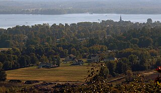
Oka is a small village on the northern bank of the Ottawa River, northwest of Montreal, Quebec, Canada. Located in the Lower Laurentians on Lake of Two Mountains, where the Ottawa has its confluence with the St. Lawrence River, the town has a main thoroughfare that is now part of Quebec Route 344.It's located 50 km northwest of Montreal.
The current campus was built in 1983, replacing the previous facility. [2]
As of 2005 [update] the school has the "16 Plus" alternative education program for students at risk of dropping out of high school altogether; they may receive a life skills diploma, but not a full high school diploma, if they graduate from this program. [3]
Saint-Eustache is an off-island village of Montreal, in western Quebec, Canada, west of Montreal on the north shore of the Rivière des Mille Îles. It is located 35 km (22 mi) northwest of Montreal.
Boisbriand is an off-island suburb of Montreal, in southwestern Quebec, Canada, on the north shore of the Rivière des Mille Îles in the Thérèse-De Blainville Regional County Municipality.
Sainte-Thérèse is an off-island suburb northwest of Montreal, in southwestern Quebec, Canada, in the Thérèse-De Blainville Regional County Municipality.
Deux-Montagnes is a suburban municipality in southwestern Quebec, Canada on the north shore of the Rivière des Mille Îles where it flows out of Lake of Two Mountains. It is the seat of the Deux-Montagnes Regional County Municipality in the greater Montreal region. It is located 40 km from Montreal.
Sainte-Anne-des-Plaines is a city in southwestern Quebec, Canada, 40 km northwest of the city of Montreal in the regional county of Laurentides more precisely in the district of Thérèse-De Blainville. Its population was 14,990 by the census of 2014.
Lorraine is an affluent off-island suburb of Montreal, in southwestern Quebec, Canada on the north shore of the Rivière des Mille-Îles in the Thérèse-De Blainville Regional County Municipality. There are no industries and only a very limited commercial district ; almost all houses are of the detached type. Furthermore, a large portion of the town territory is set aside as wild forest ; some bike/ski trails run through it. The town is divided into two areas, Uptown and Downtown. These two areas are also delimited by Quebec freeway A-640, and are only joined together by the main street overpass.
Argenteuil—Papineau—Mirabel was a federal electoral district in Quebec, Canada, that was represented in the House of Commons of Canada from 1867 to 2015.
Lake of Two Mountains is part of the river delta widening of the Ottawa River in Quebec, Canada, at its confluence with the St. Lawrence River.
Laval-sur-le-Lac is a small sector on the western part of Laval and was a separate city until the municipal mergers on August 6, 1965. This community contains North America's oldest French speaking private golf club, Le Club Laval-sur-le-Lac, established in 1917.
The Sir Wilfrid Laurier School Board is a school board headquartered in Rosemère, Quebec in Greater Montreal.
Laurentian Regional High School is an English secondary school in Lachute in the region of Laurentides, Québec, Canada. It contains classes for grades seven through eleven, and is run by the Sir Wilfrid Laurier School Board.
Sainte-Marthe-sur-le-Lac is an off-island suburb of Montreal, in the Canadian province of Quebec, located in the Deux-Montagnes Regional County Municipality.It is located 40km from Montreal. It is crossed from east to west by road 344, commonly known as Oka road. The town shares its borders with Deux-Montagnes to the east, Saint-Joseph-du-Lac to the west, the lake of Two-Mountains to the south and Saint-Eustache to the north.
Pointe-Calumet is a municipality in the Canadian province of Quebec. The municipality is located within the Deux-Montagnes Regional County Municipality in the Laurentides region. It is situated about 30 minutes northwest of Montreal. Its population as of the 2006 Canadian Census is just over 6 000.
Saint-Placide is a municipality in the Laurentides region of Quebec, Canada, part of the Deux-Montagnes Regional County Municipality, along the north shore of the Ottawa River.
Saint-Joseph-du-Lac is a municipality in the Laurentides region of Quebec, Canada, part of the Deux-Montagnes Regional County Municipality.
The Commission scolaire de la Seigneurie-des-Mille-Îles (CSSMI) is a francophone school district in the Canadian province of Quebec. It comprises several primary schools and high schools across municipalities in the Laurentides region. The commission is overseen by a board of elected school trustees.
Laval Liberty High School (LLHS) was an Anglophone senior high school in Laval, Quebec and a part of the Sir Wilfrid Laurier School Board (SWLSB). It was formed in 2005 after Western Laval High School was split into two schools, with lower secondary levels forming Laval Junior High School. On July 1, 2015 it merged with Laurier Senior High School to form Laval Senior Academy.
Coordinates: 45°32′28″N73°54′49″W / 45.5411°N 73.9136°W
A geographic coordinate system is a coordinate system that enables every location on Earth to be specified by a set of numbers, letters or symbols. The coordinates are often chosen such that one of the numbers represents a vertical position and two or three of the numbers represent a horizontal position; alternatively, a geographic position may be expressed in a combined three-dimensional Cartesian vector. A common choice of coordinates is latitude, longitude and elevation. To specify a location on a plane requires a map projection.