
Chishtian is a city in Bahawalnagar district in Punjab Province, Pakistan. For administrative purposes, it is a part of the similarly-named Chishtian Tehsil.
Vehari District, , is a district in the Punjab province of Pakistan. The city of Vehari is the capital of the district.

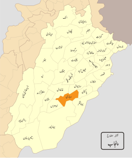
Bahawalpur Division was an administrative division of the Punjab Province, Pakistan until the reforms of 2000 abolished the third tier of government.

Minchinabad, is a city of Bahawalnagar District in the Punjab province of Pakistan. The city is the capital of Minchinabad Tehsil. It underwent rapid development in the late 1860s and 1870s. The city is named after Colonel Charles Minchin, the British Political Agent overseeing the Bahawalpur Princely State from 1866-1876

Dunga Bunga, is a town in Bahawalnagar District in the Punjab province, Pakistan. It located on the Bahawalnagar-Fort Abbas road 29 km (18 mi) away from Bahawalnagar. 20 km (12 mi) away from Haroonabad. 39 km (24 mi) away from Faqirwali. 58 km (36 mi) away from Khichiwala. 77 km (48 mi) away from Fort Abbas. The city hosts the Union council of Bahawalnagar Tehsil and is located near to the city of Bahawalnagar at 29°45'0N 73°15'0E with an altitude of 154 metres (505 ft). It lies on the Haroonabad-Bahawalnagar road.

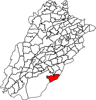
Bahawalnagar Tehsil is a tehsil located in Bahawalnagar District, Punjab, Pakistan. There are two towns in Bahawalnagar Tehsil: Bahawalnagar and Dunga Bunga. The city of Bahawalnagar is the headquarters of the tehsil which is administratively subdivided into 31 Union Councils.

Chistian Tehsil is a tehsil located in Bahawalnagar District, Punjab, Pakistan. The city of Chishtian is the headquarters of the tehsil which is administratively subdivided into 29 Union Councils.

Minchinabad Tehsil, is a tehsil located in Bahawalnagar District, Punjab, Pakistan. The city of Minchinabad is the headquarters of the tehsil which is administratively subdivided into 20 Union Councils.

Haroonabad Tehsil is a tehsil located in Bahawalnagar District, Punjab, Pakistan. The city of Haroonabad is the headquarters of the tehsil which is administratively subdivided into 22 Union Councils.
Dullāh Bhādera is a village and Union Council of Bahawalnagar District in the Punjab province of Pakistan. It is part of Chishtian Tehsil. It was built by and named after Abdullah Khan Bhadera three centuries ago. It is a few kilometers from the bank of river Sutlej. The village has a hospital and a middle school for girls.
Qasimka is a village and Union Council of Bahawalnagar District in the Punjab province of Pakistan. It is part of Bahawalnagar District.

Haroonabad or Harunabad is a tehsil (sub-district) in Bahawalnagar District of the Punjab Province of Pakistan. The town is the headquarters of Haroonabad Tehsil and administrative subdivision of the district.
Fort Abbas is a tehsil located in Bahawalnagar District, Punjab, Pakistan.
Amruka railway station is located in Amruka town of Minchinabad tehsil in Bahawalnagar district, Punjab province, Pakistan.
Bahawalnagar Junction railway station is located in Pakistan.
Samasata Junction railway station ( is located in Samasata town, Bahawalpur district of Punjab province, Pakistan. The station served as the junction between the Karachi–Peshawar Railway Line and the now defunct Samasata–Amruka Branch Line.
Bahawalnagar–Fort Abbas Branch Line was one of several branch lines in Pakistan, operated and maintained by Pakistan Railways. The line began at Bahawalnagar Junction and ended at Fort Abbas. The total length of this railway line is 84 kilometers (52 mi) with 4 railway stations.
Bahawalnagar is a city in Punjab, Pakistan.


