Related Research Articles

The Oregon Trail was a 2,170-mile (3,490 km) east–west, large-wheeled wagon route and emigrant trail in the United States that connected the Missouri River to valleys in Oregon. The eastern part of the Oregon Trail spanned part of what is now the state of Kansas and nearly all of what are now the states of Nebraska and Wyoming. The western half of the trail spanned most of the current states of Idaho and Oregon.

The name Jornada del Muerto translates from Spanish as "Single Day's Journey of the Dead Man" or even "Route of the Dead Man, though the modern literal translation is closer to "The Working Day of the Dead". It was the name given by the Spanish conquistadors to the Jornada del Muerto Desert basin, and the particularly dry 100-mile (160 km) stretch of a route through it from Las Cruces to Socorro, New Mexico. The trail led northward from central Spanish colonial New Spain, present-day Mexico, to the farthest reaches of the viceroyalty in northern Nuevo México Province. The route later became a section of the Camino Real de Tierra Adentro.
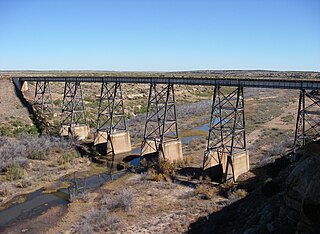
The Canadian River is the longest tributary of the Arkansas River in the United States. It is about 906 miles (1,458 km) long, starting in Colorado and traveling through New Mexico, the Texas Panhandle, and Oklahoma. The drainage area is about 47,700 square miles (124,000 km2).

The California Trail was an emigrant trail of about 1,600 mi (2,600 km) across the western half of the North American continent from Missouri River towns to what is now the state of California. After it was established, the first half of the California Trail followed the same corridor of networked river valley trails as the Oregon Trail and the Mormon Trail, namely the valleys of the Platte, North Platte, and Sweetwater rivers to Wyoming. The trail has several splits and cutoffs for alternative routes around major landforms and to different destinations, with a combined length of over 5,000 mi (8,000 km).
Sheffield is an unincorporated community in Pecos County, Texas, United States. According to the Handbook of Texas, the community had an estimated population of 600 in 2000.

The path followed by the Oregon Trail, California Trail and Mormon Trail spans 400 miles (640 km) through the U.S. state of Wyoming. The trail entered from Nebraska on the eastern border of the state near the present day town of Torrington and exited on the western border near the towns of Cokeville and Afton. An estimated 350,000 to 400,000 settlers traveled on the trail through Wyoming between 1841 and 1868. All three trails follow the same path through most of the state. The Mormon Trail splits at Fort Bridger and enters Utah, while the Oregon and California Trails continue to Idaho.

Preston, also known as Preston Bend, is an unincorporated community and census-designated place located on the Red River in Grayson County, Texas, United States. It grew in the 19th century at the intersection of several military and trade roads and was an important crossing on the Shawnee cattle trail. Preston lost prominence after the MK&T railroad bypassed the town to the east, leading to a decline in traveler and cattle drive traffic. Much of its former town site is submerged beneath the waters of Lake Texoma. Its population was 2,096 as of the 2010 census.
Howard Draw is a valley that heads in the extreme south of Reagan County, Texas at an elevation of 2720 feet at 30°05′09″N101°22′27″W, and runs through Crockett County to its foot on the Pecos River in Val Verde County, elevation 1575 feet.
The San Antonio–El Paso Road, also known as the Lower Emigrant Road or Military Road, was an economically important trade route between the Texas cities of San Antonio and El Paso between 1849 and 1882. Mail, freight, and passengers traveled by horse and wagon along this road across the Edwards Plateau and dangerous Trans-Pecos region of West Texas.

Southern Emigrant Trail, also known as the Gila Trail, the Kearny Trail, Southern Trail and the Butterfield Stage Trail, was a major land route for immigration into California from the eastern United States that followed the Santa Fe Trail to New Mexico during the California Gold Rush. Unlike the more northern routes, pioneer wagons could travel year round, mountain passes not being blocked by snows, however it had the disadvantage of summer heat and lack of water in the desert regions through which it passed in New Mexico Territory and the Colorado Desert of California. Subsequently, it was a route of travel and commerce between the eastern United States and California. Many herds of cattle and sheep were driven along this route and it was followed by the San Antonio-San Diego Mail Line in 1857–1858 and then the Butterfield Overland Mail from 1858–1861.
In Texas, the Butterfield Overland Mail service created by Congress on March 3, 1857, operated until March 30, 1861. The route that was operated extended from San Francisco, California to Los Angeles, then across the Colorado Desert to Fort Yuma, then across New Mexico Territory via, Tucson and Mesilla, New Mexico to Franklin, Texas, midpoint on the route. The route through Texas followed first the northern route to the Pecos River and downstream to Horse Head Crossing. The route in West Texas was changed in 1859, in order to secure a better water supply on the route and to provide mail service to a more settled area, the stages between Franklin, Redmond, Washington and the Pecos River followed the San Antonio-El Paso Road to Camp Stockton and then turned east to Horsehead Crossing. From Horsehead Crossing the route crossed Texas to the Red River and into Indian Territory. In 1860 the route was changed to another route from Jacksboro to Sherman via Decatur due to the building of a new toll bridge at Bridgeport, that avoided delays crossing the West Fork of the Trinity River when it was flooded. From Colberts Ferry the route went on to Fort Smith, then up across Arkansas and southwest Missouri to Tipton with the final leg by train to St. Louis. The Texas mail route was so long that the route there, like that in California, was divided into two divisions each under a superintendent.
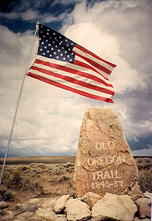
The historic 2,170-mile (3,490 km) Oregon Trail connected various towns along the Missouri River to Oregon's Willamette Valley. It was used during the 19th century by Great Plains pioneers who were seeking fertile land in the West and North.
The Stockton–Los Angeles Road, also known as the Millerton Road, Stockton–Mariposa Road, Stockton–Fort Miller Road or the Stockton–Visalia Road, was established about 1853 following the discovery of gold on the Kern River in Old Tulare County. This route between Stockton and Los Angeles followed by the Stockton–Los Angeles Road is described in "ITINERARY XXI. From Fort Yuma to Benicia, California", in The Prairie Traveler: A Hand-book for Overland Expeditions by Randolph Barnes Marcy. The Itinerary was derived from the report of Lieutenant R. S. Williamson on his topographical survey party in 1853, that was in search of a railroad route through the interior of California.
Howard Springs, was a historical spring, located in the stream channel of Howard Draw at an elevation of 2031 feet, just north of the mouth of Government Canyon at its confluence with Howard Draw in what is now Crockett County, Texas.
Live Oak Creek, a stream with its source in Reagan County, Texas at 31°10′45″N101°42′01″W at an elevation of 2938 feet, that runs southward to its mouth at an elevation of 2001 feet on the Pecos River in Crockett County, Texas.
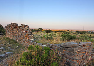
Head of Devil's River, a place on the Devils River where it has its confluence with Pecos Canyon at an elevation of 1722 feet, below Beaver Lake, nineteen and a half miles above the second crossing of Devils River. Here the San Antonio-El Paso Road left the Devils River to go northwest, 44 miles across Johnson Draw, Government Canyon and Howard Draw to Howard Springs, then 30.44 miles on to Live Oak Creek and Fort Lancaster, 3 miles further near the Pecos River.
San Diego Crossing, was a major ford on the Rio Grande, in Doña Ana County, New Mexico during the 19th Century. It was named for San Diego Mountain, on the east side of the Rio Grande, located directly west of the crossing. It was 11 miles north from Doña Ana, New Mexico then 7 miles northwest from the Camino Real to the crossing and 17 miles along the west bank from the crossing to their last camp along the river before their junction with Cooke's Wagon Road.
Leaving of Pecos was originally a camping place along the west bank of the Pecos River, on the wagon road called the Lower Emigrant Road, Military Road or San Antonio-El Paso Road in Texas. It was located 38 miles north of the Lancaster Crossing of the Pecos, and 16 miles east of the first crossing of Escondido Creek. It was also located a mile north of where the wagon road had its junction with a cutoff to the north to the wagon road called the Upper Emigrant Road between Fredericksburg, Texas and Comanche Springs, now Fort Stockton, Texas, where it joined the Lower Emigrant Road. It was later a stopping place on the route of San Antonio - El Paso Mail and the San Antonio-San Diego Mail Line.
Fosters Hole or La Tinaja, was a waterhole on the original route of Cooke's Wagon Road in what is now Sierra County, New Mexico. It is located in narrow crevasse at the foot of a cliff in Jug Canyon that is difficult to spot, except from a few vantage points.
Pope's Crossing was a ford on the Pecos River located one mile south of the New Mexico–Texas border on the modern Loving–Reeves county line. Discovered by members of an 1855 expedition tasked with drilling artesian wells east of the Pecos led by U.S. Army topographical engineer John Pope, the ford quickly became the primary crossing of the river on the "upper" military or emigrant road between San Antonio and the ford on the Rio Grande opposite the Mexican town of El Paso del Norte. Heavily used by emigrants, soldiers, traders, and freighters eager to avoid the more difficult and unpredictable crossings further south, Pope's Crossing became a well-traveled part of the network of transcontinental wagon roads that developed across Texas in the 1850s to facilitate settlement and commerce in the southwestern lands recently acquired as a result of the Mexican–American War.
References
- 1 2 Robert Eccleston, Edited by George P. Hammond and Edward H. Howes, Overland to California on the Southwestern Trail, University of California Press, Berkeley, 1950, p.89-91.
- ↑ Patrick Dearen, Crossing Rio Pecos, Texas Christian University Press, Fort Worth, 1996, pp.87-107