Land van Altena

Last updated

Land van Altena (region 3 minus the southeast) RMSDeltaNorth.jpg
Land van Altena (region 3 minus the southeast)

The Land of Altena (Dutch : Land van Altena) is a historical region and former fiefdom of the Lords of Altena, historically part of the County of Holland, but since 1815 located in the Dutch province of North Brabant.

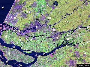
The Land of Altena lies on a river island in the estuary of the rivers Rhine and Meuse. It is enclosed by the rivers Boven Merwede (north), Afgedamde Maas (east) and Oude Maasje/Bergse Maas (south) and by the regions De Biesbosch (west) and the (former) Land of Heusden (southeast). It contains the former municipalities of Werkendam (the largest town of the island), and Woudrichem (the historical centre of the island and whose village Almkerk contains the site of the former castle of Altena).

Since 1904 it is united with the Land of Heusden (only the part above the Bergse Maas) as the Land of Heusden and Altena .

Unlike most parts of North Brabant the Land of Altena has a strong Protestant (Calvinist) character. Former Prime Minister Hendrikus Colijn (1869–1944) had his roots in this region.

51°46′27″N4°55′19″E / 51.774167°N 4.921944°E / 51.774167; 4.921944


Related Research Articles

<span class="mw-page-title-main">Meuse</span> River in western Europe

The Meuse or Maas is a major European river, rising in France and flowing through Belgium and the Netherlands before draining into the North Sea from the Rhine–Meuse–Scheldt delta. It has a total length of 925 km.

<span class="mw-page-title-main">Werkendam</span> Place in North Brabant, Netherlands

Werkendam is a town and a former municipality in the southern Netherlands. The municipality, part of Land van Heusden en Altena, contained a large part of De Biesbosch area as is located in the province of North Brabant. On January 1sth 2019 it joined Woudrichem and Aalburg in the new municipality of Altena.

<span class="mw-page-title-main">Woudrichem</span> City and former municipality in North Brabant, Netherlands

Woudrichem is a city and former municipality in the province of North Brabant in the Netherlands.

<span class="mw-page-title-main">Hollands Diep</span> Estuary of the Rhine and Meuse rivers in South Holland, Netherlands

Hollands Diep is a river in the Netherlands, and an estuary of the Rhine and Meuse rivers. Through the Scheldt-Rhine Canal it connects to the Scheldt river and Antwerp.

<span class="mw-page-title-main">Afgedamde Maas</span> River in the Netherlands

The Afgedamde Maas is a former distributary of the Maas River in the Dutch provinces of North Brabant and Gelderland. The Maas splits near Heusden with one channel flowing north until its confluence with the river Waal to form the Merwede, while the other channel continues west as the main distributary of the Maas.

<span class="mw-page-title-main">Bergse Maas</span>

The Bergse Maas is a canal that was constructed in 1904 to be a branch of the river Maas in the Dutch province of North Brabant. The Maas splits near Heusden into the Afgedamde Maas and the Bergse Maas. The Afgedamde Maas flows north until its confluence with the river Waal to form the Merwede, while the Bergse Maas continues west as the main distributary of the Maas. Part of the Merwede rejoins the Bergse Maas to form the Hollands Diep estuary.

<span class="mw-page-title-main">Amer (river)</span> River in the Netherlands

The Amer is a river in the Dutch province of North Brabant. It is a continuation of the Bergse Maas river from the river Donge near Raamsdonksveer to the point where it joins the river Nieuwe Merwede to form the Hollands Diep estuary, and has a total length of approximately 20 kilometres (12 mi). The Amer is a major navigation route. It forms the south boundary of the Biesbosch National Park.

<span class="mw-page-title-main">Hoeksche Waard</span> Island in South Holland, Netherlands

The Hoekse Waard is an island between the Oude Maas, Dordtsche Kil, Hollands Diep, Haringvliet and Spui rivers in the province of South Holland in the Netherlands. The island, part of the namesake municipality of Hoeksche Waard, is a mostly agricultural region, south of the outskirts of Rotterdam. The Hoeksche Waard consists of reclaimed land (polders): after the Saint Elisabeth flood of 1421 most of the area was flooded. The land has been reclaimed gradually in the following centuries.

<span class="mw-page-title-main">Merwede</span> River in the Netherlands

The Merwede is the name of several connected stretches of river in the Netherlands, between the cities of Woudrichem, Dordrecht and Papendrecht. The river is part of the Rhine–Meuse–Scheldt delta and is mostly fed by the river Rhine.

<span class="mw-page-title-main">Donge (river)</span> River in North Brabant, Netherlands

The Donge is a small river in the Dutch province of North Brabant. It rises from springs east of Baarle-Nassau as a stream called Leij. Near Tilburg the name changes to Donge. It passes the village of Dongen and flows north to the town of Geertruidenberg where it's continued by the Amer together with the Bergse Maas.

<span class="mw-page-title-main">Genderen</span> Village in North Brabant, Netherlands

Genderen is a village in the Dutch province of North Brabant. It is located in the municipality of Altena.

<span class="mw-page-title-main">Rhine–Meuse–Scheldt delta</span> Delta formed by 3 rivers in the Netherlands

The Rhine–Meuse–Scheldt delta is a river delta in the Netherlands formed by the confluence of the Rhine, the Meuse and the Scheldt rivers. In some cases, the Scheldt delta is considered a separate delta to the Rhine–Meuse delta. The result is a multitude of islands, branches and branch names, in which a waterway that appears to be one continuous stream may have numerous separate names for different sections, e.g. Rhine → Bijlands Kanaal → Pannerdens Kanaal → Nederrijn → Lek → Nieuwe Maas → Het Scheur → Nieuwe Waterweg. Since the Rhine contributes most of the water, the term "Rhine Delta" is commonly used, although this name is also used for the delta where the Alpine Rhine flows into Lake Constance. By some calculations, the Rhine–Meuse–Scheldt delta covers 25,347 km2 (9,787 sq mi), making it the largest in Europe.

<span class="mw-page-title-main">Oude Maas</span> Distributary of the Rhine River in South Holland, Netherlands

The Oude Maas is a distributary of the river Rhine, and a former distributary of the river Maas, in the Dutch province of South Holland. It begins at the city of Dordrecht where the Beneden Merwede river splits into the Noord and the Oude Maas. It ends when it joins the Nieuwe Maas to form Het Scheur.

<span class="mw-page-title-main">Nieuwe Maas</span> River in South Holland, the Netherlands

The Nieuwe Maas is a distributary of the Rhine River, and a former distributary of the Maas River, in the Dutch province of South Holland. It runs from the confluence of the rivers Noord and Lek, and flows west through Rotterdam. It ends west of the city where it meets the Oude Maas, near Vlaardingen, to form Het Scheur. After a few miles, the Scheur continues as the artificial Nieuwe Waterweg. The total length of the Nieuwe Maas is approximately 24 kilometres (15 mi).

<span class="mw-page-title-main">Oude Maasje</span> River in North Brabant, The Netherlands

The Oude Maasje is a former distributary of the river Maas, which runs parallel to the current canalised Bergse Maas.

<span class="mw-page-title-main">Heusden Canal</span> River in North Brabant, Netherlands

The Heusden Canal is a canal on the border of the Dutch provinces North Brabant and Gelderland, roughly between Wijk en Aalburg and Heusden. The canal connects the Afgedamde Maas and Bergse Maas and has a total length of approximately 2.3 km. The canal used to connect the city of Heusden to the main branch of the river Meuse. Later on, the original main branch was closed off and the river received a new, artificial mouth: the Bergse Maas. After that, the Heusden Canal was improved to maintain a shipping connection between the two Meuse branches.

<span class="mw-page-title-main">Land van Heusden en Altena</span> Region in North Brabant, Netherlands

The Land of Heusden and Altena is a region located in the Dutch province of North Brabant. In 1904 it consisted of the historical regions Land van Altena and Land van Heusden. Historically this region has been a part of North Brabant since 1815. During the Dutch Republic it belonged to Holland. It resembles comparable landscapes in the latter one, like e.g. the Alblasserwaard, which is situated just north of the region.

<span class="mw-page-title-main">Altena, North Brabant</span> Municipality in North Brabant, Netherlands

Altena is a municipality in the Netherlands, on a river island in the very north of the province of North Brabant, bordering the provinces of Gelderland and South Holland. Nearby cities are Dordrecht in the west, Gorinchem in the north, and Waalwijk in the south.

<span class="mw-page-title-main">Drongelens Canal</span> Drainage canal in the Netherlands

The Drongelens Canal is a drainage canal that runs from 's-Hertogenbosch to Drongelen in North Brabant. The colloquial Dutch name, and the name used on street signs is Drongelens Kanaal. The official Dutch name is Afwateringskanaal van 's-Hertogenbosch naar Drongelen.