Landl

Last updated
Landl
Anton Hansch Blick ins steirische Landltal 1837.jpg
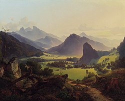
Looking into the Landl valley of Styria; Anton Hansch, 1837
AUT Landl COA.jpg
Austria adm location map.svg
Red pog.svg
Landl
Location within Austria
Coordinates: 47°39′03″N14°44′13″E / 47.65083°N 14.73694°E / 47.65083; 14.73694
Country Austria
State Styria
District Liezen
Government
   Mayor Bernhard Moser (SPÖ)
Area
[1]
  Total
254.85 km2 (98.40 sq mi)
Elevation
520 m (1,710 ft)
Population
 (2018-01-01) [2]
  Total
2,720
  Density11/km2 (28/sq mi)
Time zone UTC+1 (CET)
  Summer (DST) UTC+2 (CEST)
Postal code
8931
Area code 03633
Vehicle registration LI
Website www.landl.at

Landl is a municipality in the district of Liezen in the Austrian state of Styria.

Contents

Second World War History

Late in the Second World War a group of about 70 Wehrmacht soldiers that were scattered on the march back and were looking for their troop units. They were stopped outside of the village and put before a drumhead court-martial. They were suspected of being deserters, because they were marching unorganized, carrying enemy infantry weapons, marching away from the front, and their papers and orders were disorganized. Being found guilty all men were executed on 12 April 1945. Today their grave stones lay in war graves on a cemetery next to a yellow chapel, a memorial place. [3] [4]

Geography

Landl lies in the Landltal valley near the confluence of the Salza and the Enns.

References

  1. "Dauersiedlungsraum der Gemeinden Politischen Bezirke und Bundesländer - Gebietsstand 1.1.2018". Statistics Austria. Retrieved 10 March 2019.
  2. "Einwohnerzahl 1.1.2018 nach Gemeinden mit Status, Gebietsstand 1.1.2018". Statistics Austria. Retrieved 9 March 2019.
  3. "Hieflau (Soldatenfriedhof), Bezirk Leoben, Steiermark, Österreich". Onlineprojekt Gefallenendenkmäler (in German). Archived from the original on 29 July 2018. Retrieved 22 January 2020.
  4. Hasitschka, Josef. "Wandau: Kriegsgreuel". Das Gesäuse (PDF) (in German). p. 66. Retrieved 22 January 2020.