Landmark Place

Last updated
Landmark Place
LandmarkPlaceHamilton.JPG
Landmark Place
General information
TypeResidential/ retail
Architectural style Brutalist / Modernist
Location Hamilton, Ontario, Canada
Completed1974
Height
Roof127 m (417 ft)
Technical details
Floor count44 including observation deck
Lifts/elevators6

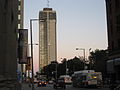
Landmark Place is the tallest building in downtown Hamilton, Ontario, Canada, at the corner of Main Street East and Catharine Street South in the Corktown neighbourhood. This 43-storey building (130 metres/427 feet) was completed in 1974, and was originally known as the Century 21 building. [1] It was built by Al Frisina as a mixed use building; commercial, residential and retail. Original plans included adding a heliport and a revolving rooftop restaurant but those plans were scrapped. Frisina also believes that no other building will be built in Hamilton taller than Landmark Place because as he puts it; 'the demand's not there and nobody's crazy enough to do it.' In the early 1960s, Frisina took on Hamilton's six-storey height limit. He brought in a consultant who told the city it could save money on services by building up instead of out. Frisina won and built the 18-storey Clarendon on Hunter near Bay. Today it is known as The Fontainebleu. [2]

Contents

The top 5 floors of the building are now occupied by luxury suites. [1]

Images

See also

Related Research Articles

<span class="mw-page-title-main">University of Toronto Graduate House</span>

Graduate House at the University of Toronto is a student residence specifically for graduate students, designed by Thom Mayne of Morphosis Architects in Los Angeles together with Toronto's Teeple Architects. It is located at 60 Harbord Street, Toronto, Ontario, Canada.

<span class="mw-page-title-main">Bronte, Ontario</span> Unincorporated community in Ontario, Canada

Bronte is the community that makes up much of the west end of Oakville, in Ontario, Canada. Twelve Mile Creek flows through the middle of town and empties into Lake Ontario. Main roads include Bronte Road (north-south), Lakeshore Road West and Rebecca Street (east-west). Streets in the business section include Lakeshore, Jones, Marine, and Ontario Street. Bronte is also accessed via a superhighway located to the north of the former village. Other main roads include Third Line, Speers Road and Burloak Drive to the west

<span class="mw-page-title-main">Royal Bank Building (Toronto)</span> Office buildings in Ontario, Canada

The Royal Bank Building refers to two office buildings constructed for the Royal Bank of Canada in Toronto financial district in Ontario, Canada:

<span class="mw-page-title-main">One Yonge Street</span> Toronto Star headquarters

One Yonge Street is a 25-storey office building in Toronto, Ontario, Canada. The building served as the headquarters of Torstar and its flagship newspaper, the Toronto Star, from 1971 to 2022. It is 100 metres tall and built in the International style. It was built as a replacement to the Old Toronto Star Building, which was located at 80 King Street West. That building was torn down to make room for First Canadian Place.

<span class="mw-page-title-main">William H. Wright Building</span>

The William H. Wright Building was a six-storey office building located at 140 King Street West in Toronto, Ontario, at the corner of King and York streets. Designed by the firm Mathers and Haldenby and built between 1937 and 1938, it was one of Toronto's best examples of streamline moderne architecture. The building was home to The Globe and Mail newspaper and was named after the founder of that paper, William Henry Wright (1876–1951). In 1974 it was demolished to make way for the new Exchange Tower.

<span class="mw-page-title-main">Dominion Public Building</span> Building in Toronto, Canada

The Dominion Public Building is a five-storey Beaux-Arts neoclassical office building built between 1926 and 1935 for the government of Canada at southeast corner of Front and Bay streets in Toronto, Ontario, Canada.

<span class="mw-page-title-main">Toronto Normal School</span> Former teachers college in Toronto, Canada

The Toronto Normal School was a teachers college in Toronto, Ontario, Canada. Opened in 1847, the normal school was located at Church and Gould streets in central Toronto, and was a predecessor to the current Ontario Institute for Studies in Education. The Royal Ontario Museum, the Ontario College of Art & Design and the Ontario Agricultural College all originated at the Normal School's campus and the provincial Department of Education was also located there. Officially named St. James Square, the school became known as "the cradle of Ontario's education system". The school's landmark Gothic-Romanesque building was designed by architects Thomas Ridout and Frederick William Cumberland in 1852. The landmark building was demolished in 1963, but architectural elements of the structure remain on the campus of Toronto Metropolitan University.

<span class="mw-page-title-main">Bay Street (Hamilton, Ontario)</span>

Bay Street is a lower city arterial road in Hamilton, Ontario, Canada. It starts at Inglewood Drive, just South of Aberdeen Avenue, as a collector road with only two lanes, then eventually becomes a six lane thoroughfare at its peak. Bay Street also passes through downtown Hamilton, where many high-rise buildings are found. Bay Street is a one-way street from Aberdeen Avenue to Cannon Street West. Bay Street continues as an arterial route to Strachan Street, where it is downgraded to a neighbourhood collector and eventually ends at a curb at Pier 4 Park at Burlington Street in the city's North End.

<span class="mw-page-title-main">100 King Street West</span> Third tallest building in Hamilton, Ontario

100 King Street West, formerly known as Stelco Tower, is the third tallest building in Hamilton, Ontario, Canada. The 103 metres (338 ft), 25-storey office skyscraper was completed in 1972, and is part of the larger Lloyd D. Jackson Square complex.

<span class="mw-page-title-main">Commerce Place (Hamilton, Ontario)</span> Commercial complex in Hamilton, Ontario, Canada

Commerce Place in a commercial complex, consisting of two towers, in Hamilton, Ontario, Canada.

<span class="mw-page-title-main">Wellington Street (Hamilton, Ontario)</span>

Wellington Street is a Lower City arterial road in Hamilton, Ontario, Canada. It starts off at Charlton Avenue East as a two-way street for only one block where it's then blocked off by the Corktown Park and a couple of Canadian National Railway lines that cut through it. It then starts up again north of the park on Young Street and is a one-way street the rest of the way (Southbound). It ends in the North End of the City on Burlington Street East, in front of the Lakeport Brewing Company and the Administration offices of the Hamilton Port Authority.

<span class="mw-page-title-main">Queen Street, Hamilton, Ontario</span> Lower City arterial road in Hamilton, Ontario, Canada

Queen Street is a Lower City arterial road in Hamilton, Ontario, Canada. It starts off at Beckett Drive, a mountain-access road in the city and is a two-way street up to King Street West and a one-way street (southbound) the rest of the way north up to the Canadian National Railway Yard, where the road turns right, merging with Stuart Street which travels in a west–east direction.

<span class="mw-page-title-main">Victoria Avenue (Hamilton, Ontario)</span>

Victoria Avenue is a Lower City arterial road in Hamilton, Ontario, Canada. It starts off as a ramp and part of a Mountain-access road, the Claremont Access, on Hunter Street East in the Stinson neighbourhood. It's also a one-way thoroughfare that flows north through the Landsdale and the city's North End industrial neighbourhood past Burlington Street East where it ends at Pier 11.

<span class="mw-page-title-main">Catharine Street (Hamilton, Ontario)</span>

Catharine Street is a Lower City collector road in Hamilton, Ontario, Canada. It starts off at Charlton Avenue East at Woolverton Park in the Corktown neighbourhood as a one-way street (southbound), tunnels underneath the Hunter Street Railway bridge and stretches up to Barton Street East where it then turns two-way and cutoff by the CN Railway lines that cut through Strachan Street Park one block north past Barton. Catharine Street then resumes again on Strachan Street East, north of the Park again as a two-way road for 3 blocks and interrupted again at Picton Street East, the site of St. Lawrence Elementary School and resumes again north of this property on Macauley Street East, again as a two-way street for another 3 blocks where it's interrupted for a third time at Brock Street, the site of Eastwood Park and Eastwood Arena. Catherine Street resumes again north of Eastwood Park on Guise Street East and ends at the city's North End waterfront, the site of a Royal Canadian Navy base and Pier 9.

<span class="mw-page-title-main">Main Street (Hamilton, Ontario)</span>

Main Street is a street in Hamilton, Ontario, Canada.

<span class="mw-page-title-main">King Street Gaol (1824)</span> Demolished jail in Toronto, Canada

The second King Street Gaol was built in 1824 to replace the first King Street Gaol in York, Upper Canada. At that time, the town needed a larger, better constructed jail to replace the original, which was little more than a plain log building with a stockade.

<span class="mw-page-title-main">Royal Connaught Hotel</span> 13-storey building in downtown Hamilton, Ontario

The Royal Connaught Hotel is a 13-storey building in downtown Hamilton, Ontario. It was built by Harry Frost of Buffalo, New York in 1914, who also started up and owned the Frost Fence Company in Hamilton. It is located at the corner of King Street East and John Street South. From 2014-2018, it was converted to condominiums.

<span class="mw-page-title-main">Strathcona, Hamilton</span> Neighbourhood in Hamilton, Ontario

The Strathcona neighbourhood is located west of downtown Hamilton, Ontario, and is bounded by Highway 403, the CNR rail line, Queen Street, York Boulevard and Main Street. The neighbourhood is also intersected by several other major street arteries: Dundurn Street, Locke Street, and King Street West. As of the 2016 census, Strathcona has a population of 6,555, up from 5,800 in the 1996 census.

<span class="mw-page-title-main">Colborne Street, Toronto</span> Street in Toronto, Ontario, Canada

Colborne Street is a street running several hundred metres east of Yonge Street in downtown Toronto, Ontario, Canada. It crosses Victoria Street and Leader Lane, ending at Church Street. It is located between and parallel to King Street East and Wellington Street East. The street is notable for retaining several historic buildings built during the reign of Queen Victoria.

References

  1. 1 2 "Landmark Place/ Century 21 Building: 1974 (www.emporis.com)". Archived from the original on April 1, 2007. Retrieved 2007-02-07.
  2. Wilson, Paul (2007-01-31). "Street Beat: Hamilton's Empire State builder". The Hamilton Spectator.

43°15′14″N79°51′56″W / 43.2540°N 79.8655°W / 43.2540; -79.8655