
Downtown Toronto is the main central business district of Toronto, Ontario, Canada. Located entirely within the district of Old Toronto, it is approximately 16.6 square kilometres in area, bounded by Bloor Street to the northeast and Dupont Street to the northwest, Lake Ontario to the south, the Don Valley to the east, and Bathurst Street to the west. It is also the home of the municipal government of Toronto and the Government of Ontario.
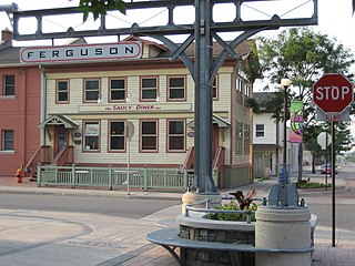
Below is a timeline of events in Hamilton, Ontario, Canada.

Bay Street is a lower city arterial road in Hamilton, Ontario, Canada. It starts at Inglewood Drive, just South of Aberdeen Avenue, as a collector road with only two lanes, then eventually becomes a six lane thoroughfare at its peak. Bay Street also passes through downtown Hamilton, where many high-rise buildings are found. Bay Street is a one-way street from Aberdeen Avenue to Cannon Street West. Bay Street continues as an arterial route to Strachan Street, where it is downgraded to a neighbourhood collector and eventually ends at a curb at Pier 4 Park at Burlington Street in the city's North End.
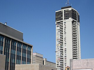
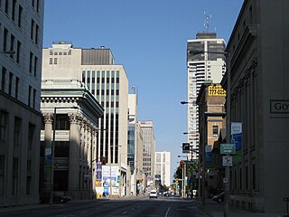
Landmark Place is the tallest building in downtown Hamilton, Ontario, Canada, at the corner of Main Street East and Catharine Street South in the Corktown neighbourhood. This 43-storey building was completed in 1974, and was originally known as the Century 21 building. It was built by Al Frisina as a mixed use building; commercial, residential and retail. Original plans included adding a heliport and a revolving rooftop restaurant but those plans were scrapped. Frisina also believes that no other building will be built in Hamilton taller than Landmark Place because as he puts it; 'the demand's not there and nobody's crazy enough to do it.' In the early 1960s, Frisina took on Hamilton's six-storey height limit. He brought in a consultant who told the city it could save money on services by building up instead of out. Frisina won and built the 18-storey Clarendon on Hunter near Bay. Today it is known as The Fontainebleu.

Hughson Street is a Lower City collector road in Hamilton, Ontario, Canada. It starts at Charlton Avenue East at St. Joseph's hospital and runs north to Haymarket Street in the downtown where it's cut off by the Hamilton GO Transit station. Up to this point it is a two-way street. It then starts up again north of the station on Hunter Street East, where it then becomes a one-way street going north just past Barton Street East to Murray Street where it's cut off again by a parking lot for LIUNA Station. It then starts up again one block north past the CN railway tracks on Strachan Street and from this point onwards becomes a two-way street again that extends to the city's North End to the waterfront on Guise Street West, the site of the Canada Marine Discovery Centre and Pier 9.

MacNab Street is a Lower City collector road in Hamilton, Ontario, Canada. It starts in the Durand neighbourhood on Markland Street, as a one-way street going north to Bold Street, where it becomes two-way for one block until Hurst Place where it's cut off by a wall for the Hunter Street railway bridge. Pedestrians may cross Hunter Street at an underpass. MacNab Street starts again north of the Railway line on Hunter Street as a two-way street but is cut off again at King Street where the Lloyd D. Jackson Square mall and Stelco Tower are situated. MacNab Street continues north of this Mall on York Boulevard, in front of the Hamilton Public Library & the entrance to the Hamilton Farmer's Market, again as a two-way street right through the city's North End to Burlington Street. It continues as a one-way street to the waterfront where it ends at Guise Street West, the site of the Royal Hamilton Yacht Club and Pier 5.

John Street is a Lower City arterial road in Hamilton, Ontario, Canada. Originally it was known as Mountain Road or Ancaster Road. It starts off at the base of Arkledun Avenue, a Mountain-access road in the city, just east of St. Joseph's Hospital, where it is a one-way street going north and tunnels underneath the Hunter Street Railway bridge and continues onward to the city's North End at the waterfront, where it ends at Guise Street East, the site of Pier 9.

James Street is a Lower City arterial road in Hamilton, Ontario, Canada. It starts off at the base of the Niagara Escarpment from James Mountain Road, a mountain-access road in the city. It was one of many arterials in the central business district converted to one-way operation in 1956 when the city retained Wilbur Smith and Associates to develop a Traffic and Transportation Plan. Parts of it were restored to two-way operation in 2002. It extends north to the city's waterfront at the North End where it ends at Guise Street West right in front of the Harbour West Marina Complex and the Royal Hamilton Yacht Club.

Wellington Street is a Lower City arterial road in Hamilton, Ontario, Canada. It starts off at Charlton Avenue East as a two-way street for only one block where it's then blocked off by the Corktown Park and a couple of Canadian National Railway lines that cut through it. It then starts up again north of the park on Young Street and is a one-way street the rest of the way (Southbound). It ends in the North End of the City on Burlington Street East, in front of the Lakeport Brewing Company and the Administration offices of the Hamilton Port Authority.
Ferguson Avenue is a Lower City collector road in Hamilton, Ontario, Canada. It is a two-way street throughout that starts off at the base of the Mountain on Foster Street. It's interrupted 3 blocks north at Corktown Park where Canadian Pacific Railway lines passes through it. Ferguson Avenue resumes again north of the Park right before Hunter Street East, extending northward past Barton Street East through the city's North End industrial neighbourhood where it ends on Dock Service Road, the site of a Royal Canadian Navy base and Pier 10.

Cannon Street is a Lower City collector road in Hamilton, Ontario, Canada. It starts off at Queen Street North as a one-way street (Westbound) up to Sherman Avenue North where it then switches over to a two-way street the rest of the way Eastward and ends just past Kenilworth Avenue North on Barons Avenue and merges with Britannia Avenue, a street that runs parallel with Cannon Street from Ottawa Street North to Barons Avenue.

King Street is a Lower City arterial road in Hamilton, Ontario, Canada, also known as Highway 8. The western-end starts off beside McMaster University Medical Centre as a two-way street and passes through Westdale. At Paradise Road, King Street switches over to a one-way street (westbound) right through the city's core up to "the Delta", a spot in town where King and Main streets intersect. From the Delta onwards, King Street then switches over to become a two-way street again and ends at Highway 8 in Stoney Creek.
Main Street is a street in Hamilton, Ontario, Canada.

Jackson Street, is a Lower City collector road in Hamilton, Ontario, Canada. It starts off West of Locke Street South at Jackson Playground as a one-way street (Westbound) up to Queen Street South where it then switches over to a two-way street and is interrupted at Bay Street South the site of the Hamilton City Hall and the Canadian Football Hall of Fame (museum), resumes again East of the property on MacNab Street South and then ends at Wellington Street South.

Hunter Street is a Lower City collector road in Hamilton, Ontario, Canada. It is a one-way street (Westbound) that starts West of Locke Street at Hill Street Park and ends two blocks East of Victoria Avenue at Emerald Street. Hunter Street is a two-way street between Victoria and Emerald Streets.
Augusta Street is a Lower City collector road in Hamilton, Ontario, Canada. A two-way collector road that starts off on James Street South and ends 4-blocks East at Shamrock Park just past Walnut Street South.
Upper James Street, is an Upper City (mountain) arterial road in Hamilton, Ontario, Canada. It starts at the Claremont Access, a mountain-access road in the north, and extends southward towards the John C. Munro Hamilton International Airport where it then changes its name to the Hamilton Port Dover Plank Road,. It is a two-way street throughout. As with most of the "Upper" streets, their addresses start at roughly the point where their lower counterpart finishes just below the Escarpment and were originally labelled without the "Upper" prefix.
The North End is a mostly residential neighbourhood in Hamilton, Ontario, Canada, immediately north of Downtown. The area is bounded by the CNR Railway to the south, Wellington Street to the east, and the Hamilton Harbour on both the north and west sides of the neighbourhood.


