Main Street (Hamilton, Ontario)

Last updated
Main Street, looking East MainEastHamilton.JPG
Main Street, looking East

Main Street is a street in Hamilton, Ontario, Canada.

Contents

History

Landed Banking & Loan Co. Building, Main Street East LandedBankingLoanHamilton.JPG
Landed Banking & Loan Co. Building, Main Street East
John Sopinka Courthouse, Main Street East JohnSopinkaCourthouse.JPG
John Sopinka Courthouse, Main Street East

Main Street was originally called Court Street, after the first courthouse that stood on it. It is now called Main Street because it formed the "main" concession line of Barton Township. [1]

On June 20, 1877, the first commercial telephone service in Canada began in Hamilton, Ontario. [2] Hugh Cossart Baker, Jr. learned of Alexander Graham Bell's invention in 1877 at the Philadelphia International Exposition and from there decided to test the communication tool in Hamilton. [3] Hugh Cossart Baker Jr. is credited with making the first telephone exchange in the British Empire from an office building (Exchange Building) at the corner of James and Main Street East which still stands there today (March 2007). [3]

In 1925, The first traffic lights in Canada went into operation at the Delta. (11 June 1925). [4]

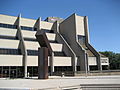
McMaster University arrived in Hamilton in 1930 from Bloor Street in Toronto. The total student population at McMaster University is well over 27,000. Almost two-thirds of the students come from outside the immediate Hamilton region. [5]

Built in 1931, Westdale Secondary School was immediately deemed the largest composite school in the British Empire, having cost $1.3 million to build and consisting of 4.7 hectares of building, grounds and athletic fields. [6]

Landmarks

Convention Centre & Hamilton Place Auditorium HamiltonPlaceConvention.JPG
Convention Centre & Hamilton Place Auditorium

Note: Listing of Landmarks from West to East.

Communities

Delta Secondary School DeltaHamilton.JPG
Delta Secondary School
Railway line at Main East, near Gage Avenue MainAndGageRailline.JPG
Railway line at Main East, near Gage Avenue
Railway line at Main East, near Gage Avenue MainAndGageRaillineA.JPG
Railway line at Main East, near Gage Avenue
The Delta, where King & Main Streets cross over TheDeltaHamilton.JPG
The Delta, where King & Main Streets cross over

Note: Listing of neighbourhoods from West to East. [8]


Related Research Articles

<span class="mw-page-title-main">Hamilton, Ontario</span> City in Canada

Hamilton is a port city in the Canadian province of Ontario. Hamilton has a population of 569,353, and its census metropolitan area, which encompasses Burlington and Grimsby, has a population of 785,184. The city is situated approximately 45 kilometres (28 mi) southwest of Toronto in the Greater Toronto and Hamilton Area (GTHA).

<span class="mw-page-title-main">Parkdale, Toronto</span> Neighbourhood in Toronto, Ontario, Canada

Parkdale is a neighbourhood and former village in Toronto, Ontario, Canada, west of downtown. The neighbourhood is bounded on the west by Roncesvalles Avenue, on the north by the CP Rail line where it crosses Queen Street and Dundas Street. It is bounded on the east by Dufferin Street from Queen Street south, and on the south by Lake Ontario. The original village incorporated an area north of Queen Street, east of Roncesvalles from Fermanagh east to the main rail lines, today known as part of the Roncesvalles neighbourhood. The village area was roughly one square kilometre in area. The City of Toronto government extends the neighbourhood boundaries to the east, south of the CP Rail lines, east to Atlantic Avenue, as far south as the CN Rail lines north of Exhibition Place, the part south of King Street commonly known as the western half of Liberty Village neighbourhood.

<span class="mw-page-title-main">Ancaster—Dundas—Flamborough—Westdale (federal electoral district)</span> Federal electoral district in Ontario, Canada

Ancaster—Dundas—Flamborough—Westdale was a federal electoral district in Ontario, Canada, that has been represented in the House of Commons of Canada from 2004 until the electoral boundaries were redrawn for the 2015 election.

<span class="mw-page-title-main">Westdale, Hamilton</span>

Westdale is a residential neighbourhood in Hamilton, Ontario, Canada. It is centred in the Westdale Village shopping district and located near McMaster University. It is bordered to the north by Cootes Paradise, an extensive nature reserve marking the western end of Lake Ontario, to the south by Main Street and Ainslie Wood, to the east by Highway 403, and to the west by McMaster University.

<span class="mw-page-title-main">Geography of Hamilton, Ontario</span>

Hamilton is located on the western end of the Niagara Peninsula and wraps around the westernmost part of the Lake Ontario. Most of the city including the downtown section lies along the south shore. Situated in the geographic centre of the Golden Horseshoe, it lies roughly midway between Toronto and Buffalo. The two major physical features are Hamilton Harbour marking the northern limit of the city and the Niagara Escarpment running through the middle of the city across its entire breadth, bisecting the city into 'upper' and 'lower' parts.

<span class="mw-page-title-main">Timeline of events in Hamilton, Ontario</span>

Below is a timeline of events in Hamilton, Ontario, Canada.

<span class="mw-page-title-main">James Street (Hamilton, Ontario)</span>

James Street is a Lower City arterial road in Hamilton, Ontario, Canada. It starts off at the base of the Niagara Escarpment from James Mountain Road, a mountain-access road in the city. It was one of many arterials in the central business district converted to one-way operation in 1956 when the city retained Wilbur Smith and Associates to develop a Traffic and Transportation Plan. Parts of it were restored to two-way operation in 2002. It extends north to the city's waterfront at the North End where it ends at Guise Street West right in front of the Harbour West Marina Complex and the Royal Hamilton Yacht Club.

<span class="mw-page-title-main">Queen Street, Hamilton, Ontario</span>

Queen Street is a Lower City arterial road in Hamilton, Ontario, Canada. It starts off at Beckett Drive, a mountain-access road in the city and is a two-way street up to King Street West and a one-way street (southbound) the rest of the way north up to the Canadian National Railway Yard, where the road turns right, merging with Stuart Street which travels in a west–east direction.

<span class="mw-page-title-main">Gage Avenue (Hamilton, Ontario)</span>

Gage Avenue is a Lower City arterial road in Hamilton, Ontario, Canada. It starts off at Lawrence Road at the base of the Niagara Escarpment (mountain) at the south end of Gage Park. It is a two-way arterial road that extends north through the city's North End industrial neighbourhood and ends at Industrial Drive.

<span class="mw-page-title-main">Cannon Street (Hamilton, Ontario)</span>

Cannon Street is a Lower City collector road in Hamilton, Ontario, Canada. It starts off at Queen Street North as a one-way street (Westbound) up to Sherman Avenue North where it then switches over to a two-way street the rest of the way Eastward and ends just past Kenilworth Avenue North on Barons Avenue and merges with Britannia Avenue, a street that runs parallel with Cannon Street from Ottawa Street North to Barons Avenue.

<span class="mw-page-title-main">Wilson Street (Hamilton, Ontario)</span>

Wilson Street is a Lower City collector road in Hamilton, Ontario, Canada. It starts off at James Street North and works its way East and ends at Sherman Avenue North. The section between James Street and Ferguson Avenue was a one-way road, but was converted to a two-way street at 10 am on December 10, 2010.

<span class="mw-page-title-main">King Street, Hamilton, Ontario</span>

King Street is a Lower City arterial road in Hamilton, Ontario, Canada, also known as Highway 8. The western-end starts off beside McMaster University Medical Centre as a two-way street and passes through Westdale. At Paradise Road, King Street switches over to a one-way street (westbound) right through the city's core up to "the Delta", a spot in town where King and Main streets intersect. From the Delta onwards, King Street then switches over to become a two-way street again and ends at Highway 8 in Stoney Creek.

<span class="mw-page-title-main">Jackson Street (Hamilton, Ontario)</span>

Jackson Street, is a Lower City collector road in Hamilton, Ontario, Canada. It starts off West of Locke Street South at Jackson Playground as a one-way street (Westbound) up to Queen Street South where it then switches over to a two-way street and is interrupted at Bay Street South the site of the Hamilton City Hall and the Canadian Football Hall of Fame (museum), resumes again East of the property on MacNab Street South and then ends at Wellington Street South.

<span class="mw-page-title-main">Hunter Street (Hamilton, Ontario)</span> Lower City collector road in Hamilton, Ontario, Canada

Hunter Street is a Lower City collector road in Hamilton, Ontario, Canada. It is a one-way street (Westbound) that starts West of Locke Street at Hill Street Park and ends two blocks East of Victoria Avenue at Emerald Street. Hunter Street is a two-way street between Victoria and Emerald Streets.

Beasley Park is a park in the Lower City of Hamilton, Ontario, Canada and named after Richard Beasley, (1761–1842), a soldier, political figure, farmer, and businessman in Upper Canada. who was one of Hamilton's first settlers and came to Canada from New York in 1777.

<span class="mw-page-title-main">Aberdeen Avenue</span>

Aberdeen Avenue is a Lower City minor arterial road in Hamilton, Ontario, Canada. It starts off just west of Longwood Road South and east of Highway 403 as a two-way thoroughfare up to Queen Street South, where it then switches over to a one-way collector road (eastbound) to Bay Street South and then to another two-way section from Bay Street to James Mountain Road, a mountain-access road in the city near the base of the Niagara Escarpment (mountain).

<span class="mw-page-title-main">Strathcona, Hamilton</span> Neighbourhood in Hamilton, Ontario

The Strathcona neighbourhood is located west of downtown Hamilton, Ontario, and is bounded by Highway 403, the CNR rail line, Queen Street, York Boulevard and Main Street. The neighbourhood is also intersected by several other major street arteries: Dundurn Street, Locke Street, and King Street West. As of the 2016 census, Strathcona has a population of 6,555, up from 5,800 in the 1996 census.

<span class="mw-page-title-main">Hamilton Cemetery</span>

Hamilton Cemetery on York Boulevard in Hamilton, Ontario, is the oldest public burial ground in the city. It is located on Burlington Heights, a high sand and gravel isthmus that separates Hamilton's harbor on the east from Cootes Paradise on the west.

References

  1. Manson, Bill (2003). Footsteps In Time: Exploring Hamilton's heritage neighbourhoods. North Shore Publishing Inc. ISBN   1-896899-22-6.
  2. "Chronology of the Regional Municipality of Hamilton-Ontario" . Retrieved 2007-03-26.
  3. 1 2 Houghton, Margaret (2003). The Hamiltonians, 100 Fascinating Lives . James Lorimer & Company Ltd., Publishers Toronto. p.  6. ISBN   1-55028-804-0.
  4. Houghton, Margaret (2006). Vanished Hamilton Calendar. North Shore Publishing. ISBN   1-896899-39-0.
  5. "McMaster's Economic Impact on the Hamilton Community". McMaster University. Archived from the original on 2006-11-13. Retrieved 2007-04-23.
  6. "Celebrity High: Westdale Secondary Alumni" (Press release). The Hamilton Spectator. 2006-05-19. Archived from the original on 2007-09-30. Retrieved 2007-04-21.
  7. Bailey, Thomas Melville (1981). Dictionary of Hamilton Biography (Vol I, 1791-1875). W.L. Griffin Ltd.
  8. "Hamilton Neighbourhood Boundaries, (map.hamilton.ca)" (PDF). Archived from the original (PDF) on 2007-09-27. Retrieved 2007-05-11.