
CHCH-DT is an independent television station in Hamilton, Ontario, Canada. Owned by Channel Zero, the station maintains studios on Innovation Drive in the west end of Hamilton; prior to 2021, it was located near the corner of Jackson and Caroline streets in downtown Hamilton for nearly 65 years. The station has additional offices at the Marriott on the Falls in Niagara Falls, Ontario. Its old transmitter was located on First Road West in the former city of Stoney Creek it was demolished in March 2024 and replaced with a new transmitter located on Highway 5 near Millgrove Side Road in Dundas, Ontario, which started transmitting in November 2023.

Downtown Toronto is the main central business district of Toronto, Ontario, Canada. Located entirely within the district of Old Toronto, it is approximately 16.6 square kilometres in area, bounded by Bloor Street to the northeast and Dupont Street to the northwest, Lake Ontario to the south, the Don Valley to the east, and Bathurst Street to the west. It is also the home of the municipal government of Toronto and the Government of Ontario.

Downtown Edmonton is the central business district of Edmonton, Alberta. Located at the geographical centre of the city, the downtown area is bounded by 109 Street to the west, 105 Avenue to the north, 97 Street to the east, 97 Avenue and Rossdale Road to the south, and the North Saskatchewan River to the southeast.
Below is a timeline of events in Hamilton, Ontario, Canada.

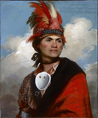
Hamilton, Ontario's culture has built on its historical and social background. Some attractions include a museum of aircraft, HMCS Haida National Historic Site, historic naval ship; Canada's most famous warship and the last remaining Tribal Class in the world, a stately residence of a Prime Minister of Upper Canada, a functioning nuclear reactor at McMaster University, a horticultural haven, the Canadian Football Hall of Fame, African Lion Safari and Christ the King Cathedral.

In 1930 Hamilton, Ontario, Canada was the site of the very first Commonwealth Games, then known as the British Empire Games. The Games came to Hamilton as a result of the efforts of Melville Marks Robinson, and were Canada's first major international athletic event, and bid unsuccessfully for the Commonwealth Games in 2010, losing out to New Delhi in India. On 7 November 2009, in Guadalajara, Mexico it was announced that Toronto will host the 2015 Pan Am Games after beating out two rival South American cities, Lima, Peru and Bogota, Colombia. The city of Hamilton will be co-hosting the Games with Toronto. Hamilton Mayor Fred Eisenberger said "the Pan Am Games will provide a 'unique opportunity for Hamilton to renew major sport facilities giving Hamiltonians a multi-purpose stadium, a 50-metre swimming pool, and an international-calibre velodrome to enjoy for generations to come.'"

MacNab Street is a Lower City collector road in Hamilton, Ontario, Canada. It starts in the Durand neighbourhood on Markland Street, as a one-way street going north to Bold Street, where it becomes two-way for one block until Hurst Place where it's cut off by a wall for the Hunter Street railway bridge. Pedestrians may cross Hunter Street at an underpass. MacNab Street starts again north of the Railway line on Hunter Street as a two-way street but is cut off again at King Street where the Lloyd D. Jackson Square mall and Stelco Tower are situated. MacNab Street continues north of this Mall on York Boulevard, in front of the Hamilton Public Library & the entrance to the Hamilton Farmer's Market, again as a two-way street right through the city's North End to Burlington Street. It continues as a one-way street to the waterfront where it ends at Guise Street West, the site of the Royal Hamilton Yacht Club and Pier 5.

James Street is a Lower City arterial road in Hamilton, Ontario, Canada. It starts off at the base of the Niagara Escarpment from James Mountain Road, a mountain-access road in the city. It was one of many arterials in the central business district converted to one-way operation in 1956 when the city retained Wilbur Smith and Associates to develop a Traffic and Transportation Plan. Parts of it were restored to two-way operation in 2002. It extends north to the city's waterfront at the North End where it ends at Guise Street West right in front of the Harbour West Marina Complex and the Royal Hamilton Yacht Club.

Hess Village is a pedestrianized area in the downtown of Hamilton, Ontario, Canada. Its streets, in contrast to other areas in Hamilton, are quite thin and restrict vehicle access. It is located between Main and King Street, and a block north west of city hall. It is home to various amenities and shops, notably nightclubs, bars, and historic buildings. It is named after Hess Street, a north-south Lower City collector street that travels through the centre of the area.
Queen Street is a Lower City arterial road in Hamilton, Ontario, Canada. It starts off at Beckett Drive, a mountain-access road in the city and is a two-way street up to King Street West and a one-way street (southbound) the rest of the way north up to the Canadian National Railway Yard, where the road turns right, merging with Stuart Street which travels in a west–east direction.

Locke Street is a Lower City collector road in Hamilton, Ontario, Canada. It starts off at Aberdeen Avenue as a two-way street going through the Locke Street shopping district up to Main Street where it then becomes a one-way street until it crosses King Street and becomes two-way again going north past Victoria Park and ends just past Barton Street West on Tecumseh Street, a road that winds West and leads to the back-end of Dundurn Park.
Dundurn Street is a Lower City arterial road in Hamilton, Ontario, Canada. It is a two-way street that starts off at Mountain Face Park, Niagara Escarpment in front of the Bruce Trail as a collector road, right behind Hillcrest Avenue and then turns into a four lane thoroughfare from Aberdeen Avenue northward to York Boulevard where it ends in front of Dundurn Park.

Cannon Street is a Lower City collector road in Hamilton, Ontario, Canada. It starts off at Queen Street North as a one-way street (Westbound) up to Sherman Avenue North where it then switches over to a two-way street the rest of the way Eastward and ends just past Kenilworth Avenue North on Barons Avenue and merges with Britannia Avenue, a street that runs parallel with Cannon Street from Ottawa Street North to Barons Avenue.

King Street is a Lower City arterial road in Hamilton, Ontario, Canada, also known as Highway 8. The western-end starts off beside McMaster University Medical Centre as a two-way street and passes through Westdale. At Paradise Road, King Street switches over to a one-way street (westbound) right through the city's core up to "the Delta", a spot in town where King and Main streets intersect. From the Delta onwards, King Street then switches over to become a two-way street again and ends at Highway 8 in Stoney Creek.
Main Street is a street in Hamilton, Ontario, Canada.

Hunter Street is a Lower City collector road in Hamilton, Ontario, Canada. It is a one-way street (Westbound) that starts West of Locke Street at Hill Street Park and ends two blocks East of Victoria Avenue at Emerald Street. Hunter Street is a two-way street between Victoria and Emerald Streets.

Aberdeen Avenue is a Lower City minor arterial road in Hamilton, Ontario, Canada. It starts off just west of Longwood Road South and east of Highway 403 as a two-way thoroughfare up to Queen Street South, where it then switches over to a one-way collector road (eastbound) to Bay Street South and then to another two-way section from Bay Street to James Mountain Road, a mountain-access road in the city near the base of the Niagara Escarpment (mountain).
Norm Marshall was a Canadian radio and television broadcaster. He and Larry O'Brien were commentators for the first telecast of a Grey Cup football game 29 November 1952 on CBLT Toronto. CBC paid both Marshall and O'Brien CAD$250 for this inaugural broadcast. He was inducted into the Canadian Football Hall of Fame in 1989.


