Mohawk Road is an arterial road in Hamilton, Ontario, Canada, running through the Ancaster and Upper City (mountain) districts, and has two distinct segments. The western segment begins as a continuation of Rousseaux Street in Ancaster just west of the interchange with Highway 403 and the Lincoln M. Alexander Parkway (The Linc), and travels eastward to the interchange with the two freeways, defaulting into the latter. The eastern segment begins as a continuation of Golf Links Road (which runs east from Meadowlands) at the same interchange near the Iroquoia Heights Conservation Area, and runs parallel with the Linc, cuts across the Hamilton mountain and ends at Mountain Brow Boulevard, the site of Mohawk Sports Park.
The first area of Hamilton mountain to be settled was by the Pennsylvania DutchLoyalists at present-day Mohawk Road, west of Upper James Street, which runs to the mountain brow between Queen Street and the Sanatorium. Upper James Street at the time was known as the Caledonia Highway.[2]
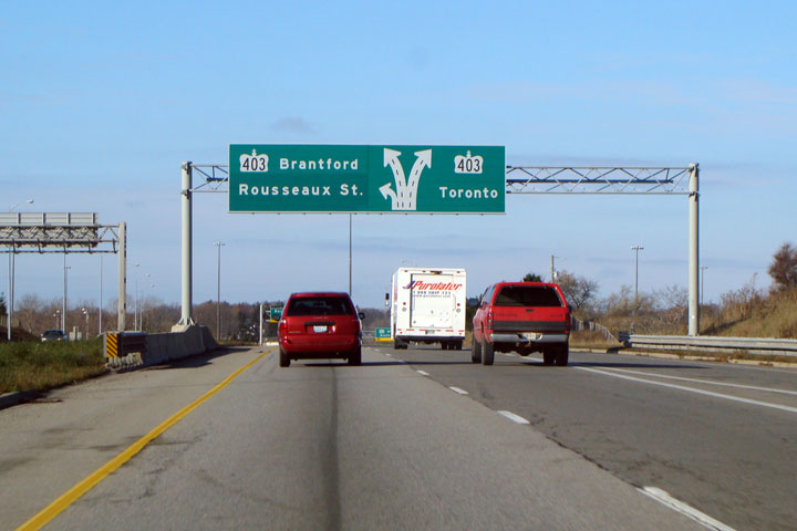
In 2019, there was a proposal to rename the Ancaster portion that continues from Rousseaux Street, to Rousseaux Street; to avoid confusing motorists since the street was broken due to the construction of the Linc. However, due to lack of enough support, the proposal was cancelled.[3] Despite this, the exits for Mohawk Road on both Highway 403 and the Linc are today signed as Rousseaux Street.[4]
↑ Houghton, Margaret (2002). Hamilton Street Names: An Illustrated Guide. James Lorimer & Co. Ltd. ISBN1-55028-773-7.
↑ "Out of the Storied Past: Some families on the west end of the mountain. (By: Mabel Burkholder)" (Press release). The Hamilton Spectator. 1948-01-31.
This page is based on this Wikipedia article Text is available under the CC BY-SA 4.0 license; additional terms may apply. Images, videos and audio are available under their respective licenses.

