Royal Botanical Gardens (Ontario)

Last updated
Royal Botanical Gardens
AbbreviationRBG
TypeOrganizations based in Canada with royal patronage
Legal statusActive
PurposeAdvocate and public voice, educator and network
Headquarters Burlington, Ontario, Canada
Coordinates 43°17′28″N79°52′33″W / 43.29111°N 79.87583°W / 43.29111; -79.87583
Region served
Burlington and Hamilton, Ontario, Canada
Official language
English, French
Website www.rbg.ca
Official nameRoyal Botanical Gardens National Historic Site of Canada
Designated1 January 1994 [1]

Royal Botanical Gardens (RBG) is headquartered in Burlington owning extensive environmental protection areas, historic sites and culturally relevant gardens in Hamilton, Ontario, Canada. It is one of the major tourist attractions between Niagara Falls and Toronto, as well as a significant local and regional horticultural, education, conservation, and scientific resource. The mandate is derived by a Provincial Act of 1941 centred on human interaction with the natural world and protection of environmentally significant lands that form the western tip of Lake Ontario. Royal Botanical Gardens spans an area of about 10 km by 4 km, dominated by two coastal wetlands, and glacial-carved landscapes that extend from the lake up to the Niagara Escarpment plateau. The various gardens and natural areas are accessed through nine public entrance locations. It is one of several Prescribed Public Bodies listed under the Ontario Heritage Act.

Contents

In 2006, in support of the United Nations Convention on Biological Diversity, Royal Botanical Gardens was selected as Canada's National Focal Point for the Global Strategy for Plant Conservation (GSPC) by Environment and Climate Change Canada. [2]

The 980 hectares (2,422 acres) of nature sanctuary owned by the Royal Botanical Gardens is largely a remnant of the Dundas Marsh Game Preserve created in 1927. The properties now carry many cultural and environmental designations. Multiple national historic site features are associated with area, with the site featuring prominently as a landing and connection point to other regions of the Great Lakes. It is considered an important plant biodiversity hotspot for Canada, with a very high proportion of the wild plants of Canada in one area; is an Important Bird Area according to Bird Studies Canada; [3] and is part of the Niagara Escarpment World Biosphere Reserve. [4] More than 1,100 species of plants grow within its boundaries including the Bashful Bulrush (Trichophorum planifolium) which is found nowhere else in Canada, and the largest remaining population of one of Canada's most endangered trees, the Red Mulberry (Morus rubra). Both of these plants are listed as Endangered in Canada under the Species at Risk Act. [5] [6] In 2008, the RBG was designated as an Important Amphibian and Reptile Area by CARCNET, the Canadian Amphibian and Reptile Conservation Network. Several plants listed on various Endangered Species Protection programs are held for protection and education purposes in various garden areas.

Unusually Royal Botanical Gardens is both the owner of the land under Cootes Paradise and Grindstone Marsh as well as regulator of activities on the water, despite it being an inlet of Lake Ontario. Water area activity regulation was formerly under the Hamilton Harbour Commission (Now Hamilton Oshawa Port Authority) as part of the areas historical federal port regulation. In the late 1970s the Harbour Commission and Royal Botanical Gardens made an agreement transferring regulation of use of the water area to the Gardens in support of its environmental protection mandate. However, Royal Botanical Gardens has no regulatory control over the quality of water flowing into its wetlands.

History

Plaque with history on T. B. McQuesten, the founder of Royal Botanical Gardens. Royal Botanical Gardens, Ontario, Rock Garden plaque close-up 01.jpg
Plaque with history on T. B. McQuesten, the founder of Royal Botanical Gardens.

Royal Botanical Gardens developed as a concept in the 1920s under the City of Hamilton Board of Park Management, led by Thomas McQuesten. Initially the proposed botanical garden was to be located along the south shore of Cootes Paradise Marsh surrounding the Hamilton campus of McMaster University. The proposed botanical garden would also protect extensive natural areas along the marsh. [7]

Formal permission was obtained in 1930 from King George V to call the gardens the "Royal Botanical Gardens". [8] At the same time as the proposal for the botanical gardens was under consideration, the City of Hamilton was undertaking an ambitious program of beautification on the nearby Burlington Heights. The North-Western Entrance to Hamilton project included an extensive set of gardens designed by the Toronto firm of Wilson, Bunnell and Borgstrom. Among these was the Rock Garden created by lining a 5.5 acre abandoned gravel pit with limestone from the Niagara Escarpment. In 1932 the Board of Park Management brought together the Burlington Heights gardens and the south shore of Cootes Paradise as Royal Botanical Gardens.

The original vision of RBG was a mixture of horticultural displays and protected natural forests and wetlands. The first Director of RBG, Dr. Norman Radforth, was appointed in 1947 and was a Professor of Botany at nearby McMaster University. In 1954 Leslie Laking, initially Assistant Director and Horticulturist, was appointed as Director and served until 1981. Under his guidance, the institution developed into the major entity it is today. In the 1960s growth in horticultural expertise enriched the gardens and its programs, including new staff such as taxonomist Dr. James Pringle and Curator Freek Vrugtman. Over the years additional protected lands were added to RBG, including most recently the Berry Tract South property in 2015.

With approximately 1,100 ha (2,700 acres) of property, Royal Botanical Gardens is one of the largest such institutions in North America. In 2006, the Auxiliary of RBG published Love, sweat and soil: a history of Royal Botanical Gardens from 1930 to 1981 authored by Dr. Laking. [9]

Financial

Funding for the institution was initially provided largely by the City of Hamilton and then in the 1940s by the Province of Ontario. By the early 1980s, funding restrictions and the desire to become increasingly self-supported led to charging of an admission fee for the cultivated garden areas. Admission is free to members. The extensive system of nature trails, more than 20 kilometres (12 mi) in length, has remained accessible to the local community within walking distance or by taking public transit. Membership revenues are critical to facilitating access. As of 2006, approximately 40% of the RBG's annual budget comes from support from the Province of Ontario, the City of Hamilton and the Region of Halton. The remainder, 60%, is classed as 'self-generated revenue' and is raised annually from admissions, memberships, donations, summer camps, and fees-for-service. [10] [11]

An organized volunteer group of more than 500 members supports the efforts to fulfill the RBG mandate. Annually, volunteers help raises tens of thousands of dollars and donate tens of thousands of hours in such roles as tour guides, events support, staffing the Archives, and maintaining plant collections. [12]

Attractions

Royal Botanical Gardens presents five garden areas to visitors: Hendrie Park, RBG Centre (which includes the Mediterranean Garden, RBG's only conservatory), The Arboretum, Laking Garden, and the David Braley and Nancy Gordon Rock Garden. Major natural areas include trails through the valley of the lower Grindstone Creek, Rock Chapel, north and south shores of Cootes Paradise, and Princess Point.

Long standing RBG trails on the Niagara Escarpment at Rock Chapel are part of the original founding of the Bruce Trail. In 2010, RBG partnered with Geotrail to bring its trail network to the internet through an interactive website. [13]

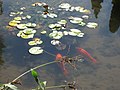
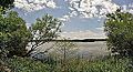
The natural lands or nature sanctuaries of Royal Botanical Gardens include some of the most significant wildlife and native plant areas in Canada. The largest area, which includes the wetland called Cootes Paradise or Dundas Marsh, is a major spawning area for native fish species in Lake Ontario, one of the best bird-watching areas in Canada, [3] and is the subject of one of Canada's largest ecological rehabilitation efforts aimed at a wetland, called 'Project Paradise.'

The Arboretum contains one of the world's most diverse lilac collections, the Katie Osborne Lilac Collection. The "Lilac Dell" contains 570 plants of 407 unique varieties and is one of RBG's biggest attractions in late May. [14] Royal Botanical Gardens also holds the second-largest garden show in Canada called The Ontario Garden Show. It comes second only to Canada Blooms which is held in Toronto.[ citation needed ]

Innovative educational programs are operated from both RBG's main building in Burlington and the Nature Interpretive Centre, located in the Arboretum to the north of Cootes Paradise in Hamilton. More than 18,000 school children per year visit the organized school programs, and over 200 public education offerings include such diverse topics as botanical illustration, organic cooking and basic botany. Aldershot School offers an ECO Studies program in conjunction with the RBG. [15]

Royal Botanical Gardens is a member of the American Public Gardens Association and Botanic Gardens Conservation International and is active in local, regional, national, and international efforts to conserve plant diversity and ensure its sustainable use.

Royal Botanical Gardens's properties span Bayview Junction, hosting several popular locations for railfanning.

Images

See also

Related Research Articles

<span class="mw-page-title-main">Bruce Peninsula National Park</span> National park in Ontario, Canada

Bruce Peninsula National Park is a national park on the Bruce Peninsula in Ontario, Canada. Located on a part of the Niagara Escarpment, the park comprises 156 square kilometres and is one of the largest protected areas in southern Ontario, forming the core of UNESCO's Niagara Escarpment World Biosphere Reserve. It was established in 1987 to protect the rock formations and shoreline of the Niagara Escarpment. The park offers opportunities for many outdoor activities, including hiking, camping, and bird watching. The park has trails ranging in difficulty from easy to expert, and connects to the Bruce Trail. Bruce Peninsula National Park is known for its crystal clear blue waters, cobblestone beaches, rocky cliffs and karst formations.

<span class="mw-page-title-main">Bruce Trail</span> Hiking trail in Ontario, Canada

The Bruce Trail is a hiking trail in southern Ontario, Canada, from the Niagara River to the tip of Tobermory, Ontario. The main trail is more than 890 km (550 mi) long and there are over 400 km (250 mi) of associated side trails. The trail mostly follows the edge of the Niagara Escarpment, one of the nineteen UNESCO World Biosphere Reserves in Canada. The land the trail traverses is owned by the Government of Ontario, local municipalities, local conservation authorities, private landowners, and the Bruce Trail Conservancy (BTC). The Bruce Trail is the oldest and longest marked hiking trail in Canada. Its name is linked to the Bruce Peninsula and Bruce County, through which the trail runs. The trail is named after the county, which was named after James Bruce, 8th Earl of Elgin who was Governor General of the Province of Canada from 1847 to 1854.

<span class="mw-page-title-main">Niagara Escarpment</span> Escarpment in Canada and the United States

The Niagara Escarpment is a long escarpment, or cuesta, in Canada and the United States that starts from the south shore of Lake Ontario westward, circumscribes the top of the Great Lakes Basin running from New York through Ontario, Michigan, and Wisconsin. The escarpment is the cliff over which the Niagara River plunges at Niagara Falls, for which it is named.

Hamilton West was a federal electoral district in Ontario, Canada, that was represented in the House of Commons of Canada from 1904 to 2004.

<span class="mw-page-title-main">Desjardins Canal</span> Canal in Ontario, Canada

The Desjardins Canal, named after its promoter Pierre Desjardins, was a canal in Ontario, Canada. It was built to give the town of Dundas easier access to Lake Ontario and the Great Lakes system of North America. Although a technological achievement and a short term commercial success, the canal was soon eclipsed by the railway, and Dundas by neighbouring Hamilton.

<span class="mw-page-title-main">Thomas McQuesten</span> Canadian politician

Thomas Baker McQuesten was a politician in Ontario, Canada. He was a Liberal member of the Legislative Assembly of Ontario from 1934 to 1943 who represented the riding of Hamilton—Wentworth. He served as a cabinet minister in the governments of Mitchell Hepburn and Gordon Conant.

<span class="mw-page-title-main">Westdale, Hamilton</span>

Westdale is a residential neighbourhood in Hamilton, Ontario, Canada. It is centred in the Westdale Village shopping district and located near McMaster University. It is bordered to the north by Cootes Paradise, an extensive nature reserve marking the western end of Lake Ontario, to the south by Main Street and Ainslie Wood, to the east by Highway 403, and to the west by McMaster University.

Cootes Paradise is a property of the Royal Botanical Gardens at the western end of Lake Ontario, and a remnant of the larger 3700 acre Dundas Marsh Crown Game Preserve established by the Province of Ontario in 1927. It is a 600 hectare environmental protection and education area, dominated by a 4.5km long rivermouth wetland, representing the lake's western terminus. It is found on the west side of Hamilton Harbour and is located in the municipality of Hamilton, Ontario, Canada.

Cootes Drive, formerly known as the Dundas Diversion, is a city street in Hamilton, Ontario. The route connects York Road and King Street in Dundas with Main Street to the southeast, and is considered one of the first divided highways in Canada. Originally constructed as the Dundas Diversion, the route served to bypass several sharp turns along the nearby Highway 8, as well as to demonstrate the new dual highway concept that would soon thereafter evolve into the 400-series highway network. Construction began in 1936, and the route opened on the weekend of September 11, 1937.

<span class="mw-page-title-main">Bayview Junction</span>

Bayview Junction is a major railway junction in southern Ontario, Canada. It is located at the intersection of three of the nation's busiest rail lines and is a popular location for railfans and trainspotters.

<span class="mw-page-title-main">Albion Falls</span> Waterfall in Hamilton, Ontario

Albion Falls is a 19 m (62 ft) classical/cascade waterfall flowing down the Niagara Escarpment in Red Hill Valley, in Hamilton, Ontario, Canada. With cascade falls the downpour is staggered into a series of steps causing water to "cascade". The top of the falls are located on Mountain Brow Blvd. The lower-end of the falls can be found at the south-end of King's Forest Park in lower Hamilton by following the Red Hill Creek south towards the Niagara Escarpment.

<span class="mw-page-title-main">Greenbelt (Golden Horseshoe)</span> Protected area in Southern Ontario, Canada

The Greenbelt is a protected area of green space, farmland, forests, wetlands, and watersheds, located in Southern Ontario, Canada. It surrounds a significant portion of the Golden Horseshoe.

<span class="mw-page-title-main">Geography of Hamilton, Ontario</span>

Hamilton is located on the western end of the Niagara Peninsula and wraps around the westernmost part of the Lake Ontario. Most of the city including the downtown section lies along the south shore. Situated in the geographic centre of the Golden Horseshoe, it lies roughly midway between Toronto and Buffalo. The two major physical features are Hamilton Harbour marking the northern limit of the city and the Niagara Escarpment running through the middle of the city across its entire breadth, bisecting the city into 'upper' and 'lower' parts.

<span class="mw-page-title-main">Burlington Heights (Ontario)</span> Promontory and peninsula between Hamilton and Burlington, Ontario, Canada

Burlington Heights refers to a promontory or area of flat land sitting elevated above the west end of Hamilton Harbour in the city of Hamilton, Ontario which continues as a peninsula to the north toward the city of Burlington, Ontario. It separates Cootes Paradise Marsh on the west from the harbor on the east. Geologically the Burlington Heights is a sand and gravel bar formed across the eastern end of the Dundas Valley by Glacial Lake Iroquois. It is the northern continuation of the longer Iroquois Bar which extends south into Hamilton.

<span class="mw-page-title-main">Borer's Falls</span> Waterfall in Hamilton, Ontario

Borer's Falls is a 15-metre-high (49 ft) ribbon-style waterfall found in the Borer's Falls Conservation Area in Dundas, Hamilton, Ontario, Canada. Its source is Borer's Creek. A very picturesque waterfall featured on many Hamilton waterfall postcards over the years. Named after the Borer family who ran a sawmill for over a century. This mill was the lifeblood of the village of Rock Chapel. Also known as Rock Chapel Falls. The area is a hiker's haven and also an ice-climbing destination in the winter when the weather is cold enough to freeze the Falls.

<span class="mw-page-title-main">Dundas Valley Conservation Area</span> Conservation area in Ontario, Canada

Dundas Valley Conservation Area is located on the Niagara Escarpment in Dundas, Ontario, a constituent community of Hamilton, Ontario, and is owned and operated by the Hamilton Conservation Authority. Its 40-kilometre trail system provides a connection to the Bruce Trail. The area contains a trailhead of the Hamilton-Brantford-Cambridge Trails, Canada's first fully developed interurban multi-use trail system, which is a part of the Trans Canada Trail.

<span class="mw-page-title-main">King Street, Dundas, Ontario</span>

King Street starts off as a collector road in the east-end of town in Dundas, Hamilton, Ontario, Canada beside Cootes Paradise and the Desjardins Canal at Olympic Drive and switches to an arterial road at York Street and cuts through the town of Dundas where it ends in the west-end by the CN railway tracks at the base of the Niagara Escarpment. It is a two-way street throughout.

Princess Point is located in the south east corner of Cootes Paradise marsh in Hamilton, Ontario, and is the principal access point to the surrounding natural areas. The property is part of the Cootes Paradise Nature Sanctuary owned and managed by the Royal Botanical Gardens (RBG). The low waterside peninsula has made Princess Point a natural gathering place for people for thousands of years. Archeological discoveries have indicated that between 1000 and 800 AD the Middle Woodland Culture brought agriculture in the form of corn production to the region. The discovery of this has given rise to the term the Princess Point Complex, referring to this archeological group of native people that cover a large region of eastern North America.

References

  1. "Royal Botanical Gardens National Historic Site of Canada". Parks Canada. Government of Canada. Retrieved 28 September 2019.
  2. "Botanical Garden named National Focal Point for Plant Conservation". Botanic Gardens Conservation International. 2006-08-02. Archived from the original on 2008-09-05. Retrieved 2009-05-04.
  3. 1 2 "Dundas Valley and Dundas Marsh - Dundas, Ontario". Bird Studies Canada. Archived from the original on 2011-06-12. Retrieved 2009-05-03.
  4. "Biosphere Reserve Information - Canada - Niagara Escarpment Biosphere Reserve". MAB Biosphere Reserves Directory. UNESCO . Retrieved 2009-05-03.
  5. "Species Profile - Bashful Bulrush". Species at Risk Public Registry. Environment Canada. 2008-04-25. Archived from the original on 2013-06-10. Retrieved 2009-05-04.
  6. "Species Profile - Red Mulberry". Species at Risk Public Registry. Environment Canada. 2008-04-25. Archived from the original on 2013-06-10. Retrieved 2009-05-04.
  7. Riley, John L. (2013-10-01). The Once and Future Great Lakes Country: An Ecological History. MQUP. p. 274. ISBN   978-0-7735-8982-7 . Retrieved 2014-07-07.
  8. "Gardens' History". Royal Botanical Gardens. Archived from the original on April 2, 2009. Retrieved 2009-05-04.
  9. Laking, Leslie (2006). Love, sweat and soil: a history of Royal Botanical Gardens from 1930 to 1981 . Hamilton, ON: Royal Botanical Gardens Auxiliary. ISBN   978-0-9691759-4-0. OCLC   64344711.
  10. "Donate - Royal Botanical Gardens". www.rbg.ca. Retrieved 2020-01-13.
  11. "Donor Accountability Report 2018" (PDF). 2018. p. 23.
  12. "RBG Auxiliary Volunteer Opportunities and Information Page". The Royal Botanical Gardens. Retrieved 2015-06-14.
  13. InsideHalton Article: RBG hikers, bird watchers benefit from trail software
  14. "Lilacs". Royal Botanical Gardens. Retrieved 2021-03-30.
  15. "RBG ECO Studies". Aldershot School . Retrieved 2009-05-03.[ dead link ]