Pier 4 Park

Last updated
Pier 4 Park Pier4ParkHamilton2.JPG
Pier 4 Park

Pier 4 Park is a 2.4 hectare park found in the west-end of Hamilton Harbour near Bay Street North in Hamilton, Ontario, Canada.

Contents

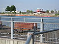
The park features a multi-use asphalt trail, 349 metres in length and 4 metres wide which provides barrier-free access to all areas of the park and linkages with the surrounding harbourfront precinct. [1] A total of $2.2 million has been invested for the redevelopment of the park which includes a 24-metre tugboat which acts as the centrepiece of an interactive water play area for children. A dramatically curved lookout pier includes a protected sun shelter and benches to view the marinas, parkland and vistas of the surrounding Bay.

In addition Hamilton Harbour Commissioners (HHC) have constructed Hamilton Pier which provides 0.4 hectares of additional parkland and fish habitat.

Nearby attractions include the Harbour West Marina Complex, Macassa Bay Yacht Club, Pier 8, Bayfront Park, HHC Sailing School and the Royal Hamilton Yacht Club.

Images

Related Research Articles

Toronto Islands archipelago in Lake Ontario, Canada

The Toronto Islands are a chain of 15 small islands in Lake Ontario, south of mainland Toronto, Ontario, Canada. Comprising the only group of islands in the western part of Lake Ontario, the Toronto Islands are located just offshore from the city's downtown and provide shelter for Toronto Harbour. The islands are home to parkland, the Billy Bishop Toronto City Airport, several yacht clubs, Centreville Amusement Park, a residential area, and several beaches. The island community is considered to be the largest urban car-free community in North America, although some service vehicles are permitted. Access to the Islands is by ferry, including the City of Toronto ferries operating from Jack Layton Ferry Terminal at the foot of Bay Street, or by water taxis.

Harbourfront (Toronto) Neighbourhood in Toronto, Ontario, Canada

Harbourfront is a neighbourhood on the northern shore of Lake Ontario within the downtown core of the city of Toronto, Ontario, Canada. Part of the Toronto waterfront, Harbourfront extends from Bathurst Street in the west, along Queens Quay, with its ill-defined eastern boundary being either Yonge Street or York Street. Its northern boundary is the Gardiner Expressway.

Toronto waterfront

The Toronto waterfront is the lakeshore of Lake Ontario in the City of Toronto, Ontario in Canada. It spans 46 kilometres between the mouth of Etobicoke Creek in the west, and the Rouge River in the East.

Port Credit Neighbourhood in Peel, Ontario, Canada

Port Credit is a neighbourhood in the south-central part of the City of Mississauga, Ontario, Canada, centred around the mouth of the Credit River on the north shore of Lake Ontario. Its main intersection is Hurontario Street and Lakeshore Road, about 0.6 km. east of the river. Until 1974, Port Credit was an incorporated town. Its approximate boundaries are the Canadian National Railway to the north, Seneca Avenue to the east and Shawnmarr Road to the west. It had a population of 10,260 at the 2001 census.

Toronto Harbour

Toronto Harbour or Toronto Bay is a bay on the north shore of Lake Ontario, in Toronto, Ontario, Canada. It is a natural harbour, protected from Lake Ontario waves by the Toronto Islands. Today, the harbour is used primarily for recreational boating, including personal vessels and pleasure boats providing scenic or party cruises. Ferries travel from docks on the mainland to the Islands, and cargo ships deliver aggregates and raw sugar to industries located in the harbour. Historically, the harbour has been used for military vessels, passenger traffic and cargo traffic. Waterfront uses include residential, recreational, cultural, commercial and industrial sites.

Hamilton Harbour

Hamilton Harbour, formerly known as Burlington Bay, lies on the western tip of Lake Ontario, bounded on the northwest by the City of Burlington, on the south by the City of Hamilton, and on the east by Hamilton Beach and Burlington Beach. It is joined to Cootes Paradise by a narrow channel formerly excavated for the Desjardins Canal. Within Hamilton itself, it is referred to as "Hamilton Harbour", "The Harbour" and "The Bay". The bay is naturally separated from Lake Ontario by a sand bar. The opening in the north end was filled in and channel cut in the middle for ships to pass. The Port of Hamilton is on the Hamilton side of the harbour.

Sunnyside, Toronto human settlement in Ontario, Canada

Sunnyside is a lakefront district in Toronto, Ontario, Canada. It includes a beach and park area along Lake Ontario's Humber Bay, from west of Exhibition Place to the mouth of the Humber River. The area has several recreation uses, including rowing clubs, sports clubs, picnic areas, playgrounds, a nightclub, a bathing pavilion and public pool. The area is a 3 kilometres (1.9 mi) long strip along the lakeshore, bounded by the Gardiner Expressway and rail lines, which separate it from the Parkdale, Roncesvalles and Swansea neighbourhoods to the north. The name originates in a local farm owned by John Howard, which was situated just to the north, on the location of the current St. Joseph's Health Centre hospital.

Waterfront Trail

The Waterfront Trail is made up of an interconnected series of trails mainly along the shores of Lake Ontario in Canada, beginning in Niagara-on-the-Lake, Ontario and extending to Brockville, Ontario, with an extension along Former Highway 2, to the Quebec provincial border. Through Toronto, the trail is called the Martin Goodman Trail. The Waterfront Trail is also used by commuters in parts of Southern Ontario.

Bay Street (Hamilton, Ontario)

Bay Street is a Lower City arterial road in Hamilton, Ontario, Canada. It starts at Inglewood Drive, just South of Aberdeen Avenue, as a collector road with only two lanes, then eventually becomes a six lane thoroughfare at its peak. Bay Street also passes through Downtown Hamilton, where many high-rise buildings are found. Bay Street is a one-way street from Aberdeen Avenue to Cannon Street West. Bay Street continues as an arterial route to Strachan Street, where it is downgraded to a neighbourhood collector and eventually ends at a curb at Pier 4 Park at Burlington Street in the city's North End.

Hughson Street (Hamilton, Ontario)

Hughson Street is a Lower City collector road in Hamilton, Ontario, Canada. It starts at Charlton Avenue East at St. Joseph's hospital and runs north to Haymarket Street in the downtown where it's cut off by the Hamilton GO Transit station. Up to this point it is a two-way street. It then starts up again north of the station on Hunter Street East, where it then becomes a one-way street going north just past Barton Street East to Murray Street where it's cut off again by a parking lot for LIUNA Station. It then starts up again one block north past the CN railway tracks on Strachan Street and from this point onwards becomes a two-way street again that extends to the city's North End to the waterfront on Guise Street West, the site of the Canada Marine Discovery Centre and Pier 9.

MacNab Street (Hamilton, Ontario)

MacNab Street is a Lower City collector road in Hamilton, Ontario, Canada. It starts in the Durand neighbourhood on Markland Street, as a one-way street going north to Bold Street, where it becomes two-way for one block until Hurst Place where it's cut off by a wall for the Hunter Street railway bridge. Pedestrians may cross Hunter Street at an underpass. MacNab Street starts again north of the Railway line on Hunter Street as a two-way street but is cut off again at King Street where the Lloyd D. Jackson Square mall and Stelco Tower are situated. MacNab Street continues north of this Mall on York Boulevard, in front of the Hamilton Public Library & the entrance to the Hamilton Farmer's Market, again as a two-way street right through the city's North End to Burlington Street. It continues as a one-way street to the waterfront where it ends at Guise Street West, the site of the Royal Hamilton Yacht Club and Pier 5.

York Boulevard Arterial road in Hamilton, Ontario, Canada

York Boulevard is a Lower City arterial road in Hamilton, Ontario, Canada. Formerly known as Highway 2 and Highway 6, it starts in Burlington, Ontario at Plains Road West as a two-way arterial road that wraps around and over Hamilton Harbour, enters the city of Hamilton in the west end at Dundurn Park, and ends at James Street North. It has a one-way section from Queen Street to Bay Street North, and continues east of James Street North as Wilson Street.)

The Palace Pier

The Palace Pier is the site of Palace Place and Palace Pier, two cruciform condominium towers tied for the 45th-tallest building in Toronto, Ontario, Canada. They are located at 2045 Lake Shore Boulevard West and 1 Palace Pier Court in the Humber Bay neighbourhood in the former city of Etobicoke.

Beach Boulevard (Hamilton, Ontario)

Beach Boulevard is a Lower city street in Hamilton, Ontario, Canada, east of the Hamilton Harbour on a thin piece of land that crosses over Lake Ontario and stretches from where Woodward Avenue becomes Eastport Drive in the south to near the Lift Bridge in the north at Eastport Drive (again). It runs parallel with the QEW and the Burlington Bay James N. Allan Skyway Bridge.

Bayfront Park (Hamilton, Ontario)

Bayfront Park is a 16-hectare (40-acre) park found in the West-end of Hamilton Harbour near Bay Street North in Hamilton, Ontario, Canada.

Marina Park (Thunder Bay)

Marina Park is a local waterfront park and marina located on the shores of Lake Superior in Thunder Bay, Ontario. The park is located in the city's north end near the downtown north core. Aside from pleasure craft docks and a fueling facility, the park also has walking paths and a boardwalk, playground equipment, picnic tables, a Mariner's Monument and the historic CN Rail Station.

East Bayfront Neighbourhood in Toronto, Ontario, Canada

East Bayfront, or the East Bayfront Precinct, is an emerging neighbourhood in Toronto, Ontario, Canada. It is currently undergoing a transformation from industrial use to mixed-use as part of Waterfront Toronto's plans to create a residential and commercial district urban core near the lake.

Martin Goodman Trail

The Martin Goodman Trail is a 56-kilometre (35 mi) multi-use path along the waterfront in Toronto, Ontario, Canada. It traverses the entire lake shore from one end of the city to the other, from Humber Bay Arch Bridge in the west to the Rouge River in the east. The Martin Goodman Trail is part of the 730 km Waterfront Trail around Lake Ontario.

West Harbour, Hamilton is a neighbourhood in Hamilton, Ontario, Canada.

Ashbridges Bay bay in Ontario, Canada

Ashbridge's Bay is a bay and park in Toronto, Ontario, Canada. It is located along Lake Shore Boulevard next to Woodbine Beach in the Beaches. The Martin Goodman Trail and boardwalk run through the park along the bay. The boardwalk runs 3 kilometres (1.9 mi) from Ashbridge's Bay in the west to the R. C. Harris Water Treatment Plant in the east along Lake Ontario. It was once part of the marsh that lay east of Toronto Islands and Toronto Harbour.

References

  1. "Ontario Trails Council: PIer 4 Park Trail" . Retrieved 2008-09-15.


Coordinates: 43°16′24″N79°52′02″W / 43.2733°N 79.8673°W / 43.2733; -79.8673