Wellington Street (Hamilton, Ontario)

Last updated
The David Braley Cardiac, Vascular and Stroke Research Institute is a $90-million Research Centre that will be home to 500+ scientists and will be built right behind the Hamilton General Hospital HamiltonGeneralExpansion.JPG
The David Braley Cardiac, Vascular and Stroke Research Institute is a $90-million Research Centre that will be home to 500+ scientists and will be built right behind the Hamilton General Hospital

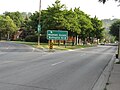
Wellington Street is a Lower City arterial road in Hamilton, Ontario, Canada. It starts off at Charlton Avenue East as a two-way street for only one block where it's then blocked off by the Corktown Park and a couple of Canadian National Railway lines that cut through it. It then starts up again north of the park on Young Street and is a one-way street the rest of the way (Southbound). It ends in the North End of the City on Burlington Street East, in front of the Lakeport Brewing Company and the Administration offices of the Hamilton Port Authority.

Contents

History

WellingtonStreetNorthSign.JPG

Originally Wellington Street was called Lovers' Lane. [1]

The Hamilton General Hospital is major teaching hospital on the corners of Barton Street East and Wellington Street North in downtown Hamilton, Ontario that is affiliated with McMaster University. It is sometimes referred to as "HGH" and was founded in 1848. [2]

The David Braley Cardiac, Vascular and Stroke Research Institute is a $90-million Research Centre that will be home to 500+ scientists and will be built right behind the Hamilton General Hospital. The new building with 165,000 square feet (15,300 m2) is expected to open in 2010. At least 250 new jobs will be added to the local economy. [3] David Braley contributed $10-million towards the project. Braley's donation marks an important transition in Hamilton's economy, as he takes money he made in the industrial economy and uses it to help the community develop a more diverse economic base. David Braley is the president of auto-parts manufacturer Orlick Industries Ltd., former owner of the Hamilton Tiger-Cats and current owner of the B.C. Lions. [4]

Lakeport Brewery LakeportBeerHamiltonD.JPG
Lakeport Brewery
Lakeport Brewery Lakeport Burlington Streeet A.JPG
Lakeport Brewery

In 1856, the Daniel C. Gunn Engine Shop on Wellington Street North, produced the first Canadian-built locomotives. [5] In 1976, First Place apartments, a seniors high rise at King and Wellington opened on the site of First United Church, which burned down in 1969. [6]

Lakeport Brewing Company is based in Hamilton and focused on producing value-priced quality beer for the Ontario take-home market. Lakeport pioneered the "24 for $24" value segment. Lakeport produces nine proprietary beer brands, two of which, Lakeport Honey Lager and Lakeport Pilsener, are two of the top ten selling brands in the province of Ontario. Lakeport has more than 200 employees at its production facility. [7] It is one of the fastest-growing companies in the Hamilton region. Lakeport Brewing Company joined forces with the Hamilton Port Authority who will finance and construct a 35,000 square foot (3,250 m2) expansion to Lakeport's Hamilton harbour front facility. [8] Lakeport Brewing Company is Canada's No.1 co-packer of beer, non-alcohol and spirit-based products. The company is also said to be North America's most modernized beverage alcohol production facility. [9] On Monday May 8, Labatt Brewing Company made it official and announced that Lakeport, who they purchased earlier in the year, (March 29, 2007), for $200-million for rights to the income trust, which controlled the plant, will continue to operate in the City of Hamilton. It will continue to operate in Hamilton as they believe it is a "viable plant" and "the company is proud to integrate it with Labbat's." The operations employees continue to brew Lakeport in Hamilton but the marketing and sales jobs are now centralized at Labatt's head offices. [10]

Kenesky Sports on Barton & Wellington Streets is the site where Emile "Pops" Kenesky invented the hockey goalie pads in 1917. His new pads were cricket pads, modified, and widened to approximately 12 inches. The new pads caught on extremely quickly, and this style of pad was used by a majority of pro goalies right on to the 1970s. NHL greats like Johnny Bower, Jacques Plante and Terry Sawchuk having worn them. Kenesky's company became the best-known manufacturer of hockey equipment in Canada. [11] Also a hockey school for hockey goalies of all-ages. Alumni include NHLers Ray Emery and Dwayne Roloson. [12]

Landmarks

Note: Listing of Landmarks from North to South.

Hamilton Port Authority HamiltonPortAuthority.JPG
Hamilton Port Authority
Wellington North, walking tour WellingtonStreetNorthA.JPG
Wellington North, walking tour

Communities

Note: Listing of neighbourhoods from North to South [13]

Images

See also

Related Research Articles

<span class="mw-page-title-main">Hamilton, Ontario</span> City in Ontario, Canada

Hamilton is a port city in the Canadian province of Ontario. Hamilton has a population of 569,353, and its census metropolitan area, which includes Burlington and Grimsby, has a population of 785,184. The city is approximately 45 kilometres (28 mi) southwest of Toronto in the Greater Toronto and Hamilton Area (GTHA).

<span class="mw-page-title-main">Labatt Brewing Company</span> Belgian-owned brewery in Canada

Labatt Brewing Company Limited is a Belgian-owned brewery headquartered in Toronto, Ontario, Canada. Founded in 1847, Labatt is the largest brewer in Canada.

The Lakeport Brewing Company was a brewery located in Hamilton, Ontario, Canada. Although it started as a producer of premium beers, it later switched to cheap discount brands, using a strategy of selling its beer for "a buck a bottle". By 2006, it had become the largest discount brewer in Canada. In 2007, Lakeport was taken over by InBev's Canadian subsidiary, Labatt. Three years later, InBev closed the Hamilton brewing plant, and shifted production of Lakeport beers to the Labatt plant in London, Ontario.

<span class="mw-page-title-main">Geography of Hamilton, Ontario</span>

Hamilton is located on the western end of the Niagara Peninsula and wraps around the westernmost part of the Lake Ontario. Most of the city including the downtown section lies along the south shore. Situated in the geographic centre of the Golden Horseshoe, it lies roughly midway between Toronto and Buffalo. The two major physical features are Hamilton Harbour marking the northern limit of the city and the Niagara Escarpment running through the middle of the city across its entire breadth, bisecting the city into 'upper' and 'lower' parts.

<span class="mw-page-title-main">Timeline of events in Hamilton, Ontario</span>

Below is a timeline of events in Hamilton, Ontario, Canada.

<span class="mw-page-title-main">Burlington Street (Hamilton, Ontario)</span> Road in Hamilton, Ontario, Canada

Burlington Street is a partially at grade and elevated roadway in Hamilton, Ontario, stretching along the south shore of Hamilton Harbour in Lake Ontario. Burlington Street has four different statuses along the route. In its western terminus, it is a collector route ending at Bay Street North. Upon the intersection at Wellington Street, the road becomes an arterial route with four lanes. The Street ends at Parkdale Avenue. On October 14, 2015, city council approved the renaming of the upper portion of Burlington Street from 165 meters east of Ottawa St to the QEW to Nikola Tesla Boulevard.

<span class="mw-page-title-main">Hughson Street</span>

Hughson Street is a Lower City collector road in Hamilton, Ontario, Canada. It starts at Charlton Avenue East at St. Joseph's hospital and runs north to Haymarket Street in the downtown where it's cut off by the Hamilton GO Transit station. Up to this point it is a two-way street. It then starts up again north of the station on Hunter Street East, where it then becomes a one-way street going north just past Barton Street East to Murray Street where it's cut off again by a parking lot for LIUNA Station. It then starts up again one block north past the CN railway tracks on Strachan Street and from this point onwards becomes a two-way street again that extends to the city's North End to the waterfront on Guise Street West, the site of the Canada Marine Discovery Centre and Pier 9.

<span class="mw-page-title-main">John Street (Hamilton, Ontario)</span> Street in Hamilton, Ontario, Canada

John Street is a Lower City arterial road in Hamilton, Ontario, Canada. Originally it was known as Mountain Road or Ancaster Road. It starts off at the base of Arkledun Avenue, a Mountain-access road in the city, just east of St. Joseph's Hospital, where it is a one-way street going north and tunnels underneath the Hunter Street Railway bridge and continues onward to the city's North End at the waterfront, where it ends at Guise Street East, the site of Pier 9.

<span class="mw-page-title-main">James Street (Hamilton, Ontario)</span>

James Street is a Lower City arterial road in Hamilton, Ontario, Canada. It starts off at the base of the Niagara Escarpment from James Mountain Road, a mountain-access road in the city. It was one of many arterials in the central business district converted to one-way operation in 1956 when the city retained Wilbur Smith and Associates to develop a Traffic and Transportation Plan. Parts of it were restored to two-way operation in 2002. It extends north to the city's waterfront at the North End where it ends at Guise Street West right in front of the Harbour West Marina Complex and the Royal Hamilton Yacht Club.

<span class="mw-page-title-main">Queen Street, Hamilton, Ontario</span>

Queen Street is a Lower City arterial road in Hamilton, Ontario, Canada. It starts off at Beckett Drive, a mountain-access road in the city and is a two-way street up to King Street West and a one-way street (southbound) the rest of the way north up to the Canadian National Railway Yard, where the road turns right, merging with Stuart Street which travels in a west–east direction.

<span class="mw-page-title-main">Victoria Avenue (Hamilton, Ontario)</span>

Victoria Avenue is a Lower City arterial road in Hamilton, Ontario, Canada. It starts off as a ramp and part of a Mountain-access road, the Claremont Access, on Hunter Street East in the Stinson neighbourhood. It's also a one-way thoroughfare that flows north through the Landsdale and the city's North End industrial neighbourhood past Burlington Street East where it ends at Pier 11.

<span class="mw-page-title-main">Catharine Street (Hamilton, Ontario)</span>

Catharine Street is a Lower City collector road in Hamilton, Ontario, Canada. It starts off at Charlton Avenue East at Woolverton Park in the Corktown neighbourhood as a one-way street (southbound), tunnels underneath the Hunter Street Railway bridge and stretches up to Barton Street East where it then turns two-way and cutoff by the CN Railway lines that cut through Strachan Street Park one block north past Barton. Catharine Street then resumes again on Strachan Street East, north of the Park again as a two-way road for 3 blocks and interrupted again at Picton Street East, the site of St. Lawrence Elementary School and resumes again north of this property on Macauley Street East, again as a two-way street for another 3 blocks where it's interrupted for a third time at Brock Street, the site of Eastwood Park and Eastwood Arena. Catherine Street resumes again north of Eastwood Park on Guise Street East and ends at the city's North End waterfront, the site of a Royal Canadian Navy base and Pier 9.

<span class="mw-page-title-main">Ferguson Avenue (Hamilton, Ontario)</span>

Ferguson Avenue is a Lower City collector road in Hamilton, Ontario, Canada. It is a two-way street throughout that starts off at the base of the Mountain on Foster Street. It's interrupted 3 blocks north at Corktown Park where Canadian Pacific Railway lines passes through it. Ferguson Avenue resumes again north of the Park right before Hunter Street East, extending northward past Barton Street East through the city's North End industrial neighbourhood where it ends on Dock Service Road, the site of a Royal Canadian Navy base and Pier 10.

<span class="mw-page-title-main">Sherman Avenue (Hamilton, Ontario)</span>

Sherman Avenue is a collector road in the lower portion of Hamilton, Ontario, Canada. It begins at the Niagara Escarpment just south of Cumberland Avenue and is a one-way street bisecting the industrialized northern neighbourhoods of the city. It ends at Ship Street — the site of Steel Company of Canada (Stelco).

<span class="mw-page-title-main">Gage Avenue (Hamilton, Ontario)</span>

Gage Avenue is a Lower City arterial road in Hamilton, Ontario, Canada. It starts off at Lawrence Road at the base of the Niagara Escarpment (mountain) at the south end of Gage Park. It is a two-way arterial road that extends north through the city's North End industrial neighbourhood and ends at Industrial Drive.

<span class="mw-page-title-main">Ottawa Street (Hamilton, Ontario)</span>

Ottawa Street is a Lower City arterial road in Hamilton, Ontario, Canada. It starts off at Lawrence Road at the base of the Niagara Escarpment (mountain) and is a two-way street throughout, cutting through the Delta and Crown Point neighbourhoods and the City's North End industrial neighbourhood. It ends at Industrial Drive, the site of the Dofasco steel company. This used to be one of the east ends' mountain access roads - it continued south over the train tracks at Lawrence Road and quickly turned right towards the brick manufacturing plant once known as Hamilton Brick. It took several turns before joining what is now the Kenilworth Access near the old water reservoir entrance. Its routing up the mountain is fairly consistent with the current Kenilworth Access with one exception - another hair-pin turn at the top; not the traffic circle that is present now. It was because of these hair-pin turns that the Hamilton Street Railway discontinued bus service on this road in 1944, and why the City planned a new Kenilworth Access to the east which opened in 1957.

<span class="mw-page-title-main">Kenilworth Avenue (Hamilton, Ontario)</span>

Kenilworth Avenue is a Lower City arterial road in Hamilton, Ontario, Canada. It starts off at the Kenilworth Traffic Circle and Kenilworth Access, a mountain-access road at the base of the Niagara Escarpment (mountain) and is a two-way street throughout stretching northward through the city's North End industrial neighbourhood where it then flows underneath the Burlington Street bridge and right into Dofasco's Industrial Park.

Beasley is a neighbourhood in the Lower City area of Hamilton, Ontario, Canada. The Beasley neighbourhood is bounded in the north by the Canadian National Railway tracks just north of Barton Street, James Street (west), Main Street (south) and Wellington Street (east).

Anheuser-Busch InBev SA/NV is the largest beer company in the world. It had 200 brands prior to the merger with SABMiller on October 10, 2016. The combined ABInBev/SAB Miller entity has approximately 400 beer brands as of January 2017.

References

  1. Manson, Bill (2003). Footsteps In Time: Exploring Hamilton's heritage neighbourhoods. North Shore Publishing Inc. ISBN   1-896899-22-6.
  2. "Hamilton Health Sciences". Archived from the original on 2007-02-08. Retrieved 2007-04-27.
  3. "Good Medicine: A $90-million health research centre set to rise on the edge of Hamilton's industrial heartland points the way to life after steel". Hamilton Spectator. 2007-05-09.
  4. Hemsworth, Wade (2007-05-09). "'Our city's going to be strong.'". The Hamilton Spectator.
  5. Bailey, Thomas Melville (1981). Dictionary of Hamilton Biography (Vol I, 1791-1875). W.L. Griffin Ltd.
  6. "Skyscraperpage.com: Hamilton, Ontario" . Retrieved 2007-03-26.
  7. "Lakeport Brewing Company". Yahoo Finance. Retrieved 2007-04-21.[ dead link ]
  8. "Lakeport Brewing Company & Hamilton Port Authority join forces; Warehouse Expansion" (PDF). Hamilton Port Authority (media release- pdf. file). Archived from the original (PDF) on 2007-09-28. Retrieved 2007-04-21.
  9. "History of Industry in Hamilton, Ontario". Archived from the original on 2006-02-06. Retrieved 2007-04-21.
  10. "Labatt keeping Lakeport open". Hamilton Spectator. 2007-05-08.
  11. "Collections Canada: Early days of Hockey (www.collectionscanada.gc.ca)". Archived from the original on 2009-01-21. Retrieved 2008-08-14.
  12. "Kenesky Sports: Kenesky Goaltending School (www.keneskysports.com)". Archived from the original on 2009-01-21. Retrieved 2008-08-14.
  13. "Hamilton Neighbourhood Boundaries, (map.hamilton.ca)" (PDF). Archived from the original (PDF) on 2007-09-27. Retrieved 2007-05-11.


43°15′50″N79°51′21″W / 43.2638°N 79.8558°W / 43.2638; -79.8558