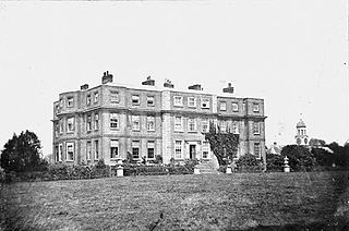
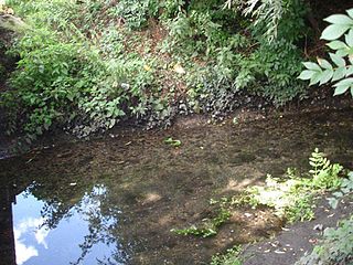
The Langley Park Estate was an English country house estate on the south side of Beckenham, Kent. [1] [2]
An English country house is a large house or mansion in the English countryside. Such houses were often owned by individuals who also owned a town house. This allowed them to spend time in the country and in the city—hence, for these people, the term distinguished between town and country. However, the term also encompasses houses that were, and often still are, the full-time residence for the landed gentry that ruled rural Britain until the Reform Act 1832. Frequently, the formal business of the counties was transacted in these country houses.
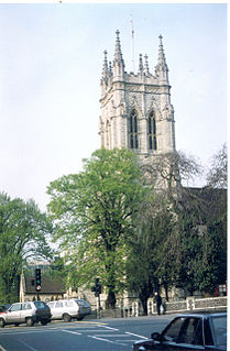
Beckenham is a town in Greater London, England, forming part of the borough of Bromley. It borders Beckenham Place Park and Bellingham in the London Borough of Lewisham and is centred 8.4 miles (13.5 km) south east of Charing Cross. Historically part of Kent, Beckenham was, until the coming of the railway in 1857, a small village, with most of its land being rural and private parkland. John Barwell Cator and his family began the leasing and selling of land for the building of villas which led to a rapid increase in population, between 1850 and 1900, from 2,000 to 26,000. Housing and population growth has continued at a lesser pace since 1900.
Kent is a county in South East England and one of the home counties. It borders Greater London to the north-west, Surrey to the west and East Sussex to the south-west. The county also shares borders with Essex along the estuary of the River Thames, and with the French department of Pas-de-Calais through the Channel Tunnel. The county town is Maidstone.
Over the centuries the estate was owned by the Malmains, Style, Elwill and Burrell families.
The Langley Farm forming the west side of the estate was sold in the 1880s. By 1903 the remaining estate and mansion were vacant. It was bought by H & G Taylor Builders who began developing the land as the Park Langley Estate in 1910. They retained the mansion as the club house to their new golf club. The mansion was subsequently destroyed by fire.
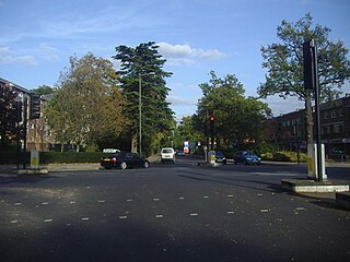
Park Langley is a suburb of Beckenham, London which was first developed in the 1900s on the historic Langley Park Estate by H & G Taylor Builders.
The family names of the previous estate owners are used for roads laid out by H & G Taylor.
The London Borough of Bromley is the most south-eastern of the 32 London boroughs that, along with the City of London, make up Greater London. The borough is named after Bromley, its principal town. The local authority is Bromley London Borough Council.
Crafton is a hamlet in the civil parish of Mentmore, in Buckinghamshire, England.
John Cator was an English timber merchant and politician who sat in the House of Commons between 1772 and 1793. He became a landowner and property developer with estates in later life in: Blackheath, Beckenham, Addington, Croydon and Waltham Forest – now in London, then in Kent, Surrey and Essex; at Leigh and Hever in Kent.
The Chinese Garage is a garage and former petrol station situated in Beckenham in the London Borough of Bromley, on a roundabout linking Beckenham, Eden Park and Shortlands. Built in 1928 to a Japanese pagoda style design by Edmund B. Clarke, it was voted the most unusual garage in England in 2001.
Langley Moor is a former mining village in County Durham, England. It lies between Brandon, Meadowfield and the Neville's Cross area of Durham.
The River Beck is one of the tributaries of the River Ravensbourne in south London. The source of the River Beck is in Spring Park where Shirley and West Wickham meet. For its first mile or so it forms the border between the London boroughs of Croydon and Bromley. Indeed, historically, this was also the border between Surrey and Kent. It gives its name to Beck Lane, Elmers End and Beck Way, Beckenham.
Beckenham was a local government district in north west Kent from 1878 to 1965 around the town of Beckenham. The area was suburban to London, formed part of the Metropolitan Police District and from 1933 was included in the area of the London Passenger Transport Board.
Coldean is a suburb of Brighton and Hove, England. It is situated in a steep sided valley on the extreme north-east of the city. It is surrounded by the Wild Park, the Ditchling Road ridge and the estate of Stanmer Park.
Codrington is a settlement in South Gloucestershire, England. It is located near Junction 18 of the M4 motorway south of Wapley and Yate.
Gidea Hall was a manor house in Gidea Park, the historic parish and Royal liberty of Havering-atte-Bower, whose former area today is part of the north-eastern extremity of Greater London.
Grangewood Park is an extensive woodland area situated in South Norwood, London. It is managed by the London Borough of Croydon. It is bounded by Grange Road, Wharncliffe Road, and Ross Road. It covers an area of 273⁄4 acres 11.23 hectares. The park is located on the main A212 road between Thornton Heath and Upper Norwood/Crystal Palace. The nearest stations are Thornton Heath, Selhurst and Norwood Junction.
Steven's Eyot is a narrow ait (island) in the River Thames in the Royal Borough of Kingston upon Thames, London, England, on the non-tidal reach above Teddington Lock.
Kelsey Park is a public park in Beckenham in the borough of Bromley, Greater London. It historically formed the landscaped park of the Kelsey Manor Estate. The river Beck runs through it.
Springfield Park is a park in Upper Clapton in the London Borough of Hackney.
Beckenham Place Park is a large park located near Beckenham in the London Borough of Lewisham. It lies close to the border with London Borough of Bromley. The Palladian-style mansion that gave the park its name now serves as a community centre and cafe.
Elmers End is an area of south east London within the London Borough of Bromley. It is located south of Beckenham.
Rossway Park is a 1,000 acres (400 ha) country estate located about 0.5 kilometers south of Berkhamsted in Hertfordshire, England. The house at the centre of the estate is a Grade II listed building.
Knapps Brook is a minor tributary of the River Lea in Bedfordshire, England. The source of the river Lea is on Leagrave Common in Luton. It forms from a combination of brooks from East End, Houghton Regis and from the Lewsey Estate near the old Lewsey Farm. It joins the River Lea from culverts under the railway embankment and Toddington Road in Leagrave.
Coordinates: 51°23′57″N0°01′06″W / 51.3993°N 0.0182°W
A geographic coordinate system is a coordinate system that enables every location on Earth to be specified by a set of numbers, letters or symbols. The coordinates are often chosen such that one of the numbers represents a vertical position and two or three of the numbers represent a horizontal position; alternatively, a geographic position may be expressed in a combined three-dimensional Cartesian vector. A common choice of coordinates is latitude, longitude and elevation. To specify a location on a plane requires a map projection.
web site = Langley Park Beckenham