The Arctic Archipelago, also known as the Canadian Arctic Archipelago, is a group of islands north of the Canadian mainland.

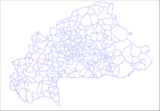
Namentenga is one of the 45 provinces of Burkina Faso, located in its Centre-Nord Region.

Grenadines is an administrative parish of Saint Vincent and the Grenadines, comprising the islands of the Grenadines other than those belonging to Grenada. The capital is Port Elizabeth.

La Montañita is a town and municipality in Caquetá Department, Colombia.
Saxacalli, located on the west bank of the Essequibo River some 25 miles (40 km) south of Parika at 6°35′N58°37′W, was originally an Arawak community. Its present population of about 250 reflects Guyana's multi-ethnicity. Life in Saxacalli is based on small-scale logging, farming and some tourism, mainly from the use of the Saxacalli beach by day-tour operators. The village is not accessible by road, nor does it have a source of electricity.
Breedy's is a village in the parish of Saint Andrew in Barbados.
East-Central Kansas is a region of Kansas. Extending roughly from Osage County, Franklin County, and Miami County in the north to Coffey County, Anderson County and Linn County in the south. The eastern border is Missouri. The region then extends westward towards the Flint Hills to Lyon County. The region is rich with Kansas history, as many locations of this region saw battles in Bleeding Kansas. The infamous abolitionist John Brown and his men battled in Osawatomie. The region geographically features rolling hills and deep forested river valleys. The main crop of this predominantly agricultural region is corn. Much of the area is powered by Wolf Creek Nuclear Generating Station which is located near Burlington. The area is more forested and more moist compared to the rest of the state. The most populous cities of this region include:

Niamina West is one of the ten districts of the Central River Division in the Gambia.

Palmar is a town and municipality in the Santander Department in northeastern Colombia.

Sotará is a town and municipality in the Cauca Department, Colombia.
Benalauría is a town and municipality in the province of Málaga, part of the autonomous community of Andalusia in southern Spain. The municipality is situated approximately 30 kilometres from Ronda and 143 from the city of Málaga. It has a population of approximately 500 residents. The natives are called Jabatos.
Ueda Glacier is a large glacier flowing eastward along the south side of the Scaife Mountains to enter Hansen Inlet near the base of Antarctic Peninsula. It was mapped by United States Geological Survey (USGS) from surveys and U.S. Navy air photos from 1961-67 and named by Advisory Committee on Antarctic Names (US-ACAN) for Herbert T. Ueda who, with B. Lyle Hansen, was in charge of the deep core drilling program at Byrd Station, summers 1966-67 and 1967-68.
Stung Treng District is a district located in Stung Treng Province, in north-east Cambodia. According to the 1998 census of Cambodia, it had a population of 24,493. The provincial capital Stung Treng town is located within the district.
Palenciana is a city located in the province of Córdoba, Spain. According to the 2006 census (INE), the city has a population of 1584 inhabitants.

Morata de Jiloca is a municipality on the river Jiloca, located in the province of Zaragoza, Aragon, Spain. According to the 2004 census (INE), the municipality has a population of 307 inhabitants.

Diéma Cercle is an administrative subdivision of the Kayes Region of Mali. Its administrative center (chef-lieu) is the small town of Diéma. The Cercle is divided into one urban commune and fourteen rural communes. In the 2009 census the cercle had a population of 212,062.

Moengotapoe is a resort in Suriname, located in the Marowijne District. Its population at the 2012 census was 579.
Rasad District is a district of the Abyan Governorate, Yemen. As of 2003, the district had a population of 54,825 inhabitants.
German submarine U-143 was a Type IID U-boat of Nazi Germany's Kriegsmarine during World War II. Her keel was laid down on 3 January 1940 by Deutsche Werke in Kiel as yard number 272. She was launched on 10 August 1940 and commissioned on 18 September under Kapitänleutnant Ernst Mengerson.
Darkuman is a town in the Accra Metropolitan district, a district of the Greater Accra Region of Ghana.


