The Battle of Espinosa de los Monteros was a battle of the Napoleonic Wars, fought on 10 and 11 November 1808 at the township of Espinosa de los Monteros in the Cantabrian Mountains. It resulted in a French victory under General Victor against Lieutenant General Joaquín Blake's Army of Galicia.

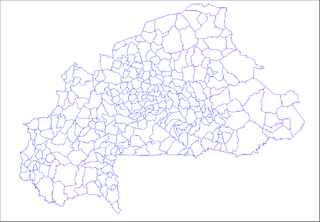
Tougan is a town located in the province of Sourou in Burkina Faso. It is the capital of Sourou Province.

Gbarzon District is one of three districts located in Grand Gedeh County, Liberia.

Palestina is a town and municipality in the Huila Department, Colombia.
La Ermita is a corregimiento in San Carlos District, Panamá Oeste Province, Panama with a population of 1,571 as of 2010. Its population as of 1990 was 1,097; its population as of 2000 was 1,218.
Komsilga is a village in the Zimtenga Department of Bam Province in northern-central Burkina Faso. It has a population of 820.

Nowy Gaj is a village in the administrative district of Gmina Góra Świętej Małgorzaty, within Łęczyca County, Łódź Voivodeship, in central Poland. It lies approximately 5 kilometres (3 mi) east of Góra Świętej Małgorzaty, 13 km (8 mi) east of Łęczyca, and 32 km (20 mi) north of the regional capital Łódź.
Pâncești is a commune in Neamț County, Romania. It is composed of five villages: Ciurea, Holm, Pâncești, Tălpălăi and Patricheni. These were part of Poienari Commune until 2004, when they were split off.

Bukowiec is a village in the administrative district of Gmina Żelechlinek, within Tomaszów Mazowiecki County, Łódź Voivodeship, in central Poland. It lies approximately 3 kilometres (2 mi) south-east of Żelechlinek, 21 km (13 mi) north of Tomaszów Mazowiecki, and 43 km (27 mi) east of the regional capital Łódź.

Lasomin is a village in the administrative district of Gmina Siennica, within Mińsk County, Masovian Voivodeship, in east-central Poland. It lies approximately 3 kilometres (2 mi) south-west of Siennica, 13 km (8 mi) south of Mińsk Mazowiecki, and 44 km (27 mi) south-east of Warsaw.

Matyldów is a village in the administrative district of Gmina Rybno, within Sochaczew County, Masovian Voivodeship, in east-central Poland. It lies approximately 5 kilometres (3 mi) north-west of Rybno, 13 km (8 mi) west of Sochaczew, and 64 km (40 mi) west of Warsaw.

Mazuchówka is a village in the administrative district of Gmina Wydminy, within Giżycko County, Warmian-Masurian Voivodeship, in northern Poland. It lies approximately 3 kilometres (2 mi) north-east of Wydminy, 21 km (13 mi) east of Giżycko, and 106 km (66 mi) east of the regional capital Olsztyn.

Lisy is a village in the administrative district of Gmina Banie Mazurskie, within Gołdap County, Warmian-Masurian Voivodeship, in northern Poland, close to the border with the Kaliningrad Oblast of Russia. It lies approximately 3 kilometres (2 mi) south-east of Banie Mazurskie, 20 km (12 mi) south-west of Gołdap, and 114 km (71 mi) north-east of the regional capital Olsztyn.
Tlacuilotepec (municipality) is a town and municipality in Puebla in south-eastern Mexico.

'Mungode,' 'Munugodu' or 'Munugode' is a village located in Munugode Mandal in Nalgonda Division of Nalgonda district of Telangana state, India. And, it is 21 Kilometers westward from Nalgonda town.
Potuga is a corregimiento in Parita District, Herrera Province, Panama with a population of 1,045 as of 2010. Its population as of 1990 was 1,101; its population as of 2000 was 1,039.
Mariabé is a corregimiento in Pedasí District, Los Santos Province, Panama with a population of 319 as of 2010. Its population as of 1990 was 236; its population as of 2000 was 269.
Saboga is a corregimiento in Balboa District, Panamá Province, Panama with a population of 713 as of 2010. Its population as of 1990 was 344; its population as of 2000 was 680.
El Pantano is a corregimiento in Santa Fé District, Veraguas Province, Panama with a population of 658 as of 2010. Its population as of 1990 was 725; its population as of 2000 was 676.


