Related Research Articles

Attu Station is a census-designated place (CDP) located on Attu Island in the Aleutians West Census Area in the U.S. state of Alaska. The population was 21 at the 2010 census, consisting entirely of coast guard personnel who resided and worked at Casco Cove Coast Guard Station, but left the island when the station was closed in August 2010, leaving it uninhabited. LORAN Station Attu had provided a navigational signal for mariners of the North Pacific since the 1970s.
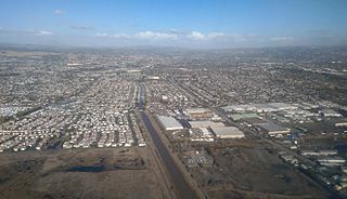
San Lorenzo is a census-designated place (CDP) located in the East Bay of the San Francisco Bay Area in Alameda County, California, United States. The population was 23,452 at the 2010 census. It is an unincorporated community, located at the banks of San Lorenzo Creek. It was originally named Squattersville in 1851, but later renamed to San Lorenzo.

Bodega Bay is a town and census-designated place (CDP) in Sonoma County, California, United States. The population was 1,077 at the 2010 census. The town, located along State Route 1, is on the eastern side of Bodega Harbor, an inlet of Bodega Bay on the Pacific coast.

Siesta Key is a barrier island off the southwest coast of the U.S. state of Florida, located between Roberts Bay and the Gulf of Mexico. A portion of it lies within the city boundary of Sarasota, but the majority of the key is a census-designated place (CDP) in Sarasota County. Siesta Key is part of the Bradenton–Sarasota–Venice Metropolitan Statistical Area.

Kailua, also known by its post office designation Kailua-Kona to differentiate it from Kailua located on the windward side of Oʻahu island, and sometimes referred to as Kona in everyday speech, is an unincorporated town in Hawaiʻi County, Hawaii, United States, in the North Kona District of the Island of Hawaiʻi. The population was 11,975 at the 2010 census, up from 9,870 at the 2000 census. It is the center of commerce and of the tourist industry on West Hawaiʻi. Kailua-Kona is served by Kona International Airport, located just to the north in the adjacent Kalaoa CDP. Kailua-Kona was the closest major settlement to the epicenter of the 2006 Kiholo Bay earthquake.

Ahuimanu or ʻĀhuimanu is a census-designated place (CDP) in the City & County of Honolulu, Hawaii, United States, on the island of Oahu. In Hawaiian ʻāhui-manu means "cluster of birds".
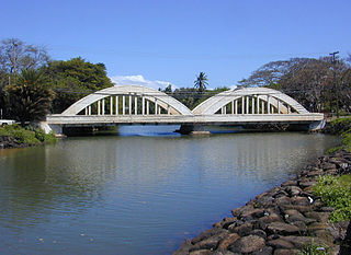
Haleʻiwa is a North Shore community and census-designated place (CDP) in the Waialua District of the island of Oʻahu, City and County of Honolulu. Haleʻiwa is located on Waialua Bay, the mouth of Anahulu Stream. A small boat harbor is located here, and the shore of the bay is surrounded by Haleʻiwa Beach Park and Haleʻiwa Aliʻi Beach Park. Further west from the center of town is Kaiaka State Recreation Area on Kiaka Point beside Kaiaka Bay. As of the 2010 census, the CDP had a population of 3,970. The 2018 estimate was 4,040. It is the largest commercial center on the North Shore of the island. Its old plantation town character is preserved in many of the buildings, making this a popular destination for tourists and residents alike, visiting surfing and diving sites along the north shore.
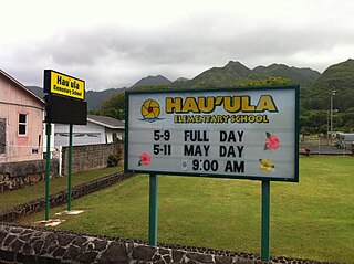
Hauʻula is a census-designated place and rural community in the Koʻolauloa District on the island of Oʻahu, City & County of Honolulu. In Hawaiian, hauʻula means "red hau". There is a small commercial center. As of the 2010 Census, the CDP population was 4,148.
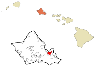
Kāneʻohe is a census-designated place (CDP) included in the City and County of Honolulu and located in Hawaiʻi state District of Koʻolaupoko on the island of Oʻahu. In the Hawaiian language, kāne ʻohe means "bamboo man". According to an ancient Hawaiian story a local woman compared her husband's cruelty to the sharp edge of cutting bamboo; thus the place was named Kāneʻohe or "Bamboo man". The population was 34,597 at the 2010 census. Kāneʻohe is the largest of several communities along Kāneʻohe Bay and one of the two largest residential communities on the windward side of Oʻahu. The commercial center of the town is spread mostly along Kamehameha Highway.

Saipan is the largest island of the Northern Mariana Islands, a commonwealth of the United States in the western Pacific Ocean. According to 2017 estimates by the United States Census Bureau and the Commonwealth's Department of Commerce, Saipan's population was 47,565.

Waikane, also known as North Koʻolaupoko, is an area and census-designated placein the County of Honolulu, Hawaii, United States, on the island of Oʻahu. It had a population of 778 at the 2010 census. In Hawaiian, koʻolau poko means "short windward", referring to the fact that this is the shorter of the two windward districts on the island. Koʻolaupoko extends from Makapuʻu Point on the southeast to Kaʻōʻio Point on the north. Included within the district, south of North Koʻolaupoko, are the largest windward towns of Kāneʻohe, Kailua, and Waimānalo.
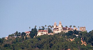
San Simeon is a town and census-designated place on the Pacific coast of San Luis Obispo County, California, United States. Its position along State Route 1 is about halfway between Los Angeles and San Francisco, each of those cities being roughly 230 miles (370 km) away. A key feature of the area is Hearst Castle, a hilltop mansion built by William Randolph Hearst in the early 20th century that is now a tourist attraction. The area is also home to a large northern elephant seal rookery, known as the Piedras Blancas rookery, located 7 miles (11 km) north of San Simeon on Highway 1.

Pagan is a volcanic island in the Marianas archipelago in the northwest Pacific Ocean, under the jurisdiction of the Commonwealth of the Northern Mariana Islands. It lies midway between Alamagan to the south, and Agrihan to the north. The island has been largely uninhabited ever since most of the residents were evacuated due to volcanic eruptions in 1981.

Garapan is the largest village and the center of the tourism industry on the island of Saipan, which is a part of the United States Commonwealth of the Northern Mariana Islands (CNMI). Garapan, as a census-designated place, has an area of 1.2 km² and a population of 3,588.

Umatac, formerly called Umata, is a village on the southwestern coast of the United States territory of Guam. The month of March in the Chamorro language is "Umatalaf," or "to catch guatafi," which is believed to be the root word of Umatac. The village's population has decreased since the island's 2000 census.

Capitol Hill is a settlement on the island of Saipan in the Northern Mariana Islands. It has a population of just over 1,000. Capitol Hill has been the territory's seat of government since 1962. It lies on the cross-island road between Tanapag and San Vicente.
Laulau is a settlement in Saipan, in the Northern Mariana Islands. It is located on the central east coast of the island, close to Laulau Beach, at the northern end of Magicienne Bay. Though fairly isolated, the beach is a popular attraction. The village is connected by road with San Vicente, which lies to the south..

Yigo, Guam is the northernmost village of the United States territory of Guam, and is the location of Andersen Air Force Base. The municipality of Yigo is larger than any other village on the island in terms of area. It contains a number of populated places, including Asatdas and Agafo Gumas.
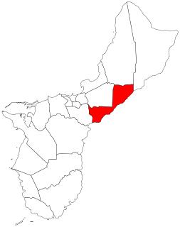
Mangilao is a village on the eastern shore of the United States territory of Guam. The village's population has increased slightly following the island's 2000 census.

The Laulau Kattan Latte Site is a prehistoric archaeological site on the island of Saipan in the Northern Mariana Islands. Located near the shore of Laulau Bay, it is a small village site containing the remains of four latte stone house foundations, and an extensive scattering of pottery artifacts. When first reported by the pioneering archaeologist Alexander Spoehr in the 1940s, the latte stones were described as mostly fallen over and extremely weathered.
References
- ↑ "laolao"
- ↑ Eugenio, Haidee V. (January 6, 2012). "Census: Garapan is most populous". Saipan Tribune. Archived from the original on January 11, 2012. Retrieved April 14, 2012.
- ↑ "Laulau Bay Village census map" (PDF). U.S. 2010 census map. Retrieved 14 April 2012.