Lapotince

Last updated
Lapotince
Village
Serbia adm location map.svg
Red pog.svg
Lapotince
Coordinates: 43°01′23″N21°47′11″E / 43.02306°N 21.78639°E / 43.02306; 21.78639
CountryFlag of Serbia.svg  Serbia
District Jablanica District
Municipality Bojnik
Population (2002)
  Total 647
Time zone CET (UTC+1)
  Summer (DST) CEST (UTC+2)

Lapotince is a village in the municipality of Bojnik, Serbia. According to the 2002 census, the village has a population of 647 people. [1]

Village Small clustered human settlement smaller than a town

A village is a clustered human settlement or community, larger than a hamlet but smaller than a town, with a population ranging from a few hundred to a few thousand. Though villages are often located in rural areas, the term urban village is also applied to certain urban neighborhoods. Villages are normally permanent, with fixed dwellings; however, transient villages can occur. Further, the dwellings of a village are fairly close to one another, not scattered broadly over the landscape, as a dispersed settlement.

Bojnik Town and municipality in Southern and Eastern Serbia, Serbia

Bojnik is a village and municipality located in Jablanica District of southern Serbia. According to 2011 census, the population of the village is 6,688 while population of the municipality was 11,073.

Serbia Republic in Southeastern Europe

Serbia, officially the Republic of Serbia, is a country situated at the crossroads of Central and Southeast Europe in the southern Pannonian Plain and the central Balkans. The sovereign state borders Hungary to the north, Romania to the northeast, Bulgaria to the southeast, North Macedonia to the south, Croatia and Bosnia and Herzegovina to the west, and Montenegro to the southwest. The country claims a border with Albania through the disputed territory of Kosovo. Serbia's population is about seven million. Its capital, Belgrade, ranks among the oldest and largest citiеs in southeastern Europe.

Related Research Articles

Satory is an area south of Versailles in France. It is mostly known for its military camp, housing:

Mjóifjörður Village in Northeast Constituency, Iceland

Mjóifjörður is a village of 11 people in East Iceland, sitting on a fjord of the same name. It is part of the municipality of Fjarðabyggð.

Dwikozy Village in Świętokrzyskie, Poland

Dwikozy is a village in Sandomierz County, Świętokrzyskie Voivodeship, in south-central Poland. It is the seat of the gmina called Gmina Dwikozy. It lies approximately 7 kilometres (4 mi) north-east of Sandomierz and 84 km (52 mi) east of the regional capital Kielce.

Qaragöz, Zangilan Place in Zangilan, Azerbaijan

Qaragöz is a village in the Zangilan Rayon of Azerbaijan.

Zdziesławice, Lesser Poland Voivodeship Village in Lesser Poland, Poland

Zdziesławice is a village in the administrative district of Gmina Michałowice, within Kraków County, Lesser Poland Voivodeship, in southern Poland. It lies approximately 12 km (7 mi) north-east of the regional capital Kraków.

Marianów, Jędrzejów County Village in Świętokrzyskie, Poland

Marianów is a village in the administrative district of Gmina Sędziszów, within Jędrzejów County, Świętokrzyskie Voivodeship, in south-central Poland. It lies approximately 4 kilometres (2 mi) west of Sędziszów, 21 km (13 mi) west of Jędrzejów, and 54 km (34 mi) south-west of the regional capital Kielce.

Żerniki, Opatów County Village in Świętokrzyskie, Poland

Żerniki is a village in the administrative district of Gmina Baćkowice, within Opatów County, Świętokrzyskie Voivodeship, in south-central Poland. It lies approximately 3 kilometres (2 mi) south-east of Baćkowice, 12 km (7 mi) west of Opatów, and 47 km (29 mi) east of the regional capital Kielce.

Rzeczyca Mokra Village in Świętokrzyskie, Poland

Rzeczyca Mokra is a village in the administrative district of Gmina Dwikozy, within Sandomierz County, Świętokrzyskie Voivodeship, in south-central Poland. It lies approximately 1 kilometre (1 mi) south of Dwikozy, 6 km (4 mi) north-east of Sandomierz, and 85 km (53 mi) east of the regional capital Kielce.

Nowy Sielc is a village in the administrative district of Gmina Krasnosielc, within Maków County, Masovian Voivodeship, in east-central Poland.

Kalinowiec, Maków County Village in Masovian, Poland

Kalinowiec is a village in the administrative district of Gmina Płoniawy-Bramura, within Maków County, Masovian Voivodeship, in east-central Poland. It lies approximately 10 kilometres (6 mi) north-west of Maków Mazowiecki and 81 km (50 mi) north of Warsaw.

Barłożno Village in Pomeranian, Poland

Barłożno is a village in the administrative district of Gmina Skórcz, within Starogard County, Pomeranian Voivodeship, in northern Poland. It lies approximately 6 kilometres (4 mi) east of Skórcz, 21 km (13 mi) south of Starogard Gdański, and 65 km (40 mi) south of the regional capital Gdańsk.

Ryzowie Village in Pomeranian, Poland

Ryzowie is a village in the administrative district of Gmina Skórcz, within Starogard County, Pomeranian Voivodeship, in northern Poland. It lies approximately 2 kilometres (1 mi) south-east of Skórcz, 21 km (13 mi) south of Starogard Gdański, and 65 km (40 mi) south of the regional capital Gdańsk.

Miodne is a settlement in the administrative district of Gmina Nowogard, within Goleniów County, West Pomeranian Voivodeship, in north-western Poland.

Tychowo, Sławno County Village in West Pomeranian, Poland

Tychowo is a village in the administrative district of Gmina Sławno, within Sławno County, West Pomeranian Voivodeship, in north-western Poland. It lies approximately 7 kilometres (4 mi) east of Sławno and 179 km (111 mi) north-east of the regional capital Szczecin.

Krupá (Kolín District) Municipality and village in Central Bohemian Region, Czech Republic

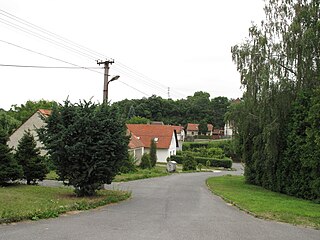
Krupá is a village and municipality in Kolín District in the Central Bohemian Region of the Czech Republic.

Pěčice Municipality and village in Central Bohemian Region, Czech Republic

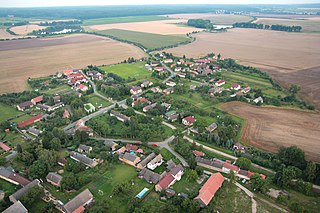
Pěčice is a village and municipality in Mladá Boleslav District in the Central Bohemian Region of the Czech Republic.

Krtok Village in Toplica District, Serbia

Krtok is a village in the municipality of Kuršumlija, Serbia. According to the 2002 census, the village has a population of 39 people.

Barje (Leskovac) Village in Jablanica District, Serbia

Barje is a village in the municipality of Leskovac, Serbia. According to the 2002 census, the village has a population of 372 people.

Tagavere is a village in Lääne-Nigula Parish, Lääne County, in western Estonia.

Zagoričani Village in Federation of Bosnia and Herzegovina, Bosnia and Herzegovina

Zagoričani is a village in the municipality of Livno, Bosnia and Herzegovina.

References

  1. Popis stanovništva, domaćinstava i Stanova 2002. Knjiga 1: Nacionalna ili etnička pripadnost po naseljima. Republika Srbija, Republički zavod za statistiku Beograd 2003. ISBN   86-84433-00-9

Coordinates: 43°01′23″N21°47′11″E / 43.02306°N 21.78639°E / 43.02306; 21.78639

Geographic coordinate system Coordinate system

A geographic coordinate system is a coordinate system that enables every location on Earth to be specified by a set of numbers, letters or symbols. The coordinates are often chosen such that one of the numbers represents a vertical position and two or three of the numbers represent a horizontal position; alternatively, a geographic position may be expressed in a combined three-dimensional Cartesian vector. A common choice of coordinates is latitude, longitude and elevation. To specify a location on a plane requires a map projection.