
Seafloor spreading, or seafloor spread, is a process that occurs at mid-ocean ridges, where new oceanic crust is formed through volcanic activity and then gradually moves away from the ridge.

Laurasia was the more northern of two large landmasses that formed part of the Pangaea supercontinent from around 335 to 175 million years ago (Mya), the other being Gondwana. It separated from Gondwana 215 to 175 Mya during the breakup of Pangaea, drifting farther north after the split and finally broke apart with the opening of the North Atlantic Ocean c. 56 Mya. The name is a portmanteau of Laurentia and Asia.

The Mid-Atlantic Ridge is a mid-ocean ridge located along the floor of the Atlantic Ocean, and part of the longest mountain range in the world. In the North Atlantic, the ridge separates the North American from the Eurasian Plate and the African Plate, north and south of the Azores Triple Junction. In the South Atlantic, it separates the African and South American plates. The ridge extends from a junction with the Gakkel Ridge northeast of Greenland southward to the Bouvet Triple Junction in the South Atlantic. Although the Mid-Atlantic Ridge is mostly an underwater feature, portions of it have enough elevation to extend above sea level, for example in Iceland. The ridge has an average spreading rate of about 2.5 centimetres (1 in) per year.

In plate tectonics, a divergent boundary or divergent plate boundary is a linear feature that exists between two tectonic plates that are moving away from each other. Divergent boundaries within continents initially produce rifts, which eventually become rift valleys. Most active divergent plate boundaries occur between oceanic plates and exist as mid-oceanic ridges.

The Gakkel Ridge is a mid-oceanic ridge, a divergent tectonic plate boundary between the North American Plate and the Eurasian Plate. It is located in the Eurasian Basin of the Arctic Ocean, between Greenland and Siberia. Geologically, it connects the northern end of the Mid-Atlantic Ridge with the Laptev Sea Rift.

The North American Plate is a tectonic plate containing most of North America, Cuba, the Bahamas, extreme northeastern Asia, and parts of Iceland and the Azores. With an area of 76 million km2 (29 million sq mi), it is the Earth's second largest tectonic plate, behind the Pacific Plate.

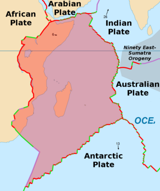
The African Plate, also known as the Nubian Plate, is a major tectonic plate that includes much of the continent of Africa and the adjacent oceanic crust to the west and south. It is bounded by the North American Plate and South American Plate to the west ; the Arabian Plate and Somali Plate to the east; the Eurasian Plate, Aegean Sea Plate and Anatolian Plate to the north; and the Antarctic Plate to the south.

In geology, a rift is a linear zone where the lithosphere is being pulled apart and is an example of extensional tectonics. Typical rift features are a central linear downfaulted depression, called a graben, or more commonly a half-graben with normal faulting and rift-flank uplifts mainly on one side. Where rifts remain above sea level they form a rift valley, which may be filled by water forming a rift lake. The axis of the rift area may contain volcanic rocks, and active volcanism is a part of many, but not all, active rift systems.

Arctica, or Arctida is a hypothetical ancient continent which formed approximately 2.565 billion years ago in the Neoarchean era. It was made of Archaean cratons, including the Siberian Craton, with its Anabar/Aldan shields in Siberia, and the Slave, Wyoming, Superior, and North Atlantic cratons in North America. Arctica was named by Rogers 1996 because the Arctic Ocean formed by the separation of the North American and Siberian cratons. Russian geologists writing in English call the continent "Arctida" since it was given that name in 1987, alternatively the Hyperborean craton, in reference to the hyperboreans in Greek mythology.
In hydrology, an oceanic basin (or ocean basin) is anywhere on Earth that is covered by seawater. Geologically, most of the ocean basins are large geologic basins that are below sea level.

Stolbovoy Island is a long and narrow island off the southwest side of the New Siberian archipelago in the eastern part of the Laptev Sea. It is located 184 km away from the Siberian coast and 100 km southwest of Kotelny Island, being thus quite detached from the New Siberian island group, although it belongs to the Lyakhov Islands subgroup of the New Siberian Islands.
The Somali Plate is a minor tectonic plate which straddles the Equator in the Eastern Hemisphere. It is currently in the process of separating from the African Plate along the East African Rift Valley. It is approximately centered on the island of Madagascar and includes about half of the east coast of Africa, from the Gulf of Aden in the north through the East African Rift Valley. The southern boundary with the Nubian-African Plate is a diffuse plate boundary consisting of the Lwandle Plate.

A mid-ocean ridge (MOR) is a seafloor mountain system formed by plate tectonics. It typically has a depth of about 2,600 meters (8,500 ft) and rises about 2,000 meters (6,600 ft) above the deepest portion of an ocean basin. This feature is where seafloor spreading takes place along a divergent plate boundary. The rate of seafloor spreading determines the morphology of the crest of the mid-ocean ridge and its width in an ocean basin.

The Chersky Range is a chain of mountains in northeastern Siberia between the Yana and Indigirka Rivers. Administratively, the area of the range belongs to the Sakha Republic, although a small section in the east is within Magadan Oblast. The highest peak in the range is the 3,003-metre (9,852 ft)-tall Peak Pobeda, part of the Ulakhan-Chistay Range. The range also includes important places of traditional Yakut culture, such as Ynnakh Mountain (Mat'-Gora) and kigilyakh rock formations.
The Siberian Shelf is a coastal shelf in the Arctic Ocean and is the largest continental shelf of the Earth, a part of the continental shelf of Russia. It extends from the continent of Eurasia in the general area of North Siberia into the Arctic Ocean. It stretches to 1,500 kilometers (930 mi) offshore. It is relatively shallow, with average depth of 100 m. A number of islands are within the shelf, including the Wrangel Island, Novaya Zemlya, and the New Siberian Islands.
The Eurasian Basin, or Eurasia Basin, is one of the two major basins into which the Arctic Basin of the Arctic Ocean is split by the Lomonosov Ridge. The Eurasia Basin may be seen as an extension of the North Atlantic Basin through Fram Strait. It is further split by the mid-ocean Gakkel Ridge into the Nansen Basin and the Amundsen Basin. The latter basin is the deepest one of the Arctic Ocean and the geographic North Pole is located there.
This is a list of articles related to plate tectonics and tectonic plates.

The geology of Russia, the world's largest country, which extends over much of northern Eurasia, consists of several stable cratons and sedimentary platforms bounded by orogenic (mountain) belts.
Balagan-Tas is a cinder cone volcano in Russia. It was discovered by V.A. Zimin in 1939 and is one of the main features of the Moma Natural Park.