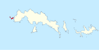
Robertson Island is an ice-covered island, 21 km (13 mi) long in a northwest-southeast direction and 10 km (6 mi) wide, lying at the east end of the Seal Nunataks off the east coast of the Antarctic Peninsula. Captain Carl Anton Larsen discovered Robertson Island from the Jason on 9 December 1893. Curious to find out if the volcano was active he skied to the top from the north side of the island, later naming it Mt. Christensen after his longtime partner and majority owner of the Jason, Christen Christensen. Larsen named Robertson Island for William Robertson, co-owner of the Hamburg-based company Woltereck and Robertson.
The Larsen Islands are a small group of islands north-west of Moreton Point, the western extremity of Coronation Island, in the South Orkney Islands of Antarctica. They were discovered by Captains George Powell and Nathaniel Palmer on the occasion of their joint cruise in December 1821. The islands were named on Petter Sørlle's chart, based upon his survey of the South Orkney Islands in 1912–1913, in honour of Carl Anton Larsen.
Borchgrevink Glacier is a large glacier in the Victory Mountains, Victoria Land, Antarctica. It drains south between Malta Plateau and Daniell Peninsula, and thence projects into Glacier Strait, Ross Sea, as a floating glacier tongue.

The Prince Charles Mountains are a major group of mountains in Mac. Robertson Land in Antarctica, including the Athos Range, the Porthos Range, and the Aramis Range. The highest peak is Mount Menzies, with a height of 3,228 m (10,591 ft). Other prominent peaks are Mount Izabelle and Mount Stinear. These mountains, together with other scattered peaks, form an arc about 420 km (260 mi) long, extending from the vicinity of Mount Starlight in the north to Goodspeed Nunataks in the south.
Lützow-Holm Bay is a large bay, about 220 kilometres (120 nmi) wide, indenting the coast of Queen Maud Land in Antarctica between Riiser-Larsen Peninsula and the coastal angle immediately east of the Flatvaer Islands. It was discovered by Captain Hjalmar Riiser-Larsen in two airplane flights from his expedition vessel, the Norvegia, on February 21 and 23, 1931. The name honours Commander Finn Lützow-Holm of the Royal Norwegian Navy Air Service, a pilot for Captain Riiser-Larsen on the Aagaard in 1935.
Drygalski Glacier is a broad glacier, 18 nautical miles long which flows southeast from Herbert Plateau through a rectangular re-entrant to a point immediately north of Sentinel Nunatak on the east coast of Graham Land, Antarctica.

Ulu Peninsula is that portion of James Ross Island northwest of the narrow neck of land between Rohss Bay and Croft Bay, extending from Cape Obelisk to Cape Lachman, in Antarctica.
Castor Nunatak is a nunatak 3 nautical miles (6 km) southwest of Oceana Nunatak in the Seal Nunataks group, off the east coast of the Antarctic Peninsula. It was first seen and mapped as an island in December 1893 by a Norwegian Sealing expedition under C.A. Larsen, who named it after the Castor, a ship which combined sealing and exploring activities along the west coast of the Antarctic Peninsula under Captain Morten Pedersen in 1893–94. The feature was determined to be a nunatak in 1902 by the Swedish Antarctic Expedition under Otto Nordenskiöld.
Christensen Nunatak is a nunatak 1 nautical mile (2 km) north of Robertson Island in the Seal Nunataks group, off the east coast of the Antarctic Peninsula. It was discovered in 1893 by a Norwegian expedition under C.A. Larsen, who named it for Christen Christensen of Sandefjord, Norway, a pioneer of modern Antarctic whaling. It was surveyed in 1902 by the Swedish Antarctic Expedition under Otto Nordenskiöld, and in 1947 and 1953 by the Falkland Islands Dependencies Survey.
The Dana Mountains are a group of mountains just northwest of New Bedford Inlet, bounded by Mosby Glacier on the north and Haines Glacier and Meinardus Glacier on the south, in Palmer Land, Antarctica.
The Juno Peaks are two steep-sided nunataks with a small rock to the west, forming part of an east–west ridge 6 nautical miles (11 km) southwest of Mimas Peak, lying near the head of Saturn Glacier in southern Alexander Island, Antarctica. They were mapped from trimetrogon air photography taken by the Ronne Antarctic Research Expedition, 1947–48, and from survey by the Falkland Islands Dependencies Survey, 1948–50. The nunataks were named by the UK Antarctic Place-Names Committee after Juno, one of the asteroids lying between the orbits of the planets Mars and Jupiter.
Pollux Nunatak is one of the Seal Nunataks, lying 2 nautical miles (3.7 km) northwest of Robertson Island in Larsen Ice Shelf. The probable existence of the feature was first reported by Falkland Islands Dependencies Survey (FIDS) in 1947 and its existence was confirmed during a FIDS survey in 1953. The United Kingdom Antarctic Place-Names Committee (UK-APC) name derives from its association with Castor Nunatak 4.5 nautical miles (8 km) to the SSW; Castor and Pollux were sons of Zeus.
Pedersen Nunatak is the westernmost of the Seal Nunataks, lying 8 nautical miles (15 km) northeast of Cape Fairweather, off the east coast of Antarctic Peninsula. First charted in 1947 by the Falkland Islands Dependencies Survey (FIDS), and named for Captain Morten Pedersen of the Norwegian sealer Castor, which operated in Antarctic waters during the 1893–94 season.
Evensen Nunatak is a nunatak 1.5 nautical miles (3 km) northwest of Dallmann Nunatak in the Seal Nunataks group, off the east coast of the Antarctic Peninsula. It was first charted by the Falkland Islands Dependencies Survey in August 1947, and named by them for Captain Carl Julius Evensen of the Hertha, who explored along the west coast of the Antarctic Peninsula in 1893.
The McDonald Heights are broad, mainly snow-covered heights about 35 nautical miles (65 km) long and rising over 1,000 metres (3,300 ft) between Cape Burks and Morris Head on the coast of Marie Byrd Land, Antarctica. The heights are bounded southward by Hull Glacier, Kirkpatrick Glacier and Johnson Glacier.
Hertha Nunatak is a nunatak 1 nautical mile (2 km) northwest of Castor Nunatak in the Seal Nunataks group, off the east coast of the Antarctic Peninsula. It was first seen and mapped as an island in December 1893 by Captain Carl Anton Larsen, who named it after the Hertha, a ship which combined sealing and exploring activities along the west coast of the Antarctic Peninsula under Captain Carl Julius Evensen in 1893–94. It was determined to be a nunatak by the Swedish Antarctic Expedition under Otto Nordenskiöld during a sledge journey in 1902.
The Hyperion Nunataks are a group of about 10 nunataks lying south of Saturn Glacier and 8 nautical miles (15 km) west of the Corner Cliffs, in the southeastern part of Alexander Island, Antarctica. The group was first seen and photographed from the air by Lincoln Ellsworth on November 23, 1935, and mapped from these photos by W.L.G. Joerg. It was surveyed in 1949 by the Falkland Islands Dependencies Survey, and so named by the United Kingdom Antarctic Place-Names Committee in association with nearby Saturn Glacier, Hyperion being one of the satellites of the planet Saturn.

Klinck Nunatak is an isolated nunatak rising to about 1,800 metres (5,900 ft) between the Blanchard Nunataks and the Holmes Hills in south-central Palmer Land, Antarctica. It was mapped by the United States Geological Survey from aerial photographs taken by the U.S. Navy, 1966–69, and was named by the Advisory Committee on Antarctic Names in 1977 for Jay C. Klinck, U.S. Navy, a construction mechanic at Palmer Station, winter party 1970, who also provided United States Antarctic Research Program operational support at Siple Station, winter party 1973.
Seacatch Nunataks is a group of nunataks rising to about 500 m between Carro Pass and Massey Heights in James Ross Island. It was named by the United Kingdom Antarctic Place-Names Committee (UK-APC) following British Antarctic Survey (BAS) geological work here from 1981-83 and is named after Seacatch, the father seal in Kipling's The White Seal, in association with similar names in this area.

