Mora County is a county in the US state of New Mexico. As of the 2010 census, the population was 4,881. Its county seat is the census-designated place (CDP) Mora. The county has another CDP, Watrous, a village, Wagon Mound, New Mexico, and 12 smaller unincorporated settlements. Mora became a formal county in the US, in what was then the New Mexico Territory, on February 1, 1860. Ecclesiastically, the county is within the Roman Catholic Archdiocese of Santa Fe. County population peaked at about 14,000 around 1920, declining to about 4,000 to 5,000 since the 1970s; the 2016 estimate was 4,500.

Alamo Village is a movie set and tourist attraction north of Brackettville, Texas, United States. It was the first movie location built in Texas, originally constructed for and best known as the setting for The Alamo (1960), directed by John Wayne and starring Wayne, Richard Widmark, Laurence Harvey and Frankie Avalon.

The Trinity River is a 710-mile-long (1,140 km) river in Texas, and is the longest river with a watershed entirely within the U.S. state of Texas. It rises in extreme northern Texas, a few miles south of the Red River. The headwaters are separated by the high bluffs on the southern side of the Red River.

State Highway 131 is a Texas state highway that runs from US 277 near Eagle Pass to US 90 in Brackettville.

Eagle Pass is a city in and the county seat of Maverick County in the U.S. state of Texas. The population was 26,255 as of the 2010 census.
The San Antonio–El Paso Road also known as the Lower Emigrant Road or Military Road was an economically important trade route between the Texas cities of San Antonio and El Paso between 1849 and 1882. The road carried mail, freight and passengers by horse and wagon across the Edwards Plateau and dangerous Trans-Pecos region of West Texas.
The San Antonio–San Diego Mail Line, also known as the Jackass Mail, was the earliest overland stagecoach and mail operation from the Eastern United States to California in operation between 1857 and 1861. It was created, organized and financed by James E. Birch the head of the California Stage Company. Birch was awarded the first contract for overland service on the "Southern Route", designated Route 8076. This contract required a semi-monthly service in four-horse coaches, scheduled to leave San Antonio and San Diego on the ninth and the 24th of each month, with 30 days allowed for each trip.
Black Seminole Scouts, also known as the Seminole Negro - Indian Scouts, or Seminole Scouts, were employed by the United States Army between 1870 and 1914. Despite the name, the unit included both Black Seminoles and some native Seminoles. However, because most of the Seminole scouts were of African descent, they were often attached to the Buffalo Soldier regiments, to guide the troops through hostile territory. The majority of their service was in the 1870s, in which they played a significant role in ending the Texas-Indian Wars.
See Elm Creek for the tributary of the Rio Grande, in Maverick County, Texas.
See Elm Creek for the tributary of the Nueces River, in Maverick County, Texas.
Turkey Creek, a tributary of the Nueces River with its source in Kinney County, Texas 29°14′32″N100°06′56″W. It passes through Uvalde and Dimmit Counties to its mouth at Espantosa Lake in Espantosa Slough south of Crystal City in Zavala County, Texas.
Pinto Creek, formerly known as Piedra Pinto Creek, a tributary to the Rio Grande in Kinney County, Texas. It has its source, at 29°30′53″N100°24′13″W.

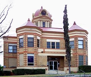
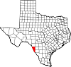
Las Moras Springs,"The Mulberries" in Spanish, are a group of springs near Brackettville in Kinney County, Texas.
Las Moras Mountain, is a summit in the Texas Hill Country four miles northeast of Brackettville in Kinney County, Texas. It stands at an elevation of 1676 feet.
Mud Creek, originally known as Maverick Creek, a stream in Kinney County, Texas tributary to Sycamore Creek and the Rio Grande. It has its source at 29°28′10″N100°36′24″W.
Sycamore Creek, a tributary stream of the Rio Grande, with its source in Edwards County, ten miles east of Carta Valley in southwest Edwards County, 29°47′33″N100°30′31″W. It flows southwestward to Val Verde County then southward to the Val Verde / Kinney County line along which it flows past its confluence with Mud Creek and Sacatosa Creek to the Rio Grande.