The San Antonio-El Paso Road also known as the Lower Emigrant Road or Military Road was an economically important trade route between the Texas cities of San Antonio and El Paso between 1849 and 1882. The road carried mail, freight and passengers by horse and wagon across the Edwards Plateau and dangerous Trans-Pecos region of West Texas.

Texas is the second largest state in the United States by both area and population. Geographically located in the South Central region of the country, Texas shares borders with the U.S. states of Louisiana to the east, Arkansas to the northeast, Oklahoma to the north, New Mexico to the west, and the Mexican states of Chihuahua, Coahuila, Nuevo León, and Tamaulipas to the southwest, while the Gulf of Mexico is to the southeast.

El Paso is a city in and the seat of El Paso County, situated in the far western corner of the U.S. state of Texas. As of July 1, 2017, the population estimate for the city from the U.S. Census was 683,577. Its U.S. metropolitan area covers all of El Paso and Hudspeth counties in Texas, and has a population of 844,818. The El Paso metropolitan area forms part of the larger El Paso–Las Cruces CSA, with a population of 1,053,267.
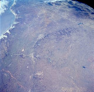
The Edwards Plateau is a region of west-central Texas which is bounded by the Balcones Fault to the south and east, the Llano Uplift and the Llano Estacado to the north, and the Pecos River and Chihuahuan Desert to the west. San Angelo, Austin, San Antonio and Del Rio roughly outline the area. The eastern portion of the plateau is known as the Texas Hill Country.
Contents
- 1859 Table of distances along the San Antonio-El Paso Road, from one station or watering-place to another from starting point[4]
- References
- External links
The "Upper Emigrant Road" originated at Austin and skirted the north of the Edwards Plateau. It intersected the Lower Road near Comanche Springs west of Horsehead Crossing of the Pecos River. [1]

Horsehead Crossing is a ford on the Pecos River in Crane County, south of Odessa, Texas. Historically, it was a major landmark on the trail west as one of a few fordable sections of the Pecos in West Texas, and as the first reliable source of water for about 75 miles on the route from the east.

The Pecos River originates in north-central New Mexico and flows into Texas, emptying into the Rio Grande. Its headwaters are on the eastern slope of the Sangre de Cristo mountain range in Mora County north of Pecos, NM, at an elevation of over 12,000 feet (3,700 m) feet. The river flows for 926 miles (1,490 km) before reaching the Rio Grande near Del Rio. Its drainage basin encompasses about 44,300 square miles (115,000 km2).
In 1848, businessmen in San Antonio hired John Coffee Hays to find a route to El Paso. Hays and a squad of Texas Rangers spent three and a half months on their quest but only made it as far as Presidio due to lack of food and water.

John Coffee "Jack" Hays was a captain in the Texas Rangers and a military officer of the Republic of Texas. Hays served in several armed conflicts from 1836 to 1848, including against the Comanche people in Texas and during the Mexican–American War.

The Texas Ranger Division, commonly called the Texas Rangers, is a state-wide investigative law enforcement agency with statewide jurisdiction in Texas, based in the capital city of Austin. Over the years, the Texas Rangers have investigated crimes ranging from murder to political corruption, acted in riot control and as detectives, protected the governor of Texas, tracked down fugitives, and functioned as a paramilitary force at the service of both the Republic (1836–1845) and the state of Texas.

Presidio is a city in Presidio County, Texas, United States. It stands on the Rio Grande, on the opposite side of the U.S.–Mexico border from Ojinaga, Chihuahua. The name originates from the Spanish and means "jail". The population was 4,167 at the 2000 census, and had increased to 4,426 as of the 2010 US census.
By 1849, gold-seekers wishing to get to California to stake claims were arriving in Texas and looking for opportunities to travel west. Brevet Major General William J. Worth ordered Lieutenant William H.C. Whiting and Lieutenant William Farrar Smith to find a suitable route to El Paso. They were to follow Hays' trail to Presidio and continue up the Rio Grande to El Paso. The team made it to El Paso but believed the route was unsatisfactory. On the return trip, they traveled down the Rio Grande only 100 miles then headed east for the Pecos River. They followed the Pecos to Devils River and the Devils back to the Rio Grande. From there, they headed east to San Antonio.

California is a state in the Pacific Region of the United States. With 39.6 million residents, California is the most populous U.S. state and the third-largest by area. The state capital is Sacramento. The Greater Los Angeles Area and the San Francisco Bay Area are the nation's second- and fifth-most populous urban regions, with 18.7 million and 8.8 million residents respectively. Los Angeles is California's most populous city, and the country's second-most populous, after New York City. California also has the nation's most populous county, Los Angeles County, and its largest county by area, San Bernardino County. The City and County of San Francisco is both the country's second-most densely populated major city after New York City and the fifth-most densely populated county, behind only four of the five New York City boroughs.
In many of the world's military establishments, a brevet was a warrant giving a commissioned officer a higher rank title as a reward for gallantry or meritorious conduct but without conferring the authority, precedence, or pay of real rank. An officer so promoted was referred to as being brevetted. The promotion would be noted in the officer's title.

William Jenkins Worth was a United States officer during the War of 1812, Second Seminole War, and Mexican–American War.
Brevet Brigadier General William S. Harney, now in command of the army in Texas after General Worth's death in the San Antonio cholera epidemic, ordered Lieutenant Smith to accompany Lieutenant Colonel Joseph E. Johnston on another survey expedition to El Paso. The survey party was escorted by a company of the First Infantry. There were also six companies of the Third Infantry and a group of California bound immigrants. [2] One of these Forty-niners, Robert Eccleston, traveling with the expedition wrote a journal describing incidents of the journey, the land they passed over, with the mileage, each day along the route. [3] The trail they followed to El Paso differed only slightly from Whiting and Smith's return route. This trail would become known as the Lower or Military Road and then the San Antonio-El Paso Road.

William Selby Harney was a Tennessee-born cavalry officer in the U.S. Army, who became known during the Indian Wars and the Mexican–American War. One of four general officers in the U.S. Army at the beginning of the Civil War, he was removed from overseeing the Department of the West due to his Confederate sympathies early in the war. Under President Andrew Johnson, he served with on the Indian Peace Commission, negotiating several treaties, before spending his retirement partly in St. Louis and partly trading reminiscences with Jefferson Davis in Mississippi.

The United States Army (USA) is the land warfare service branch of the United States Armed Forces. It is one of the seven uniformed services of the United States, and is designated as the Army of the United States in the United States Constitution. As the oldest and most senior branch of the U.S. military in order of precedence, the modern U.S. Army has its roots in the Continental Army, which was formed to fight the American Revolutionary War (1775–1783)—before the United States of America was established as a country. After the Revolutionary War, the Congress of the Confederation created the United States Army on 3 June 1784 to replace the disbanded Continental Army. The United States Army considers itself descended from the Continental Army, and dates its institutional inception from the origin of that armed force in 1775.

Cholera is an infection of the small intestine by some strains of the bacterium Vibrio cholerae. Symptoms may range from none, to mild, to severe. The classic symptom is large amounts of watery diarrhea that lasts a few days. Vomiting and muscle cramps may also occur. Diarrhea can be so severe that it leads within hours to severe dehydration and electrolyte imbalance. This may result in sunken eyes, cold skin, decreased skin elasticity, and wrinkling of the hands and feet. Dehydration can cause the skin to turn bluish. Symptoms start two hours to five days after exposure.
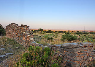
"In 1850 the largest supply train to use the road" left Fort Inge for El Paso with 340 wagons, 4000 animals, 450 civilians and 175 soldiers. [2] To protect people and supplies along the road from Indians and bandits, a series of fortifications were established by the army. These included Fort Inge (1849-1869), Fort Clark (1852-1944), Fort Lancaster (1855-1862, 1867-1874), Fort Stockton (1859-1862, 1867-1886), Fort Davis (1854-1862, 1867-1891), Fort Quitman (1858-1861, 1868-1877, 1880-1882) and Fort Bliss (1849- ). The road was used for the San Antonio-El Paso Mail from 1851-1862 and 1866-1882 and as part of the San Antonio-San Diego Mail Line route in 1857-1858. The Butterfield Overland Mail began using the Lower Road from Fort Stockton to El Paso in 1859-1861.

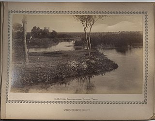
Fort Inge was a frontier fort in Uvalde County, Texas, United States.

Native Americans, also known as American Indians, Indigenous Americans and other terms, are the indigenous peoples of the United States, except Hawaii. There are over 500 federally recognized tribes within the US, about half of which are associated with Indian reservations. The term "American Indian" excludes Native Hawaiians and some Alaska Natives, while Native Americans are American Indians, plus Alaska Natives of all ethnicities. Native Hawaiians are not counted as Native Americans by the US Census, instead being included in the Census grouping of "Native Hawaiian and other Pacific Islander".

A fortification is a military construction or building designed for the defense of territories in warfare, and is also used to solidify rule in a region during peacetime. The term is derived from the Latin fortis ("strong") and facere.


