Related Research Articles
Tunas Creek formerly known as Arroyo Escondido, is a stream tributary to the Pecos River, in Pecos County, Texas. Its source is at 30°52′53″N102°34′59″W on the southwestern side of Big Mesa.
The San Antonio–El Paso Road, also known as the Lower Emigrant Road or Military Road, was an economically important trade route between the Texas cities of San Antonio and El Paso between 1849 and 1882. Mail, freight, and passengers traveled by horse and wagon along this road across the Edwards Plateau and dangerous Trans-Pecos region of West Texas.
The San Antonio–San Diego Mail Line, also known as the Jackass Mail, was the earliest overland stagecoach and mail operation from the Eastern United States to California in operation between 1857 and 1861. It was created, organized and financed by James E. Birch the head of the California Stage Company. Birch was awarded the first contract for overland service on the "Southern Route", designated Route 8076. This contract required a semi-monthly service in four-horse coaches, scheduled to leave San Antonio and San Diego on the ninth and the 24th of each month, with 30 days allowed for each trip.
In Texas, the Butterfield Overland Mail service created by Congress on March 3, 1857, was operated until March 30, 1861.
Seco Creek, is a tributary stream of the Hondo Creek, in Frio County, Texas. Named Rio Seco in 1689 by Captain Alonso De León, governor of Coahuila, when his expedition crossed the creek.
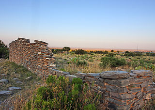
Birchville, or Smith Ranch, now a ghost town, was located in what is now Hudspeth County, Texas, United States. Birchville was a settlement on the San Antonio-El Paso Road in what was El Paso County. Birchville lay 35 miles northwest of the First Camp on Rio Grande and 24.8 miles southeast of San Elizario, according to the table of distances for the San Antonio-San Diego Mail Line in the Texas Almanac of 1857. Later used as a station on the Butterfield Overland Mail, the distances to the station for that line were given as 241⁄2 miles from San Elizario, 33 miles from Fort Quitman.
Rancheros Creek is a tributary stream of the Sabinal River, in Medina County and Uvalde County, Texas.

California Spring, or Yellow Banks, is a spring at the headwaters of Evans Creek, in Val Verde County, 4.8 miles northeast of Comstock.
The First Crossing of Devils River was the first point at which the Devils River was crossed by the San Antonio-El Paso Road. It was located 10.22 miles west of San Felipe Springs at the mouth of San Pedro Creek on the Devils River. It was 2.54 miles southeast of Painted Caves, on California Creek, a noted camp location on the road. The crossing point and the gorge leading down to it from the east are now submerged under Lake Amistad.
Turkey Creek, a tributary of the Nueces River with its source in Kinney County, Texas 29°14′32″N100°06′56″W. It passes through Uvalde and Dimmit Counties to its mouth at Espantosa Lake in Espantosa Slough south of Crystal City in Zavala County, Texas.
Pinto Creek, formerly known as Piedra Pinto Creek, a tributary to the Rio Grande in Kinney County, Texas. It has its source, at 29°30′53″N100°24′13″W.
Mud Creek, originally known as Maverick Creek, is a stream in Kinney County, Texas tributary to Sycamore Creek and the Rio Grande. It has its source at 29°28′10″N100°36′24″W.
Painted Caves was a cave containing a spring in Val Verde County, Texas, 20 kilometers southeast of Comstock, Texas. The cave accompanied a camp site along the San Antonio-El Paso Road on Painted Cave Spring Creek and was named for the indigenous cave paintings found inside. It was located 2.54 miles northwest of the First Crossing of Devils River and 15.73 miles southeast of California Spring. The cave is now submerged under Lake Amistad.
Live Oak Creek, a stream with its source in Reagan County, Texas at 31°10′45″N101°42′01″W at an elevation of 2938 feet, that runs southward to its mouth at an elevation of 2001 feet on the Pecos River in Crockett County, Texas.
Head of Devil's River, a place on the Devils River where it has its confluence with Pecos Canyon at an elevation of 1722 feet, below Beaver Lake, nineteen and a half miles above the second crossing of Devils River. Here the San Antonio-El Paso Road left the Devils River to go northwest, 44 miles across Johnson Draw, Government Canyon and Howard Draw to Howard Springs, then 30.44 miles on to Live Oak Creek and Fort Lancaster, 3 miles further near the Pecos River.
Tunas Spring, formerly Escondido Spring, a spring along Tunas Creek, a tributary of the Pecos River in Pecos County, Texas.
Leaving of Pecos was originally a camping place along the west bank of the Pecos River, on the wagon road called the Lower Emigrant Road, Military Road or San Antonio-El Paso Road in Texas. It was located 38 miles north of the Lancaster Crossing of the Pecos, and 16 miles east of the first crossing of Escondido Creek. It was also located a mile north of where the wagon road had its junction with a cutoff to the north to the wagon road called the Upper Emigrant Road between Fredericksburg, Texas and Comanche Springs, now Fort Stockton, Texas, where it joined the Lower Emigrant Road. It was later a stopping place on the route of San Antonio - El Paso Mail and the San Antonio-San Diego Mail Line.
Peters Colony is a name applied to four empresario land grant contracts first by the Republic of Texas and then the State of Texas for settlement in North Texas. The contracts were signed by groups of American and English investors originally headed by William Smalling Peters. Samuel Browning, Peters' son-in-law signed the first contract with the Republic of Texas in Austin on August 30, 1841. Ownership of the empresario company changed many times during the life of the contracts.
Point of Rocks also known as Bald Rock, is a hill and a locale in Jeff Davis County, Texas. Point of Rocks, is an isolated hill with a spring once known as Bald Rock Spring. It was used as a watering place and campsite on the San Antonio-El Paso Road, 10 miles west of Fort Davis, Texas, now Point of Rocks Roadside Park. The elevation of Point of Rocks Spring, is at 5,469 feet / 1,667 meters, at the foot of the southeast slope of the Point of Rocks that reaches over 5,920 feet along its crest.
Limpia Creek, originally known as the Rio Limpia, is a stream that heads in Jeff Davis County, Texas and its mouth is in Pecos County, Texas. Limpa is the Spanish word for "clear or clean water". The creek has its head in the Davis Mountains at an elevation of 7,160 feet, at location 30°38′27″N104°09′42″W on the northeast slope of Mount Livermore. The creek flows 42 miles down Limpia Canyon past Fort Davis and Wild Rose Pass to the canyon mouth, where it turns eastward to its mouth at its confluence with Barrilla Draw, where it disappears into the ground at an elevation of 3,533 feet / 1,077 meters.
References
- 1 2 3 4 5 U.S. Geological Survey Geographic Names Information System: Leon Creek
- ↑ "LEON CREEK (BEXAR COUNTY)," Handbook of Texas Online (tshaonline.org/handbook/online/articles/rbl39), accessed November 24, 2013. Published by the Texas State Historical Association.
- ↑ Minnie B. Cameron, "CASSIN, TX," Handbook of Texas Online (http://www.tshaonline.org/handbook/online/articles/hrc30), accessed November 24, 2013. Published by the Texas State Historical Association.
- ↑ Table of distances from Texas Almanac, 1859, Book, ca. 1859; digital images, (http://texashistory.unt.edu/ark:/67531/metapth123765/ accessed November 12, 2013), University of North Texas Libraries, The Portal to Texas History, http://texashistory.unt.edu; crediting Texas State Historical Association, Denton, Texas
- ↑ Wayne R. Austerman, "SAN ANTONIO-EL PASO MAIL," Handbook of Texas Online (http://www.tshaonline.org/handbook/online/articles/eus01), accessed November 22, 2013. Published by the Texas State Historical Association.