
The formerly free mining town ( Bergstadt ) of Lautenthal in Germany is a state-recognised, climatic spa with around 1,570 inhabitants [1] and has been part of the borough of Langelsheim since 1972.
The formerly free mining town ( Bergstadt ) of Lautenthal in Germany is a state-recognised, climatic spa with around 1,570 inhabitants [1] and has been part of the borough of Langelsheim since 1972.


Lautenthal lies in the Innerste valley between Clausthal-Zellerfeld and Langelsheim in the northwestern Upper Harz. The town is located at a height of about 300 m above sea level (NN) in a valley bowl, the surrounding mountains being up to 620 m above NN. The two rivers of the Innerste and the Laute flow through the town. Towards Langelsheim the Innerste is impounded by the Innerste Dam.
Mining of copper, lead and silver in the area around Lautenthal started about 1225. [2] In the middle of the 14th century, however, the Harz was depopulated because of plague and mining came to an end.
Mining in the Harz was started again in 1524. Lautenthal was founded in 1538 as a mining settlement on the river Laute, a small tributary of the Innerste, and had already been given the status of a town by 1580. Sixteen years later it became a free mining town. The town was enlarged in 1560 and a rectangular market place was laid out. A comparatively large town hall was built in 1570. The building was transformed into a hotel later. In 1626, the town was plundered by the troops of Johann Tserclaes, Count of Tilly in the Thirty Years' War. The Protestant town church was built 1649-59. In 1690, 28 mines were operated in and around Lautenthal. In 1821, the town had 2.006 inhabitants. [3] The railway line to Lautenthal, Innerste Valley Railway, was inaugurated in 1875 and extended to Altenau in 1914. Railway bridges were built over the Laute and the Innerste. Tourism gradually developed creating more and more jobs. At the beginning of the 20th century, Lautenthal had 2.626 inhabitants.
As of 30 June 2018, Lautenthal had a population of 1,570. [1]
With the closure of the mines in 1959 the town lost its significance and was incorporated into the borough of Langelsheim in 1972. In 1976 the railway line to Lautenthal was closed and the former railway station was transformed into a hotel.
Goslar is a district in Lower Saxony, Germany. It is bounded by the districts of Göttingen, Northeim, Hildesheim and Wolfenbüttel, the city of Salzgitter, and by the states of Saxony-Anhalt and Thuringia (Nordhausen).

Clausthal-Zellerfeld is a town in Lower Saxony, Germany. It is located in the southwestern part of the Harz mountains. Its population is approximately 15,000. The City is the location of the Clausthal University of Technology. The health resort is located in the Upper Harz at an altitude between 390 and 821 m above sea level.

Northeim is a town in Lower Saxony, Germany, seat of the district of Northeim, with, in 2011, a population of 29,000. It lies on the German Half-Timbered House Road.

Langelsheim is a town in the district of Goslar, in Lower Saxony, Germany.

Bad Sachsa is a town in the district of Göttingen, in Lower Saxony, Germany. The town was one of the few municipalities in West Germany that imported electric power from former East Germany. This was done via Neuhof Substation.

Bad Grund (Harz) is a town in the district of Göttingen, in Lower Saxony, Germany. It is situated in the western Harz, approx. 7 km west of Clausthal-Zellerfeld, and 10 km north of Osterode am Harz.

Wildemann is a town and a former municipality in the district of Goslar, in Lower Saxony, Germany. It has been part of the town Clausthal-Zellerfeld since January 1, 2015. It is situated in the west of the Harz, northwest of Clausthal-Zellerfeld. It was part of the former Samtgemeinde Oberharz.

Altenau is a town and a former municipality in the district of Goslar, in Lower Saxony, Germany. Since 1 January 2015 it is part of the town Clausthal-Zellerfeld.
The Innerste is a river in Lower Saxony, Germany. It is a right tributary of the Leine river and 101 km (63 mi) in length.
Hahnenklee is a borough of the city of Goslar, in the German state of the Lower Saxony. It is located within the Harz mountain range between Goslar and Osterode. The population is about 1200 inhabitants.
Gittelde is a village and a former municipality in the district of Göttingen, in Lower Saxony, Germany. Since 1 March 2013, it is part of the municipality Bad Grund.
Wieda is a village and a former municipality in the district of Göttingen, in Lower Saxony, Germany. Since 1 November 2016, it is part of the municipality Walkenried.
The Langelsheim–Altenau (Oberharz) railway was a railway line, that ran through the Upper Harz in Central Germany. It was also called the Upper Harz Railway or Harz Railway. It was built in order to enable the Magdeburg-Halberstadt Railway Company to access the mines in the Harz mountains.
Torfhaus is a village in the borough of the mining town of Altenau in the Harz mountains of Germany and lies at a height of about 800 m above sea level (NN). It is the highest settlement in Lower Saxony.

The Upper Harz refers to the northwestern and higher part of the Harz mountain range in Germany. The exact boundaries of this geographical region may be defined differently depending on the context. In its traditional sense, the term Upper Harz covers the area of the seven historical mining towns (Bergstädte) - Clausthal, Zellerfeld, Andreasberg, Altenau, Lautenthal, Wildemann and Grund - in the present-day German federal state of Lower Saxony. Orographically, it comprises the Harz catchment areas of the Söse, Innerste and Grane, Oker and Abzucht mountain streams, all part of the larger Weser watershed.

Oberharz am Brocken is a town in the Harz District, in Saxony-Anhalt, Germany. It was formed on 1 January 2010 by the merger of the town of Elbingerode with the municipalities of the former Verwaltungsgemeinschaft Brocken-Hochharz.

The Upper Harz Water Regale is a system of dams, reservoirs, ditches and other structures, much of which was built from the 16th to 19th centuries to divert and store the water that drove the water wheels of the mines in the Upper Harz region of Germany. The term regale, here, refers to the granting of royal privileges or rights in this case to permit the use of water for mining operations in the Harz mountains of Germany.
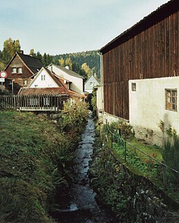
Laute is a river of Lower Saxony, Germany. It is a right tributary of the Innerste.
The Vienenburg–Langelsheim railway was a nearly 18-kilometer-long railway along the northern edge of the Harz in the German state of Lower Saxony. It was mainly used for freight traffic. It was opened in 1875, but it lost its importance with the closure of a line connecting to the east as a result of the division of Germany after the Second World War and it is now closed and dismantled.

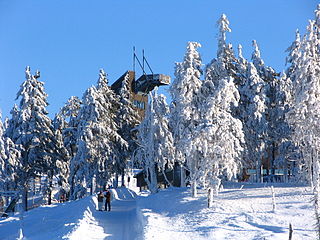
The Maaßener Gaipel is a pub catering for day trippers on the northeastern hillside of the Kranichsberg at a height of 420 m above NN, situated above the mining town of Lautenthal in the Harz Mountains of central Germany. The name goes back to the above-ground workings of the Maaßener Treibschacht or Maaßen Hoisting Shaft 51°51′49″N10°17′25″E, which was located immediately east of the inn. Gaipel is a common expression in the Upper Harz for a headframe and goes back to the use of a horse whim which in German is a Pferdegöpel. Whims were used to transport men and materiel up and down mineshafts, for example using man engines, and also to operate water management equipment. Maaßen is shorthand for the name of the local pit which was the Grube Zweite, Dritte, Vierte, Fünfte und Sechste Maß nach der Sachsenzeche. Maaß, also variously spelt Maaß, Maas or Mas, is a unit of length for a pit field (Grubenfeld) and in mining in the Upper Harz measured 28 Lachter or 53.8 metres. The pub was built in 1924 on the initiative of the Harz Club on the terrain of the old mine shaft. But decades before the area had already become a popular destination with walkers due to its views of the mining town and the valley of the Laute.
Coordinates: 51°52′13″N10°17′27″E / 51.87028°N 10.29083°E
| General | |
|---|---|
| National libraries | |